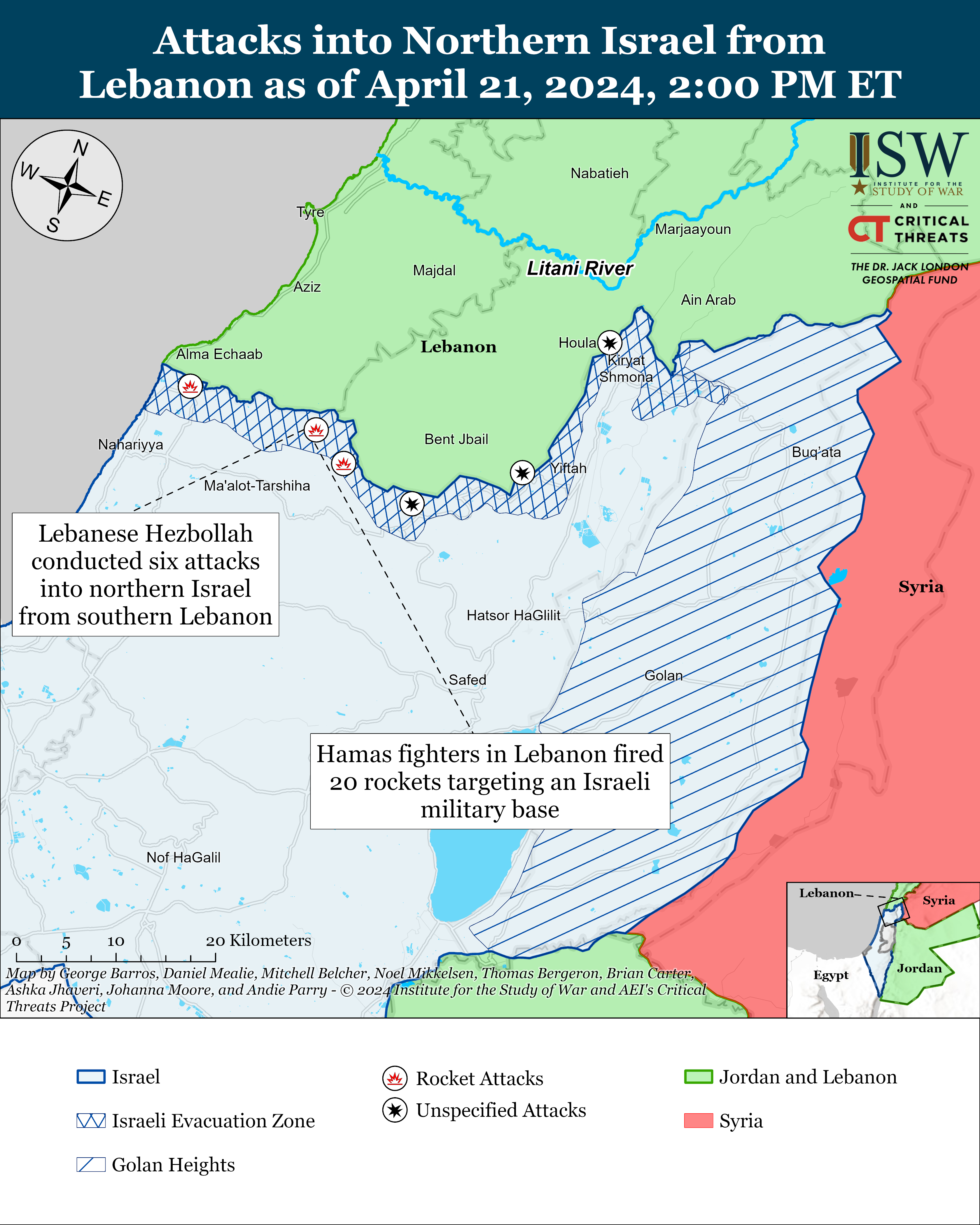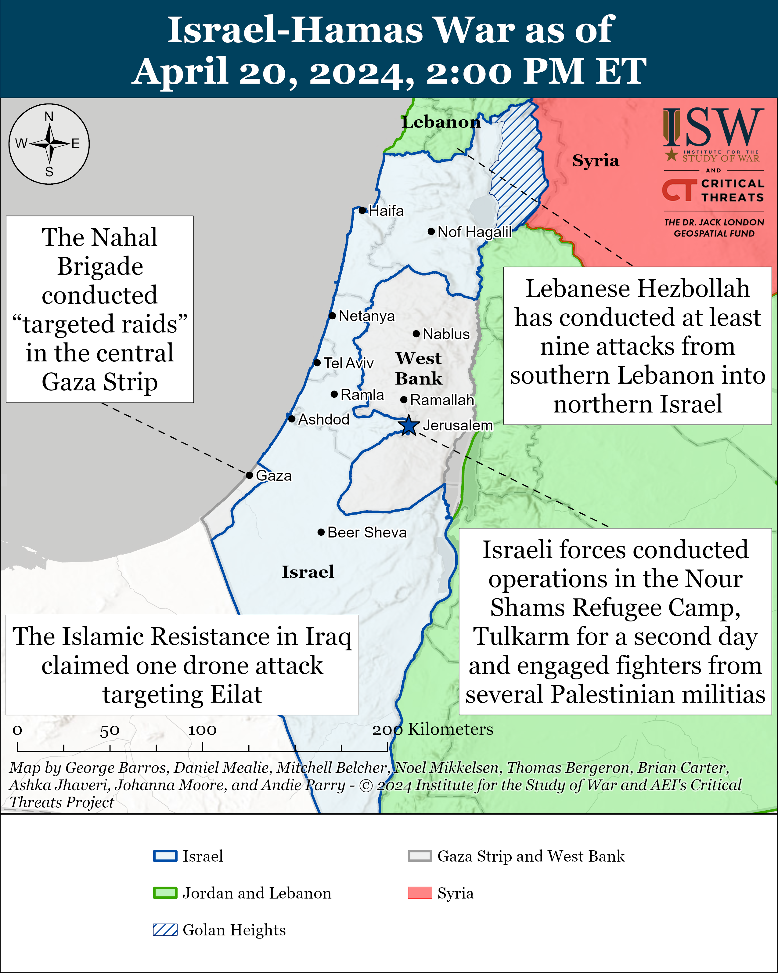
https://www.understandingwar.org/backgrounder/iran-update-april-20-2024
https://www.understandingwar.org/backgrounder/iran-update-april-20-2024
Satellite imagery released over the past 24 hours has revealed evidence of probable damage at an Iranian air base following an Israeli strike in the early hours of Friday morning.
BBC Verify has analysed two images showing part of an air-defence system at an airfield in Isfahan was damaged.
Optical imagery will be familiar to anyone who regularly uses tools like Google Earth - essentially a photograph of the land below. SAR technology uses radio waves to build an image of the Earth's surface. One advantage it has over more conventional satellite technology is its ability to capture images at night or through cloud.
The imagery it collects is rendered in black and white but at high resolution. It therefore cannot detect changes in colouration on the ground - such as burn marks - but can display material damage to structures, vehicles etc.
One such image captured by Umbra Space on 15 April shows an S-300 air defence system located at the north-western corner of the Shikari air base. The system comprises several vehicles equipped with radar, distinctive missile launchers and other equipment.
An Umbra Space image captured after Friday's strike shows damage and debris around one component - probably a radar - which has also shifted position slightly. Other vehicles have been moved away from the site.
This assessment was confirmed by an optical satellite image captured by Planet which, despite low resolution, shows a scorch mark at the same location.