This graph adds in the last 9 years.
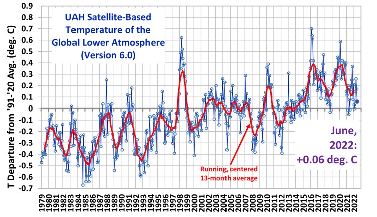
And yes, UAH satellite-based data is the best.
This graph adds in the last 9 years.
And yes, UAH satellite-based data is the best.
I’ve always wondered how “the temperature of the earth” is measured.
What is it right now?
How do you measure that?
Averaging a lot of observations?
Averaging the hottest and the coldest?
Or what?
“And yes, UAH satellite-based data is the best.”
It’s pretty good. But in the US, the absolute best is from the USCRN. They tend to hide their graphs, though.