What appears to be that supposedly 'human-dug lake', the "Moeris", shows up on Google Earth as a huge cultivated area in the middle of the desert. And the "Birket-el-O/Qerun" still appears (with much the same shape) as a water-filled lake.
Now -- is "a little ways above the Moeris" -- to the north? ...or to the south -- UPstream on the Nile?
~~~~~~~
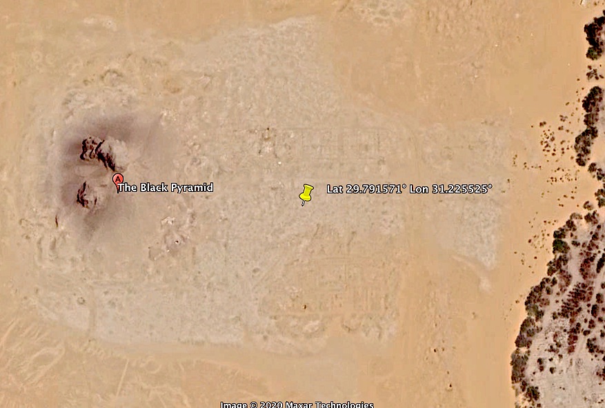
Wooops! I just did a Google Earth search for "Black Pyramid, Egypt". It's ~21 miles NE of the north edge of the Moeris depression -- but there are definitely large, complex structure remains between the pyramid remnants and the Nile valley escarpment! Be back when I've done some image post-processing...
TXnMA

This may be the wrong site -- but, there's
something there:
First, a GE ("Google Earth") grab -- including coords of the approx center of the rectangular ruins:
...and, the same area, post-processed with one of my custom convolution filters that has worked fairly well for enhancing faint lines -- both N-S & E-W:
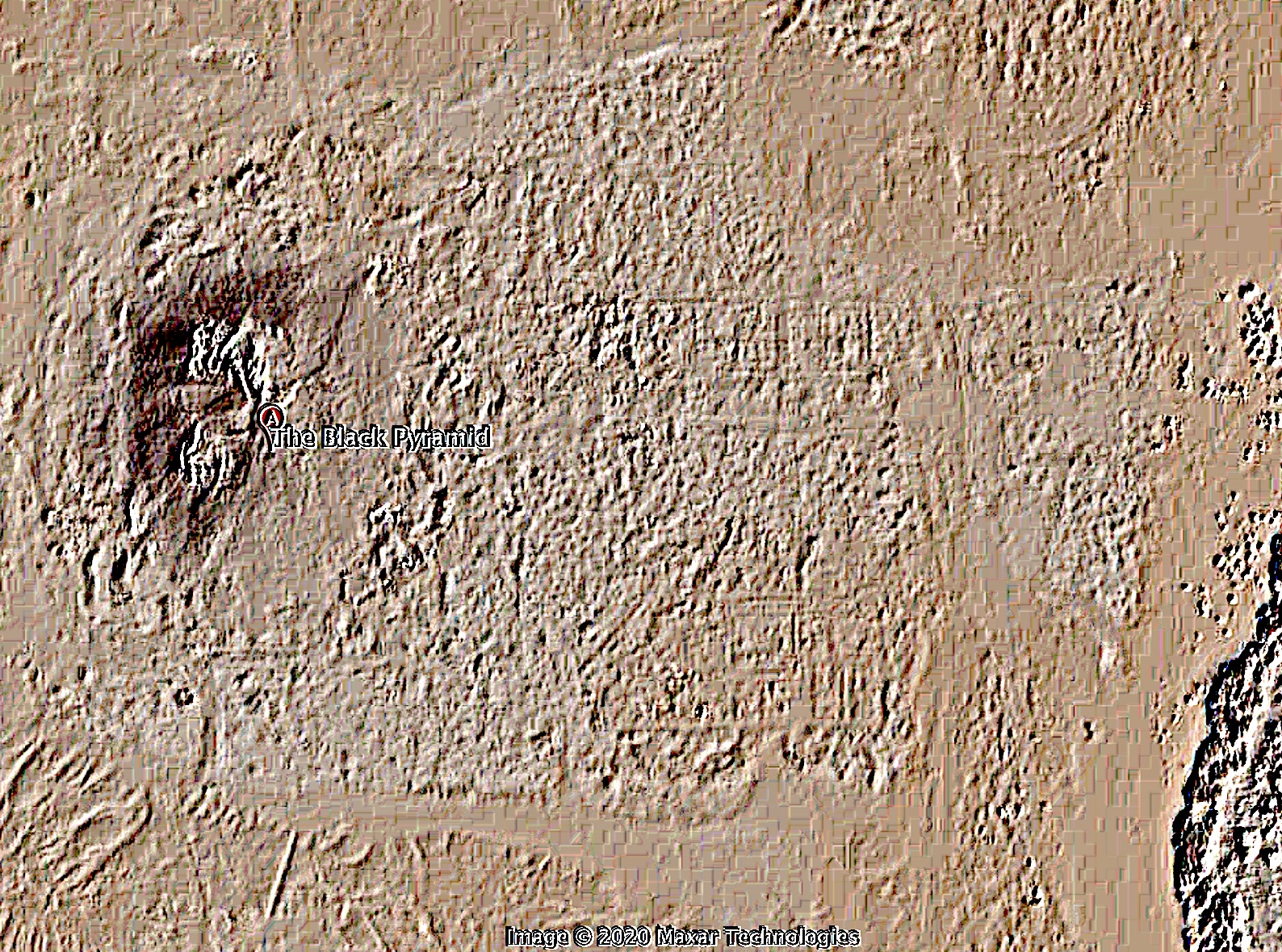
Definitely something there -- a >200 meter square area covered with complex rectangular ruins...
Doesn't sound like the right location; too far from the lake. But -- do you think it's worth the effort of further processing?
BTW, Re Ben Lurkin/s #9 map_ I think I've already located the "Usertesen II Pyramid"...
TXnMA