(Shhhh! Unless there is a secret data center in the nearby storage area in the salt mines!)
In before festival and the thread renewal!
Yeah, it's my bad for being startled about a lake I've fished often kept coming up in these searches. I always thought the central point of the U.S. was in north central Kansas but it does make sense digitally, they could assign somewhere else.
I did look to see if the salt deposits ran under Cheney Lake and they do. There is no mining activity near there that we know of. I wasn't sure how big the salt deposits were so I looked them up:
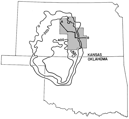
Sorry this is a little bit of a slide but I did find out a couple of things and one was how large this deposit is. The 200 & 400 represent how thick the deposit is in feet. I knew a sea once ran through this area so I looked it up here:

I knew we had ocean front property at one point :) but never went in to more detail about it. As the land masses pushed upward, and the seaway dissapated, some of the salt from the seaway settled in where that first map shows. I just found that interesting after wondering if the salt ran under Cheney Lake.
CGato