To: CptnObvious
Were we getting Played?
...
Nope.
High pressure built in front of the storm.
The storm moved west and slowed down.
The slower speed will allow time for low pressure to erode the high pressure so that the storm can move north.
11 posted on
09/01/2019 2:43:59 AM PDT by
Moonman62
(Charity comes from wealth.)
To: Moonman62; CptnObvious
Nope. High pressure built in front of the storm. The storm moved west and slowed down. The slower speed will allow time for low pressure to erode the high pressure so that the storm can move north. That's the answer right there.
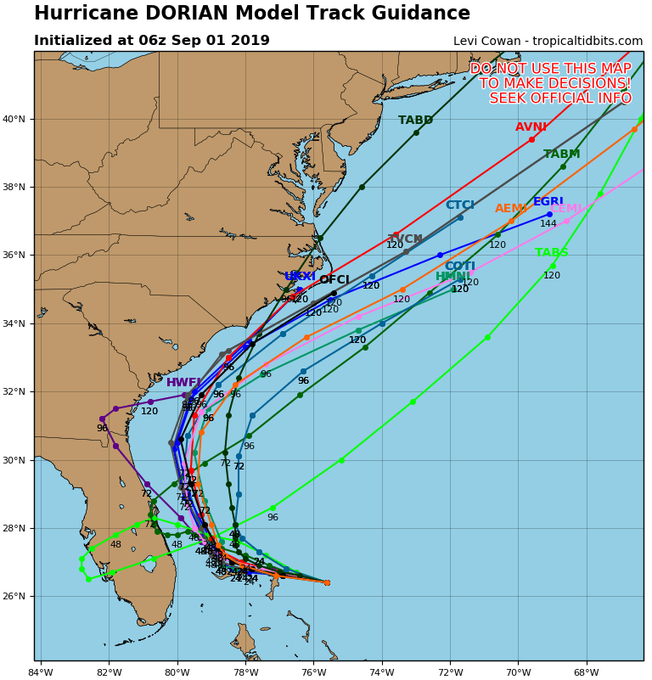
There are two high pressure systems: one over the Midwest, and one Bermuda high over the Atlantic. High pressure is steering Dorian towards the west and Florida. But, a turn to the north is then probably going to happen. The two highs have weak flow between them, almost like a gap, and as the Atlantic high is weakening faster than the Midwest high, forecasters and models now have Dorian staying off the coast.
17 posted on
09/01/2019 3:00:49 AM PDT by
SkyPilot
("I am the way and the truth and the life. No one comes to the Father except through me." John 14:6)
FreeRepublic.com is powered by software copyright 2000-2008 John Robinson