A better question is how would you calculate a FE map correctly (if in your case, theoretically) without those endless arguments with Australian and African airlines over the timing of their routes?
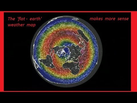
This map here gives a better idea of what is happening in real time... a weather map with overlays of ocean currents, air currents and temperatures positioned on the FE map (the same map of the United Nations, BTW, and I consider the UN the ultimate in One World antiChrist thinking, as per the Bible.)
If you click on the youtube link, the map in motion makes much more sense in terms of air currents, ocean currents and temperatures... the video shows the current flows and air flows are astoundingly simple in symmetry, function and structure...
The air and temperature flows also completely correlate with Fibonacci Spiral found throughout nature, in actual time.
(Unlike the idea that the globe is spinning on average at 666MPH, but up to 1000MPH... a little 666 joke on antiChrist in the Bible? LOL)