Free Republic
Browse · Search
General/Chat
Topics · Post Article

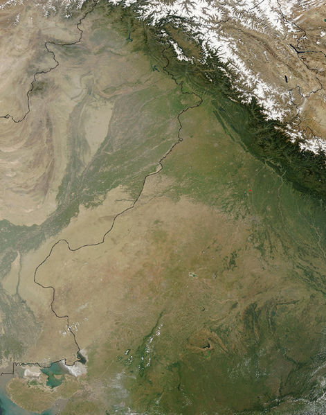
A NASA satellite image of the Thar Desert, with the India-Pakistan border superimposed. The desert is at the center left of the image; the Indus River and its tributaries are to the left side of the desert, and the dark green line at the bottom center of the image is the Aravalli Range. [Wikimedia Commons]
Excavations Uncover Earliest Middle Paleolithic Stone Tools in India

1 posted on 07/13/2013 6:39:25 AM PDT by SunkenCiv
[ Post Reply | Private Reply | View Replies ]


To: SunkenCiv

Thanks for the article post, but...

It mentions “an assemblage”. Is that just the finished tools — or does it include debitage?

As far as this lithicist is concerned, any article about “stone tools” that does not include photos of same is worthless.


4 posted on 07/13/2013 8:50:46 AM PDT by TXnMA ("Allah": Satan's current alias... "Barack": Allah's current ally...)
[ Post Reply | Private Reply | To 1 | View Replies ]

Free Republic
Browse · Search
General/Chat
Topics · Post Article


FreeRepublic, LLC, PO BOX 9771, FRESNO, CA 93794
FreeRepublic.com is powered by software copyright 2000-2008 John Robinson