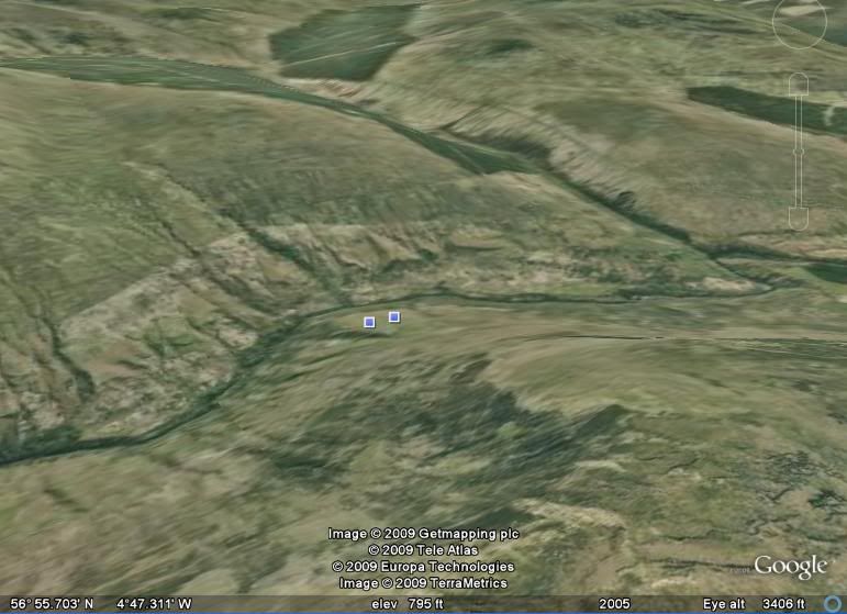
... poppycock.Welllll, here is a superview of the view from Bohuntine Hill ( bottom right ) eastward, showing the "roads" across the valley and the presumed col leading to the east.
Following it in Google Earth, it seems to lead up into the highlands, so would not be a drainage route.
Is this the basis of your asservation?

"Is this the basis of your asservation?"I don't disagree with the conclusion of the author, only the rhetorical style. It is, to use another 19th century phrase, off putting.
There's a lot of on-line material on this, and I was able to track down "Col R2" from this note in
Darwin's collected works:
4. Lauder had failed to find any overflow col on the level of Road R2, and Darwin recognized this as a major anomaly. The head of Glen Fintac, which is a small valley tributary to Glen Gluoy, was a plausible point to search for such a col from Glen Roy; in fact the col connecting them is much too high, and the overflow col for R2 was later discovered in a quite different position on the other side of Glen Roy (Glen Glaster).
I found the names, with variations ( Glen Glaster is Gleann Glas Dhoire! ) on this Map of Bohuntine Hill in Highland. Presented as a tourist map, it nevertheless has extensive topo markings. This col, or spillway, is visible at the very top of my Google Maps screen shot. It cuts to the right off the top of the image by that green patch.
And I might as well note this map of Charles Darwin's from Charles Darwin visits the Parallel Roads of Glen Roy.
You can see from the footnote above that figuring all this out was not just a matter of standing on top of the hill and looking around.
