Free Republic
Browse · Search
General/Chat
Topics · Post Article

To: TornadoAlley3; abb
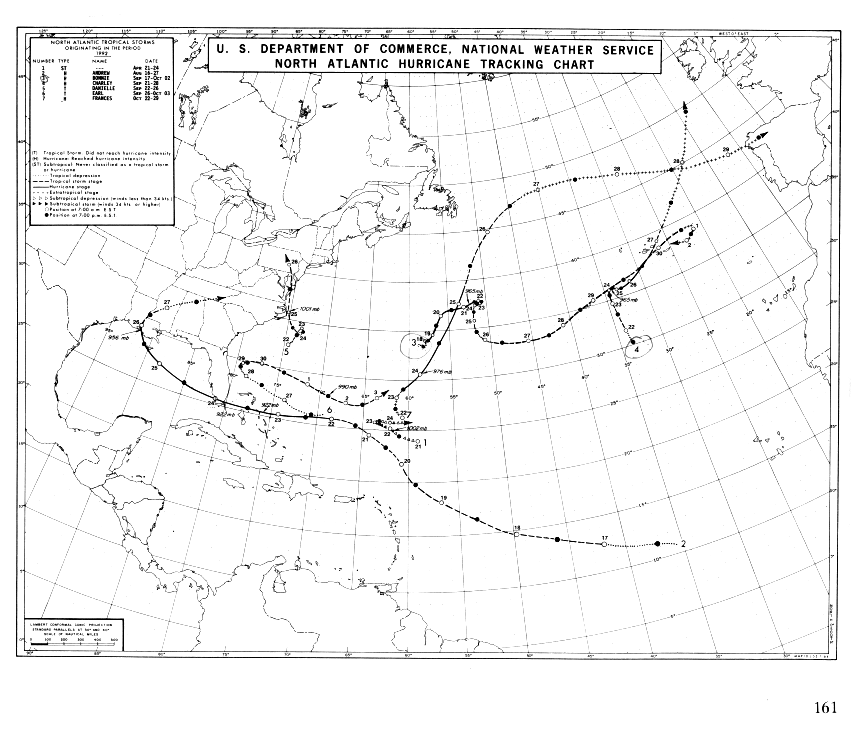
This was the Andrew track, August 1992 (the lowest track):

This was Katrina, August, 2005:

This was Rita, September 2005:

And this is Gustav, subject to change of course.


872 posted on 08/30/2008 2:48:52 PM PDT by lainie (Never underestimate the power of stupid people in large groups.)
[ Post Reply | Private Reply | To 790 | View Replies ]


To: lainie
The NOAA map is nice, but I think the WeatherUnderground maps are much prettier.


873 posted on 08/30/2008 2:50:51 PM PDT by Petronski (Why is the Democrat party so damn sexist?)
[ Post Reply | Private Reply | To 872 | View Replies ]

To: lainie

Between Cape Sabel and the Barron River there is this “white spot” clearly visible from off shore as you cruise north or south off shore a few miles. It looks like sand dunes from a distance which would be very odd for florida. But it is indeed the place were Andrew came out. The white spot is actually dead mangroves bleaching in the sun. We now have the same thing here on the West Wall of Charlotte Harbor. Charley stripped the mangroves. They are dead and turning from grey to bone white.


878 posted on 08/30/2008 2:58:04 PM PDT by Sunnyflorida (McCain 08 -- I've been Palin-ated. Gotta luv that woman.)
[ Post Reply | Private Reply | To 872 | View Replies ]

To: lainie

thanks lainie.


883 posted on 08/30/2008 3:04:30 PM PDT by TornadoAlley3 ('GOP' : Get Our Petroleum)
[ Post Reply | Private Reply | To 872 | View Replies ]

Free Republic
Browse · Search
General/Chat
Topics · Post Article


FreeRepublic, LLC, PO BOX 9771, FRESNO, CA 93794
FreeRepublic.com is powered by software copyright 2000-2008 John Robinson