Skip to comments.
Blizzard Warning for NYC and Southern NY State (20 - 30 inches)
· National Weather Service ^
| Today
| NWS
Posted on 01/25/2015 10:34:29 PM PST by Ernest_at_the_Beach
Blizzard Warning for NYC and Southern NY State
Posted 3 hours, 18 minutes ago
Crippling and potentially historic blizzard to impact the area from late Monday into Tuesday.
Blizzard Warning remains in effect from 1 pm Monday to midnight EST Tuesday night.
- Locations: New York City and surrounding immediate suburbs. Long Island, and most of southern Connecticut.
- Hazard types: Heavy snow and blowing snow, with blizzard conditions.
- Accumulations: snow accumulation of 20 to 30 inches, with locally higher amounts possible. Snowfall rates of 2 to 4 inches per hour expected late Monday night into Tuesday morning.
- Winds: north 30 to 40 mph with gusts 55 to 65 mph, strongest across eastern Long Island.
- Visibilities: one quarter mile or less at times.
- Temperatures: in the lower 20s.
- Timing: light snow will begin Monday morning, with accumulations of 1 to 3 inches possible by the evening rush. Snow will pick up in intensity Monday evening, with the heaviest snow and strongest winds from about midnight Monday night into Tuesday afternoon.
- Impacts: Life-threatening conditions and extremely dangerous travel due to heavy snowfall and strong winds, with Whiteout conditions. Secondary and tertiary roads may become impassable. Strong winds may down power lines and tree limbs.
...CRIPPLING AND POTENTIALLY HISTORIC BLIZZARD TO IMPACT THE AREA
FROM LATE MONDAY INTO TUESDAY...
...BLIZZARD WARNING REMAINS IN EFFECT FROM 1 PM MONDAY TO
MIDNIGHT EST TUESDAY NIGHT...
* LOCATIONS...NEW YORK CITY AND SURROUNDING IMMEDIATE SUBURBS...
LONG ISLAND...AND MOST OF SOUTHERN CONNECTICUT.
* HAZARD TYPES...HEAVY SNOW AND BLOWING SNOW...WITH BLIZZARD
CONDITIONS.
* ACCUMULATIONS...SNOW ACCUMULATION OF 20 TO 30 INCHES...WITH
LOCALLY HIGHER AMOUNTS POSSIBLE. SNOWFALL RATES OF 2 TO 4
INCHES PER HOUR EXPECTED LATE MONDAY NIGHT INTO TUESDAY MORNING.
* WINDS...NORTH 30 TO 40 MPH WITH GUSTS 55 TO 65 MPH...STRONGEST
ACROSS EASTERN LONG ISLAND.
* VISIBILITIES...ONE QUARTER MILE OR LESS AT TIMES.
* TEMPERATURES...IN THE LOWER 20S.
* TIMING...LIGHT SNOW WILL BEGIN MONDAY MORNING...WITH
ACCUMULATIONS OF 1 TO 3 INCHES POSSIBLE BY THE EVENING RUSH.
SNOW WILL PICK UP IN INTENSITY MONDAY EVENING...WITH THE
HEAVIEST SNOW AND STRONGEST WINDS FROM ABOUT MIDNIGHT MONDAY
NIGHT INTO TUESDAY AFTERNOON.
* IMPACTS...LIFE-THREATENING CONDITIONS AND EXTREMELY DANGEROUS
TRAVEL DUE TO HEAVY SNOWFALL AND STRONG WINDS...WITH WHITEOUT
CONDITIONS. SECONDARY AND TERTIARY ROADS MAY BECOME
IMPASSABLE. STRONG WINDS MAY DOWN POWER LINES AND TREE LIMBS.
Recommended actions
A Blizzard Warning means severe winter weather conditions are expected or occurring. Falling and blowing snow with strong winds and poor visibilities will lead to Whiteout conditions, making travel extremely dangerous. Do not travel. If you must travel. Have a winter survival kit with you. If you get stranded, stay with your vehicle.
All unnecessary travel is discouraged beginning Monday afternoon, to allow people already on the road to safely reach their destinations before the heavy snow begins, and to allow snow removal equipment to begin to clear roads.
A BLIZZARD WARNING MEANS SEVERE WINTER WEATHER CONDITIONS ARE
EXPECTED OR OCCURRING. FALLING AND BLOWING SNOW WITH STRONG WINDS
AND POOR VISIBILITIES WILL LEAD TO WHITEOUT CONDITIONS...MAKING
TRAVEL EXTREMELY DANGEROUS. DO NOT TRAVEL. IF YOU MUST TRAVEL...
HAVE A WINTER SURVIVAL KIT WITH YOU. IF YOU GET STRANDED...STAY
WITH YOUR VEHICLE.
ALL UNNECESSARY TRAVEL IS DISCOURAGED BEGINNING MONDAY
AFTERNOON...TO ALLOW PEOPLE ALREADY ON THE ROAD TO SAFELY REACH
THEIR DESTINATIONS BEFORE THE HEAVY SNOW BEGINS...AND TO ALLOW
SNOW REMOVAL EQUIPMENT TO BEGIN TO CLEAR ROADS.
The
original text for this alert has been automatically reformatted to correct capitalization.
TOPICS: Culture/Society; Government; US: New York; US: North Carolina
KEYWORDS: climatechange; globalwarming; globalwarminghoax; nycblizzard; wearher
Navigation: use the links below to view more comments.
first previous 1-20, 21-40, 41-56 last
To: MrB; Darksheare
To: petercooper
Went to the link and the storm appears to be winding up off the coast of NC/DE. What are you looking at?
To: Ernest_at_the_Beach
Philadelphia area may get around a foot or so tonight through Tuesday.
The overnight snow fall was very light. I have perhaps an inch and a
half on the car windshield. In a few hours that is going to change however.
43
posted on
01/26/2015 7:35:51 AM PST
by
Marine_Uncle
(Galt level is not far away......but alas! Honor must be earned...)
To: HiTech RedNeck
“His scientific advisors aren’t very good... that’s how it can be”
Yeah... apparently. Perhaps His Popeness needs to QC his advisor staff before attempting to direct the actions of his 1.5-billion flock.
44
posted on
01/26/2015 8:34:39 AM PST
by
ScottinVA
(Communism, liberalism and Islam: Kindred ideologies dedicated to America's destruction.)
To: Ernest_at_the_Beach
We’re expecting some minor snowfall here in VA, but nothin like the northerners are getting. Hopefully folks are well-prepared up there.
45
posted on
01/26/2015 8:36:55 AM PST
by
ScottinVA
(Communism, liberalism and Islam: Kindred ideologies dedicated to America's destruction.)
To: ScottinVA
Maybe it is time for Paul to tell Peter off again, so to speak.
46
posted on
01/26/2015 9:00:17 AM PST
by
HiTech RedNeck
(Embrace the Lion of Judah and He will roar for you and teach you to roar too. See my page.)
To: MrB
Heh heh heh.
Not enough, unfortunately.
47
posted on
01/26/2015 9:30:40 AM PST
by
Darksheare
(Those who support liberal "Republicans" summarily support every action by same.)
To: Ernest_at_the_Beach
To: Kartographer
That aint panic. Thats common sense. :-)
To: lowbridge
I wonder how many forgot the syrup? ;-)
50
posted on
01/26/2015 11:23:16 AM PST
by
Kartographer
("We mutually pledge to each other our lives, our fortunes and our sacred honor.")
To: minnesota_bound
Good luck with that. It might work if you get that gay light snow.
51
posted on
01/26/2015 11:45:09 AM PST
by
justa-hairyape
(The user name is sarcastic. Although at times it may not appear that way. Was)
To: Ernest_at_the_Beach
Jersey Shore, too- 24-36 inches predicted.
52
posted on
01/26/2015 12:11:30 PM PST
by
JimRed
(Excise the cancer before it kills us; feed & water the Tree of Liberty! TERM LIMITS NOW & FOREVER!)
To: minnesota_bound
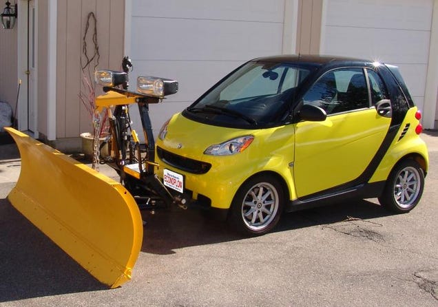
Why is that snow plow dragging that little car behind it?
To: Ernest_at_the_Beach
The sky is falling! YHE SKY ISSSS FALLLLIIINNNNGGGGGGG!
54
posted on
01/26/2015 9:11:01 PM PST
by
Candor7
(Obama fascism article:(http://www.americanthinker.com/2009/05/barack_obama_the_quintessentia_1.html))
To: who knows what evil?
TWC: Weather-fag stomping around in two inches of snow, complaining that he still can see the skyscrapers.
55
posted on
01/26/2015 9:45:05 PM PST
by
ROCKLOBSTER
(Celebrate "Republicans Freed the Slaves Month")
To: Ernest_at_the_Beach
I now live in Graham County (Hill City). Was born and raised in Thomas County (Colby).
56
posted on
01/26/2015 10:53:08 PM PST
by
tdscpa
Navigation: use the links below to view more comments.
first previous 1-20, 21-40, 41-56 last
Disclaimer:
Opinions posted on Free Republic are those of the individual
posters and do not necessarily represent the opinion of Free Republic or its
management. All materials posted herein are protected by copyright law and the
exemption for fair use of copyrighted works.
FreeRepublic.com is powered by software copyright 2000-2008 John Robinson