Skip to comments.
A New Theory On Mapping The New World
Washington Post ^
| 10-7-2002
| Guy Gugliotta
Posted on 10/08/2002 8:42:57 AM PDT by blam
click here to read article
Navigation: use the links below to view more comments.
first 1-20, 21-31 next last
We cannot post entire articles from the Washington Post. Click
here to read the entire article
1
posted on
10/08/2002 8:42:57 AM PDT
by
blam
To: ET(end tyranny); FreeLibertarian; Bohemund; Seeking the truth; Bernard Marx; RightWhale; aruanan
Ping.
2
posted on
10/08/2002 8:44:56 AM PDT
by
blam
To: blam
Interesting.
It's pretty well known that a lot of folks were hanging aroudn that part of the world on the q-t, and that Columbus was certainly not the first to make it to America.
For instance, there is a document written by a Buddhist monk around 500ad..I forget the name, but apparently not only does the monk write about flora and fauna that only appears in Mexico, but he pegged the distance from China to Mexico very closely...
3
posted on
10/08/2002 8:52:12 AM PDT
by
WyldKard
To: blam
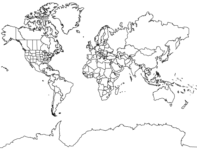
It would be nice if the Washington-BLEEP would show the map.
To: WyldKard
5
posted on
10/08/2002 8:57:03 AM PDT
by
blam
To: blam

I don't know. I'm not entirely whelmed by its depiction of South America.
6
posted on
10/08/2002 9:01:26 AM PDT
by
Physicist
To: Physicist
"I don't know. I'm not entirely whelmed by its depiction of South America." I agree. Also, take a look at SE Asia. That must have been mapped during the Ice Age while the Sundra Shelf was exposed(?).
7
posted on
10/08/2002 9:04:59 AM PDT
by
blam
To: Physicist
The article suggests that the distortion is due to the inherent problem of mapping a globe onto a flat surface. The center of the map is in proportion, and the closer things get to the edge, the more distorted they are.
8
posted on
10/08/2002 9:22:06 AM PDT
by
ffrancone
To: ffrancone
The article suggests that the distortion is due to the inherent problem of mapping a globe onto a flat surface. The center of the map is in proportion, and the closer things get to the edge, the more distorted they are. I'm not sure I buy that either. The classic Mercator projection maps do distort the sizes of things, but not as you move to the east or west, but rather to the north and south - the closer you get to the poles, and the farther from the equator, the more distorted the relative sizes of the continents are. Hence, the well-known problem of Greenland appearing to be as large as the entire continent of Africa, which it certainly is not. But there's no real distortion as you move along the equator from east to west, or west to east...
To: ffrancone
North and South America don't look merely distorted to me. They each look as if a portion of the east coast was mapped, and the shortest possible west coast drawn in to hook it together. Since they knew of the existence of the Pacific ocean (coming from the other direction), they knew the western continents couldn't extend westward indefinitely.
To: blam
That must have been mapped during the Ice Age while the Sundra Shelf was exposed This is central to the Hapgood hypothesis, which is:
. The early maps, that is, from the dawn of modern civilization, were poor copies of good world maps drawn in pre-phoenician times. Phoenicians represented the nadir of civilization, there was an advanced civilization before Phoenicians. This hypothetical advanced civilization navigated and mapped the entire globe including Antarctica. As that civilization collapsed, some of their maps were retained and copied, but copied without understanding basics such as map projections. The resulting maps, such as Ptolemaic maps were poor and distorted as a result. Thus Ptololemy, rather than being advanced intellectually, was actually stumbling about without understanding. We see the same phenomenon today in many bureaucratic agencies, and Ptolemy was nothing more than a bureaucrat.
To: blam
Blam, if you ever get around to a ping list, please put me on it!
To: Physicist
South America looks squished on this projection. It isn't the flat Mercator projection that used to hang on the gradeschool classroom wall, but one of the split appleskin projections now considered modern. In the center the distortion is minimized, but toward the edges, in any direction there is considerable foreshortening. All the same, much of Mexico, and California and Alaska are missing. Cuba is there, but Cuba was usually on the old maps even if nothing else was.
To: RightWhale
"This is central to the Hapgood hypothesis, which is:" The more I learn the more I believe this or something similar must have happened...and I do believe these ancient civilizations were ended by 'natural' catastrophies.
14
posted on
10/08/2002 10:08:29 AM PDT
by
blam
To: FreetheSouth!
"Blam, if you ever get around to a ping list, please put me on it!" Okay.
15
posted on
10/08/2002 10:10:52 AM PDT
by
blam
To: blam
Interesting read. I like the author's speculations.
To: blam
Very interesting!
I suspect that the long ago discoverer, Pablo de Gore, travelled up the west coast, took some gold from the indians, at what is now Hollywood, and returned to Spain.
Thus, Al Gore's distant relatives discovered America.
17
posted on
10/08/2002 10:19:43 AM PDT
by
aShepard
To: aShepard
Thus, Al Gore's distant relatives discovered America. More importantly, they discovered how to work its system.
To: Physicist

Archaeologists Found This Statue In Olmec Ruins In Mexico. I guess he/it flew over here, huh?
19
posted on
10/08/2002 10:45:15 AM PDT
by
blam
To: blam
Bump! Very interesting article.
BTW, the WP made me give them demographic information before they'd let me read it.
I can understand them not taking 1368 as my birth year, but they wouldn't take 1899 either. If I really was 103, I'd be pissed.
20
posted on
10/08/2002 10:53:55 AM PDT
by
dead
Navigation: use the links below to view more comments.
first 1-20, 21-31 next last
Disclaimer:
Opinions posted on Free Republic are those of the individual
posters and do not necessarily represent the opinion of Free Republic or its
management. All materials posted herein are protected by copyright law and the
exemption for fair use of copyrighted works.
FreeRepublic.com is powered by software copyright 2000-2008 John Robinson