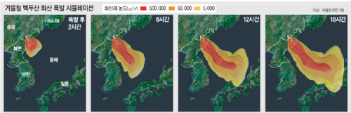
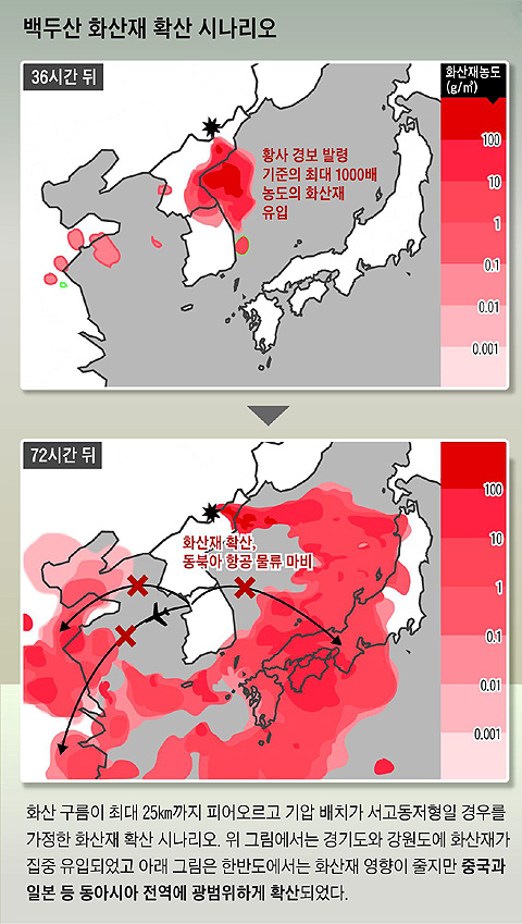
Here is one scenario about what happens if Mt. Paekdu erupts, according to
Chosun Ilbo, a S. Korean daily. This assumes that a high pressure system is in the West and a low pressure system, in the East. In winter, a high pressure system forms in the North West of Korea, and wind is blowing from NW to SE. The first map shows the pattern of volcanic ash spreading after 36 hours, and the second, after 72 hours.
Somewhere in a North Korean concentration camp there is a geologist muttering under his breath, “I told you this was going to happen, fat boy.”