Posted on 02/06/2013 1:23:57 PM PST by TSgt
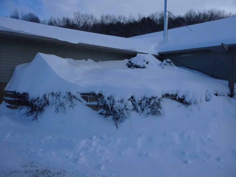
Two storms will merge quickly enough to bring colder air, heavy snow and increasing wind to New England. Some areas will be hit with an all-out blizzard and a couple of feet of snow.
The worst of the storm will hit late Friday and Friday night and will wind down Saturday morning. However, lingering effects from blowing and drifting snow, blocked roads and other travel delays are likely to linger into much of the weekend.
Numerous flight delays and cancellations are possible centered on New England, but these problems will be felt elsewhere across the nation.
Strong winds will not only cause white-out conditions but can result in massive drifts.
At the height of the storm, snow can fall at the rate of 2 to 4 inches per hour and may be accompanied by thunder and lightning.
A person traveling northeastward from New York City Friday evening along I-95 would encounter progressively worse and potentially dangerous weather conditions.
With such snowfall intensity, vehicles can become stuck and people can become stranded.
The hardest-hit areas are likely to include Hartford and Providence to Boston, Worcester, Concord, Portsmouth and Portland.
Coastal flooding is another concern with this storm along the coast of eastern Massachusetts. The period of strong northeast winds will be occurring within a couple of days of the new moon and high astronomical tides.
Warm air will play a major role in the storm from New York City, Long Island and central New Jersey on south and west in the mid-Atlantic, resulting in rain during part or all of the storm, depending on location.
Only if the two storms sync up completely would heavy snow wrap around into New York City for an extended period, bringing a foot of the white stuff. Even so, without complete phasing of the storms, New York City and Long Island will get significant snow.
A separate story on the storm's role in New York City and the mid-Atlantic is now available on AccuWeather.com.
Meanwhile, a fresh injection of arctic air will fuel the blizzard over New England. The colder air will cause rain to change to snow on Cape Cod and along the South Coast, as well as cause wet snow to become more dry and powdery with time, making it subject to blowing and drifting in central and southern areas.
In northernmost New England from northern Maine to along the Canada border of New Hampshire, Vermont and northern upstate New New York, too much dry air feeding in from the north may limit snowfall or cut off the storm completely.
Snow from the Alberta Clipper part of the storm will still deliver enough snow to shovel and plow over much of upstate New York.
Ours lasts anywhere from 6-12 months.
Eastern Massachusetts,Rhode Island and southern Connecticut (all close to the ocean) aren't accustomed to 2 feet of snow.Other parts of New England are though.Around here anything more than a foot is unusual and causes huge problems.
When I lived in North Dakota, we had a back-up propane heater and woodburner in case the power went out. We would put things in the fridge that we didn't want to freeze. Everything else went out on the porch.
Most of the blizzards that hit Massachusetts originate in the mountains of Peru and Boliva...if ya catch my drift!
If we get two feet around here they delay schools for two hours.
“That weather graphic looks like a” ..... “Johnson - get over here.”
/Austin Powers
What difference does it make?/sarc
"Johnson! -Yes, sir. Call British Intelligence and let them know about it."
In some cases (like this one) it does. Basically there is precip system running up the coast which is going to hit the non-precip system presently over the mid-west and power it up.
You all get lake effect snow which we almost never see here. We get Nor’easters which you almost never see. It’s pretty rare that you get whacked with a storm and we get whacked by the same storm. It happens, but not all that often. Sometimes our coastal storms take a funky turn and head towards the Great Lakes and power back up and you all get hit, real hard.
But I agree, it’s winter. Shouldn’t be a big surprise. That said, I’m bringing in extra wood tonight and tomorrow.
[Noticing Dr. Evil’s spaceship on radar]
Radar Operator: Colonel, you better have a look at this radar.
Colonel: What is it, son?
Radar Operator: I don’t know, sir, but it looks like a giant...
Jet Pilot: Dick. Dick, take a look out of starboard.
Co-Pilot: Oh my God, it looks like a huge...
Bird-Watching Woman: Pecker.
Bird-Watching Man: [raising binoculars] Ooh, Where?
Bird-Watching Woman: Over there. What sort of bird is that? Wait, it’s not a woodpecker, it looks like someone’s...
Army Sergeant: Privates. We have reports of an unidentified flying object. It has a long, smooth shaft, complete with...
Baseball Umpire: Two balls.
[looking up from game]
Baseball Umpire: What is that. It looks just like an enormous...
Chinese Teacher: Wang. pay attention.
Wang: I was distracted by that giant flying...
Musician: Willie.
Willie: Yeah?
Musician: What’s that?
Willie: [squints] Well, that looks like a huge...
Colonel: Johnson.
Radar Operator: Yes, sir?
Colonel: Get on the horn to British Intelligence and let them know about this.
Here in Tennessee it’s bread, milk and eggs, or the “french toast” panic buying.

Looks like they’re gonna get sacked. LOL
Don’t forget the toilet paper.
Don’t forget the TP.
Global Warming!
Cool indeed.


Let’s hope that it peters out
Disclaimer: Opinions posted on Free Republic are those of the individual posters and do not necessarily represent the opinion of Free Republic or its management. All materials posted herein are protected by copyright law and the exemption for fair use of copyrighted works.