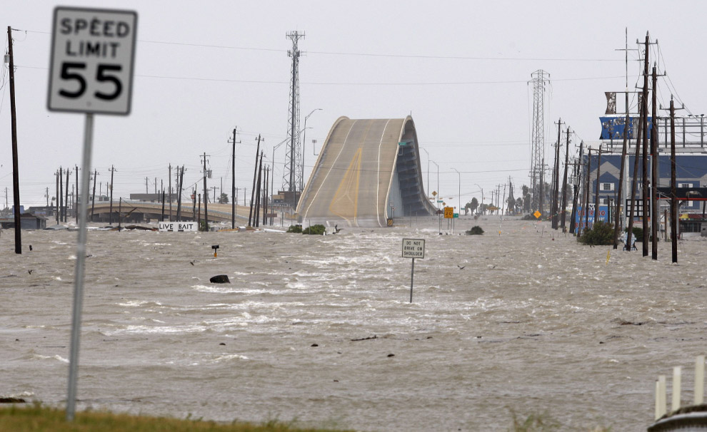
Can anyone explain to me why they put this hump in the highway like this? (I have never been to the area so from this picture view it really looks odd)
http://cache.boston.com/universal/site_graphics/blogs/bigpicture/ike_09_15/ike7.jpg
“... hump in the highway like this?”
It’s a bridge. I think that’s Surfside. If I’m right, you go west off Galveston, pay the toll at San Luis, go way down to SS, turn right at 332 and there is that shot. (Usually it has less water on the road.)
It’s probably a bridge that allows boats from the lake to get into the bay (Kemah/Seabrook area) or if it’s on Bolivar Penninsula then it allows boats to get from the bay to the gulf.
Looking closer, I think it’s the Kemah bridge. The blue bldg on the right is a Japanese restaurant.