
I focused my research on locating the "Wye" or "Y" where the traces joined. When I did so, I found that it was at the site of a town -- that vanished in 1866 -- which was a nexus of several important very early roads. We are planning a detailed on-the-ground archaeological survey of the "Old Unionville" townsite later this month.
THC (Texas Historical Commission) has just approved my application for a State Historical Marker at the location shown in the (resolution and size both reduced 50% as a courtesy to FR) photo below. It is one of the few known places where the remains of Trammel's Trace are clearly visible from a State highway. (The "marker" shown is totally computer-generated -- it resides only in my Macintosh -- and now, in my webspace...)
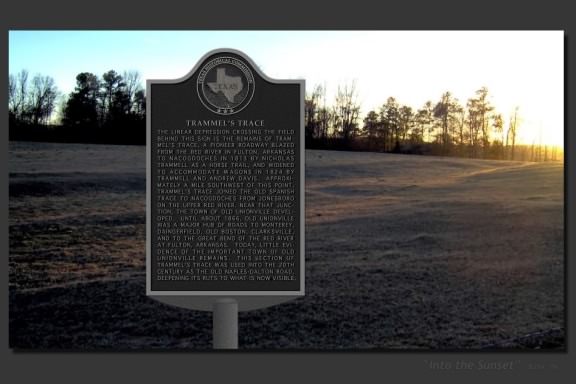
Should you wish to view the image at full-res, you can do so here. (The barbed wire fence visible at lower right marks the highway ROW where the marker will be placed...)