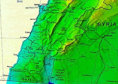
This is the general idea in small format for a quick load:

If you want the full version, it runs 281 KB and can be downloaded at this link:
http://i4.photobucket.com/albums/y138/jeffers_mz/lebanon_pol_2002plusDEMpoint3comp.jpg
The registration isn't perfect, and the projection is a little strange, but the overlay really wasn't intended to be used this way.
For the technically inclined, this is a 30 meter per pixel Digital Elevation Model, from the GTOPO30 dataset, with a raster image drape done using Global Mapper with 4 point manual registration, rendered using Photoshop 5.0 and saved at 30% JPEG compression.
I will conditionally release the image to the public domain for non-commercial use, provided no-one uses it to publicly illustrate combat operations currently underway or operations planned for future execution.