Today's silly question: How do they know the 1895 earthquake was a magnitude 6? Did they have the instruments to measure quakes back then?
Now compare that map to a county result map for either the 2000 or 2004 presidential election. Note the overlap between the damage profile and the counties that voted democrat along the Mississippi, particularly if you extend the damage area a little further up and down the river.
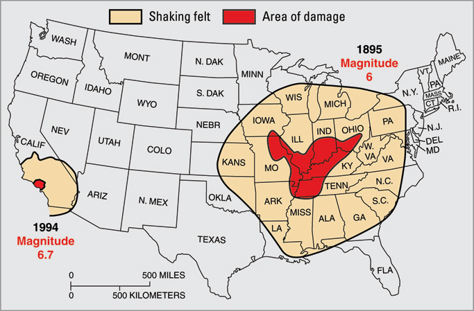
Looking at the two maps, can you deny Karl Rove's earthquake machine is behind the proposed earthquake? ]
Link to a link only county election map:
http://www.usatoday.com/news/politicselections/vote2004/countymap.htm