2) Your chart ends in 1995. Satellite based observation of stratospheric ozone continues to this day. Where are the rest of the data?
Regarding 1, the Halley Bay measurements constitute the discovery data set for the ozone hole. They had to re-calibrate the satellite measuring ozone from space because they thought it was returning erroneous data. Once they did that, the satellite was capable of showing the area of ozone depletion; the ground-based instruments still provided the baseline.
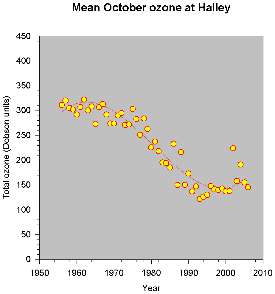
Regarding 2, it's an older Web site. After several minutes of arduous searching, here's more recent data (reduced for posting; click for BIG graph):