Skip to comments.
Tropical Storm Grace - Live Thread (due to hit TX coast Sunday afternoon)
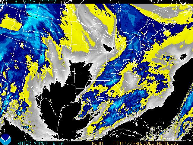
HurricaneCity.com / NHS ^
| 8.30.03
Posted on 08/30/2003 8:07:37 PM PDT by mhking
WTNT31 KNHC 310229
TCPAT1
BULLETIN
TROPICAL STORM GRACE ADVISORY NUMBER   3
NWS TPC/NATIONAL HURRICANE CENTER MIAMI FL
10 PM CDT SAT AUG 30 2003
A TROPICAL STORM WARNING IS IN EFFECT FOR THE TEXAS COAST FROM HIGH ISLAND TO CORPUS CHRISTI.
A TROPICAL STORM WARNING MEANS THAT TROPICAL STORM CONDITIONS ARE EXPECTED WITHIN THE WARNING AREA WITHIN THE NEXT 24 HOURS.
AT 10 PM CDT...0300Z...THE VERY POORLY DEFINED CENTER OF TROPICAL STORM GRACE WAS LOCATED NEAR LATITUDE 25.5 NORTH...LONGITUDE 94.5 WEST OR ABOUT 210 MILES SOUTHEAST OF CORPUS CHRISTI TEXAS.
GRACE IS MOVING TOWARD THE WEST-NORTHWEST NEAR 10 MPH ...17 KM/HR... AND THIS MOTION IS EXPECTED TO BRING THE CENTER ACROSS THE TEXAS COAST SUNDAY NIGHT. HOWEVER...THE STRONG WINDS AND RAIN ARE LOCATED NORTH AND EAST OF THE CENTER AND THE RAIN HAS ALREADY BEGUN TO AFFECT EAST TEXAS AND SOUTHERN LOUISIANA.
MAXIMUM SUSTAINED WINDS ARE NEAR 40 MPH... 65 KM/HR...WITH HIGHER GUSTS. SOME STRENGTHENING IS POSSIBLE DURING THE NEXT 24 HOURS.
TROPICAL STORM FORCE WINDS EXTEND OUTWARD UP TO 115 MILES ...185 KM FROM THE CENTER.
THE ESTIMATED MINIMUM CENTRAL PRESSURE IS 1009 MB...29.80 INCHES.
RAINFALL ACCUMULATIONS OF 6 TO 8 INCHES...WITH ISOLATED HIGHER AMOUNTS...ARE EXPECTED OVER PORTIONS OF EASTERN TEXAS AND LESSER AMOUNTS ARE EXPECTED OVER WESTERN LOUISIANA.
STORM SURGE FLOODING OF 2-4 FEET ABOVE NORMAL TIDE LEVELS...IS EXPECTED ALONG THE TEXAS COAST NEAR AND TO THE NORTH OF WHERE THE CENTER MOVES INLAND.
REPEATING THE 10 PM CDT POSITION...25.5 N... 94.5 W. MOVEMENT TOWARD...WEST-NORTHWEST NEAR 10 MPH. MAXIMUM SUSTAINED WINDS... 40 MPH. MINIMUM CENTRAL PRESSURE...1009 MB.
FOR STORM INFORMATION SPECIFIC TO YOUR AREA...PLEASE MONITOR PRODUCTS ISSUED BY YOUR LOCAL WEATHER OFFICE.
AN INTERMEDIATE ADVISORY WILL BE ISSUED BY THE NATIONAL HURRICANE CENTER AT 1 AM CDT FOLLOWED BY THE NEXT COMPLETE ADVISORY AT 4 AM CDT.
FORECASTER LAWRENCE
TOPICS: Culture/Society; Front Page News; News/Current Events; US: Texas
KEYWORDS: storm; tsgrace; weather
Navigation: use the links below to view more comments.
first 1-20, 21-22 next last
1
posted on
08/30/2003 8:07:38 PM PDT
by
mhking
OFFSHORE WATERS FORECAST FOR THE GULF OF MEXICO
NWS TPC/NATIONAL HURRICANE CENTER MIAMI FL
430 PM CDT SAT AUG 30 2003

OFFSHORE WATERS FORECAST FOR THE GULF OF MEXICO

GMZ080-310330-
NW GULF N OF 25N W OF 90W
INCLUDING THE FLOWER GARDEN BANKS NATIONAL MARINE SANCTUARY
430 PM CDT SAT AUG 30 2003


TROPICAL STORM WARNING S OF 27N FROM 92W TO 94W

TROPICAL STORM CONDITIONS EXPECTED N OF 27N W OF 94W SUN

TONIGHT
HIGHEST WIND 45 GUST TO 55 KT NEAR CENTER OF TROPICAL
STORM GRACE.  TROPICAL STORM FORCE WIND AND SEAS 12 FT WITHIN
170 NM E SEMICIRCLE AND 25 NM W SEMICIRCLE.  ELSEWHERE S OF 28N
E OF 93W  WIND E 20 TO 33 KT.  SEAS 12 FT.  N OF 28N E OF 93W
WIND SE 20 TO 25 KT.  SEAS 8 FT.  W OF 93W  WIND NE 15 TO 20
KT.  SEAS 6 FT.  WIND AND SEAS HIGHER IN NUMEROUS TSTMS.

SUN
HIGHEST WIND 55 GUST TO 65 KT NEAR CENTER OF TROPICAL
STORM GRACE.  TROPICAL STORM FORCE WIND AND SEAS 12 FT OR
GREATER WITHIN 170 NM E SEMICIRCLE AND 25 NM W SEMICIRCLE.
ELSEWHERE FROM 92W TO 95W  WIND 20 TO 33 KT.  SEAS 12 FT.
E OF 92W  WIND SE 20 KT.  SEAS 9 FT.  W OF 96W  WIND NE 15 KT.
SEAS 5 FT.  NUMEROUS TSTMS.

SUN NIGHT
HIGHEST WIND 30 GUST TO 40 KT NEAR CENTER OF
TROPICAL STORM...INLAND.  TROPICAL STORM FORCE WIND AND SEAS 12
FT OR GREATER WITHIN 90 NM OF CENTER.  ELSEWHERE N OF 26N
W OF 94W  WIND 20 TO 25 KT.  SEAS 10 FT.  ELSEWHERE WIND S 15 TO
20 KT.  SEAS 8 FT.  NUMEROUS TSTMS N OF 26N E OF 94W.
2
posted on
08/30/2003 8:08:19 PM PDT
by
mhking
To: mhking
I sure hope the cotton farmers around here get their crops harvested before it hits. The cotton crop has been very good this year due to some timely rains ealier in the summer. Rain now would damage the cotton and greatly decrease its value.
3
posted on
08/30/2003 8:12:42 PM PDT
by
Paleo Conservative
(Do not remove this tag under penalty of law.)
To: mhking
4
posted on
08/30/2003 8:14:09 PM PDT
by
mhking
To: Paleo Conservative
I think most were bringing it in as Erika approached but what do you suppose Sunday afternoon means? My kids are coming back from Brownwood tomorrow and should be near CC around 11 or 12.
5
posted on
08/30/2003 8:16:17 PM PDT
by
CindyDawg
To: mhking
To: mhking
Thanks for posting this.
By the way, I would like to register a formal complaint, a very series one.
Grace, eh? It's still a white name, how come you people don't give it an Afro sounding name, huh? This is all kind of ISM!
7
posted on
08/30/2003 8:22:23 PM PDT
by
Chong
(shiela jacka-sun lee...... GET A LIFE GIRLFRIEND!)
To: mhking
8
posted on
08/30/2003 8:22:48 PM PDT
by
Paleo Conservative
(Do not remove this tag under penalty of law.)
To: mhking
OK, don’t you guys start the BS about why I haven’t kept up with all of this? I have been working all day, and have not been able to monitor radio much less the net. FR is a great recourse for things like this, and I am looking for a little advise, I am supposed to go to Galveston tomorrow for a little get together about 1:30 to have a little lunch. Based on all of your opinions, should I go, or should I stay in Houston, catch up on some monkey work, and bath Fannie Mae the Beagle?
9
posted on
08/30/2003 8:26:48 PM PDT
by
dix
To: dix
From what I can figure, go on, but be alert and safe...
10
posted on
08/30/2003 8:28:41 PM PDT
by
mhking
To: CindyDawg
I think most were bringing it in as Erika approached but what do you suppose Sunday afternoon means? While quite a bit of cotton has already been harvested, I saw quite a bit of it still in the fields Friday when I was checking out drilling activity.
It doesn't look like this storm will be very strong. I would just stay home during the evening when it hits.
11
posted on
08/30/2003 8:29:26 PM PDT
by
Paleo Conservative
(Do not remove this tag under penalty of law.)
To: dix
recourse=resource
advise=advice
I told you it's been a long day.
12
posted on
08/30/2003 8:29:54 PM PDT
by
dix
To: Nita Nupress; Flyer
Good one! Thanks, Nita.
Flyer, I think you're gonna like this link too....
13
posted on
08/30/2003 8:34:41 PM PDT
by
Humidston
(Do not remove this tag under penalty of law)
To: Humidston
To: Nita Nupress
Hey back, sweetie! Bookmarked!
Tank youse...
15
posted on
08/30/2003 8:53:00 PM PDT
by
Humidston
(Do not remove this tag under penalty of law)
To: Nita Nupress; Humidston
The show used to be available online I believe and has a toll free number for call ins.
16
posted on
08/30/2003 8:55:15 PM PDT
by
deport
To: deport
Thanks Deport!
17
posted on
08/30/2003 9:02:11 PM PDT
by
Humidston
(Do not remove this tag under penalty of law)
To: mhking
I'm up in Tyler, thank goodness.
18
posted on
08/30/2003 9:41:23 PM PDT
by
Cathryn Crawford
(Wait, I just remembered something! You're boring and my legs work.)
To: Paleo Conservative
The cotton in our area of central Texas (north east of Austin) was harvested in the last two weeks.
19
posted on
08/30/2003 11:10:07 PM PDT
by
PokeyJoe
(Don't talk about my armchair unless you know how to pull the recliner lever.)
To: Humidston
Thanks for the links. . . now I can see all the slop I gotta go drive in today. I'm to Brenham, then Nacogdoches. That's where a lot of th rain is right now.
20
posted on
08/31/2003 3:15:24 AM PDT
by
Flyer
(If you can read this you are posting too close)
Navigation: use the links below to view more comments.
first 1-20, 21-22 next last
Disclaimer:
Opinions posted on Free Republic are those of the individual
posters and do not necessarily represent the opinion of Free Republic or its
management. All materials posted herein are protected by copyright law and the
exemption for fair use of copyrighted works.
FreeRepublic.com is powered by software copyright 2000-2008 John Robinson