Free Republic
Browse · Search
News/Activism
Topics · Post Article

Skip to comments.

N.California Weather/Wave ALERT!
NOAA ^ | 12-15-02 | GRRRRR

Posted on 12/15/2002 4:18:54 AM PST by GRRRRR

The National Weather Service - San Francisco Area/Monterey

Skip link to top News of the Day

link to NOAA Homepage

link to NWS home page

Home Button - Go to National Weather Service

News Button - go to important news of the day page

Organization Button - go to a listing of the organizational structure of the National Weather Service

San Francisco

Bay Bridge with fog The Central Coast

High Surf Advisory


Gale Warning


NATIONAL WEATHER SERVICE SAN FRANCISCO CA

POINT ARENA TO POINT PIEDRAS BLANCAS AND OUT 60 NM INCLUDING THE SAN FRANCISCO BAY AREA AND MONTEREY BAY

PZZ500-151700- SYNOPSIS FOR THE CENTRAL CALIFORNIA COAST AND BAYS INCLUDING MONTEREY BAY...GULF OF THE FARALLONES...AND CORDELL BANK NATIONAL MARINE SANCTUARIES...

THE NEXT VIGOROUS PACIFIC FRONTAL SYSTEM WILL APPROACH POINT ARENA LATE TONIGHT AND MOVE SOUTH THROUGH THE CENTRAL CALIFORNIA WATERS ON MONDAY. HIGH SEAS WILL CONTINUE THROUGH MID WEEK.

POINT ARENA TO PIGEON POINT 20 TO 60 NM OFFSHORE-
POINT ARENA TO PIGEON POINT OUT TO 20 NM-

NATIONAL WEATHER SERVICE SAN FRANCISCO CA
300 AM PST SUN DEC 15 2002

...GALE WARNING... ...HIGH SURF ADVISORY...


TODAY...WIND SW 15 TO 25 KT THIS MORNING...BECOMING S AND INCREASING TO 20 TO 35 KT THIS AFTERNOON. COMBINED SEAS 18 TO 22 FT EVERY 14 SECONDS...BUILDING TO 22 TO 26 FT. RAIN BECOMING LIKELY.
TONIGHT...WIND S 30 TO 40 KT... COMBINED SEAS 22 TO 28 FT EVERY 14 SECONDS. RAIN...HEAVY AT TIMES.
MONDAY...WIND SW 25 TO 35 KT...DECREASING TO 15 TO 25 KT IN THE AFTERNOON. COMBINED SEAS 24 TO 28 FT EVERY 14 SECONDS. PERIODS OF RAIN.
MONDAY NIGHT...WIND W 10 TO 20 KT... COMBINED SEAS 22 TO 26 FT MAINLY IN NW SWELL. SHOWERS.
TUESDAY...WIND SW 15 TO 25 KT...BECOMING NW 15 TO 25 KT IN THE AFTERNOON. COMBINED SEAS 18 TO 23 FT...MAINLY IN NW SWELL. RAIN LIKELY.


WEDNESDAY...WIND VARIABLE 15 KT...BECOMING S AND INCREASING TO 15 TO 30 KT LATE. COMBINED SEAS 14 TO 19 FT. SEAS MAINLY IN NW SWELL.
THURSDAY...WIND S 25 TO 40 KT... COMBINED SEAS 15 TO 19 FT


Other Observation Links
Point Arena Buoy
Bodega Buoy
San Francisco Buoy
Half Moon Bay Buoy


HOME


TOPICS: Front Page News; News/Current Events
KEYWORDS: galewarning; killerwaves; weather
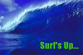
Uh-OH---Looks like the DemoSocialist need to batten down the hatches...Surf's UP DUDE!!

GRRRRRollin'

1 posted on 12/15/2002 4:18:55 AM PST by GRRRRR
[ Post Reply | Private Reply | View Replies]

To: GRRRRR

After several weeks of grueling media attention, Nancy Pelosi
has vowed not to listen to any news reports for the next few days.

2 posted on 12/15/2002 4:46:48 AM PST by Quilla
[ Post Reply | Private Reply | To 1 | View Replies]

To: GRRRRR
Damn sunny California they yell if the roads get wet.

What about us Washington coasters...

HIGH WIND WARNING TODAY AND EARLY TONIGHT... ...HIGH SURF ADVISORY... TODAY...SOUTHEAST WIND 15 TO 30 MPH...BECOMING SOUTH AND INCREASING TO 35 TO 45 MPH WITH GUSTS 65 MPH COASTAL COMMUNITIES...AND TO 80 MPH HEADLANDS. TONIGHT...SOUTH WIND 35 TO 45 MPH EARLY...WITH GUSTS TO 65 MPH COASTAL COMMUNITIES...AND TO 80 MPH HEADLANDS. WIND DECREASING AND BECOMING SOUTHEAST 15 TO 30 MPH. RAIN...HEAVY AT TIMES...TURNING TO SHOWERS. A CHANCE OF THUNDERSTORMS. LOWS NEAR 45...

Just another Northwest Coastal storm.

3 posted on 12/15/2002 5:23:34 AM PST by snodog
[ Post Reply | Private Reply | To 1 | View Replies]

To: GRRRRR
Hope a tidal wave hits. And conservatives in SF escape of course.
4 posted on 12/15/2002 5:28:57 AM PST by John Lenin
[ Post Reply | Private Reply | To 1 | View Replies]

To: GRRRRR
30 waves will cause considerable damage. Landfalling hurricanes rarely make monster waves like this. Sierra Nevada range reported 130mph winds too.

Freak weather alert...cowabunga!

Looks like the Demorats are already on the beach.


5 posted on 12/15/2002 5:51:43 AM PST by Rain-maker
[ Post Reply | Private Reply | To 1 | View Replies]

To: GRRRRR
It should make for a soggy 49er-Packer game.
6 posted on 12/15/2002 5:53:58 AM PST by csvset
[ Post Reply | Private Reply | To 1 | View Replies]

To: GRRRRR
It should make for a soggy 49er-Packer game.
7 posted on 12/15/2002 5:54:25 AM PST by csvset
[ Post Reply | Private Reply | To 1 | View Replies]

To: GRRRRR
I blame Lott.
8 posted on 12/15/2002 6:15:29 AM PST by Drango
[ Post Reply | Private Reply | To 1 | View Replies]

To: Rain-maker

Winds Batter Reno, Nev., While California Gets Heavy Drenching

Published: Dec 15, 2002
 
RENO, Nev. (AP) - A powerful windstorm lashed the Reno area Saturday, causing major property damage, flight cancellations and scattered power outages.

Gusts reached up to 82 mph in Reno and 134 mph on the Sierra Nevada crest in advance of a storm expected to dump up to 2 feet of snow in the mountains, according to the National Weather Service.

"It's the strongest winds we've ever recorded in Reno," said weather service forecaster Tom Cylke. "What we saw today were hurricane-force winds."

Meanwhile, in Northern California, rain-swollen rivers rose to flood levels, while high winds, dangerous surf, snow and even a rare coastal tornado were reported.

Winds in Nevada blew shingles off homes and toppled truck rigs, power lines, billboards, carports, trees and fences, police said. Many stoplights were out in Reno and police advised residents to stay home.

Sierra Pacific Power Co. spokeswoman Faye Anderson said outages affected an estimated 25,000 customers in Reno and Sparks.

"Our guys have their hands full," Anderson said. "We have every available crew out there."

At Reno-Tahoe International Airport, some flights were canceled and most Reno-bound flights were diverted, said spokesman Adam Mayberry.

"Some airplanes have landed here but very few. Most aren't landing here," he said.

At least three truck rigs were toppled by high winds, the Nevada Highway Patrol reported. The drivers escaped with minor injuries.

Meanwhile, the heavy rains and high winds pounding the California coast were expected to continue through the weekend.

"I would say north of San Francisco on up to Oregon will probably see the worst parts of it," said Diana Henderson of the National Weather Service.

The storm brought the heaviest rain to the coast - by Saturday morning, some coastal mountain areas surpassed 9 inches in 24 hours. The downpour gained strength by afternoon, with wind bursts driving rain horizontally in the San Francisco Bay area.

Already by midday, rains and even some thunderstorms prompted flood warnings along the Sacramento, Russian and Napa rivers. Minor flooding was expected when waters crested Saturday evening.

On the Humboldt County coast near Ferndale, the weather service reported a rare tornado that started as a water spout in the Pacific and moved onshore by late morning. No damage was reported.

High surf thundered along the California coast - waves were expected to tip 30 feet through Tuesday. Forecasters said winds could reach up to 60 miles per hour.

In San Francisco, midday gusts tossed scaffolding from a seven-story building, injuring a passer-by and damaging several cars. As many as 180,000 customers were without power at one point in the Bay area; the number dropped to about 50,000 late Saturday.

---

On the Net:

National Weather Service: http://www.wrh.noaa.gov/

http://ap.tbo.com/ap/breaking/MGA96GKOQ9D.html


9 posted on 12/15/2002 6:21:46 AM PST by Rain-maker
[ Post Reply | Private Reply | To 5 | View Replies]

To: Rain-maker
It's a message from God. Elect Pelosi leader and this is what happens.
10 posted on 12/15/2002 6:24:02 AM PST by John Lenin
[ Post Reply | Private Reply | To 5 | View Replies]

To: Rain-maker
30 waves will cause considerable damage. Landfalling hurricanes rarely make monster waves like this. Sierra Nevada range reported 130mph winds too.

The news media always turns the proverbial "mound into a mountain" - of bucks. In the winter, it is not unusual for a low level jet stream over the west coast. I once sat over Sacramento in a "parked" airplane (i. e. aircraft airspeed equal to headwind speed). Others have reported flying backwards due to a headwind in excess of aircraft airspeed. On the east coast, low level jet streams also create big winds on Mt Washington.

Low level jets at 10M to 12M feet are much less dangerous than the swirling tornadic winds of a major hurricane blowing at sea level. 30 foot waves seem high, but they are not unusual in the rugged Pacific Coastal areas. A 30 foot hurricane tidal surge is more than just a wave. It is a mass of water sucked up by abnormally low pressure and projected toward the coastline (which is usually low and flat) like a Tsunami. I believe Hawaii gets 100 foot waves, but its big surge only comes with Tsunamis.

11 posted on 12/15/2002 7:17:54 AM PST by ghostrider
[ Post Reply | Private Reply | To 5 | View Replies]

To: ghostrider
The big waves in Hawaii are caused by shoal waters where thirty foot waves climb on the reef and then break. Only happens during the Winter on the North Shore and not all that often. Monterey in Cali. has the same conditions only bigger and more dangerous.
12 posted on 12/15/2002 8:38:29 AM PST by willyone
[ Post Reply | Private Reply | To 11 | View Replies]

To: ghostrider
Thanks for the briefing on breakers verses storm surge.

13 posted on 12/15/2002 9:50:41 AM PST by Rain-maker
[ Post Reply | Private Reply | To 11 | View Replies]

Disclaimer: Opinions posted on Free Republic are those of the individual posters and do not necessarily represent the opinion of Free Republic or its management. All materials posted herein are protected by copyright law and the exemption for fair use of copyrighted works.

Free Republic
Browse · Search
News/Activism
Topics · Post Article

FreeRepublic, LLC, PO BOX 9771, FRESNO, CA 93794
FreeRepublic.com is powered by software copyright 2000-2008 John Robinson