The Red Spots are less than yesterday. They are still there and closer to Agness and the other small communities north of what used to be the Kalmiopsis Wilderness.
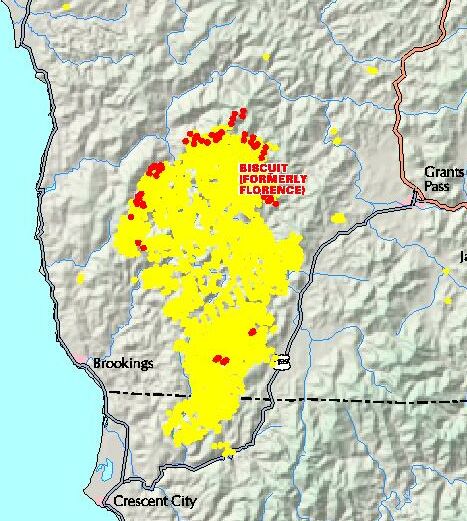
The Red Spots are less than yesterday. They are still there and closer to Agness and the other small communities north of what used to be the Kalmiopsis Wilderness.
The faint green broken line inside of the massive burn area, is the boundary of the former crown jewel of the Criminally Insane Green Jihadists of Oregon, the Former Kalmiopsis Wilderness Area.
It appears that he Floristry Circus Clowns in charge of the map making and info don't want a map that clearly shows the entire Kalmiopsis Wilderness Area has basically been burnt up. Also, their maggot green brothers and sisters who control the fishwraps of Oregon are avoiding this incredible news that an entire 180,000 Wilderness Area has been burnt up as per the agenda of the Criminally Insane Green Jihadists in charge of the State of Oregon.
