Free Republic
Browse · Search
News/Activism
Topics · Post Article

To: 21twelve

They have backed off on precip totals, but this little gem remains in the forecast:

This system moves in quickly and is pretty much done by Thursday
evening, so the short duration of this event will limit storm
total precipitation amounts. Although we can`t rule out a short
period of moderate to locally heavy precipitation that could bring
some minor flooding concerns to areas already affected by recent
floods, including rivers in northeast CA (Pit, Susan, Middle Fork
Feather), and smaller creeks around the Tahoe basin. -Edan


1,005 posted on 02/15/2017 4:02:11 AM PST by mad_as_he$$ ("It's a war against humanity!" Donald J. Trump)
[ Post Reply | Private Reply | To 1004 | View Replies ]


To: mad_as_he$$
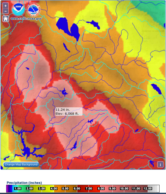
The NWS is still forecasting (as of 7:30AM today) an absurd amount of precip in the catchment basin over the next 6 days: Oroville watershed 6-day precip forecast photo IMG_1045.png
1,039 posted on 02/15/2017 10:50:07 AM PST by leakinInTheBlueSea
[ Post Reply | Private Reply | To 1005 | View Replies ]

Free Republic
Browse · Search
News/Activism
Topics · Post Article


FreeRepublic, LLC, PO BOX 9771, FRESNO, CA 93794
FreeRepublic.com is powered by software copyright 2000-2008 John Robinson