Posted on 06/16/2015 6:31:30 AM PDT by thackney
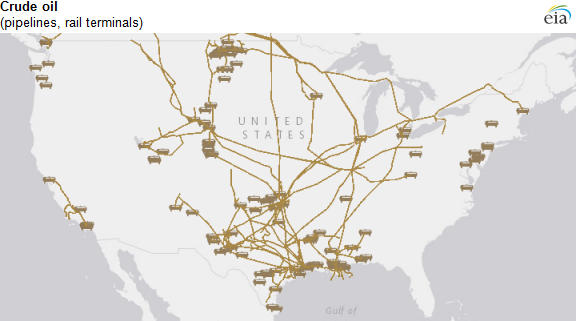
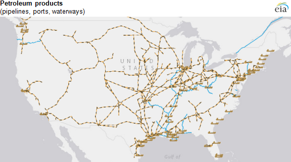
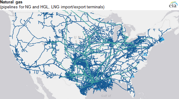
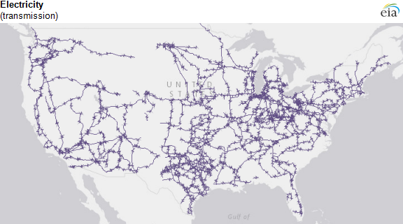
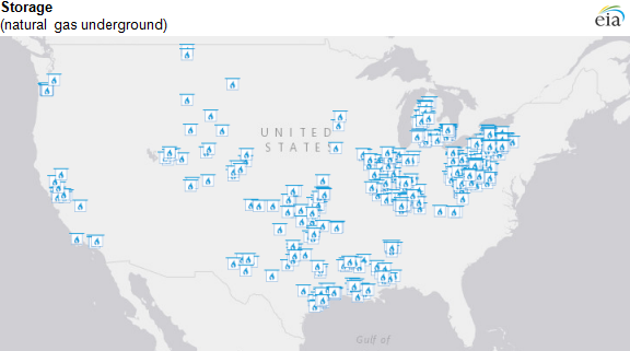
EIA's energy mapping system is a data-intensive visual reference tool that includes several map layers defining energy infrastructure components across the United States. Using this series of maps, viewers can see crude oil, petroleum, natural gas, or hydrocarbon gas liquid pipelines, terminals, and ports in their area, as well as high voltage electric transmission lines. The mapping system combines information from many government agencies as well as public and private sources. Understanding infrastructure components is helpful as energy supply and consumption patterns change.
These map layers can be presented over several base layers with geographic, topographic, street, or satellite image detail, as well as with state, county, and congressional district borders.
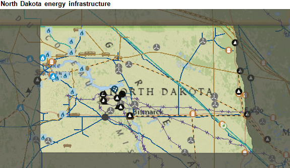
Each state's map is also included as part of EIA's State Energy Data System. For instance, within North Dakota, viewers can see several components of energy infrastructure (pipelines, rail terminals, transmission lines) in addition to parts of the energy system, such as the locations of natural gas processing plants, coal mines, and wind power plants (including individual turbines).
WHAT! Now the bad guys will know...................... Oh, they already do. But, how many every day folks realize just how vulnerable all these systems are? Hey, look over there is that one of the kardouchians?
THANK you for a most informative thread!
Good think Obama stopped that Keystone thing, or there might be a pipeline just going right across America, and we wouldn’t want that to happen.
Good think Obama stopped that Keystone thing, or there might be a pipeline just going right across America, and we wouldn’t want that to happen.
Trying to use this data set for specific location is difficult. More of general knowledge of total systems.
I have little doubt those that “need” to know specifics do know them. Or can easily find them out. I’m sure you realize as well as a lot of us that casual conversations can lead to a lot of intel. Even if you’re not looking for it.
Disclaimer: Opinions posted on Free Republic are those of the individual posters and do not necessarily represent the opinion of Free Republic or its management. All materials posted herein are protected by copyright law and the exemption for fair use of copyrighted works.