Posted on 09/14/2013 5:01:50 PM PDT by george76
Aerial photos of the flood damage caused by heavy rains along Colorado’s Front Range.
A 60-year-old Cedar Cove woman was believed to be the fifth person killed in this week’s historic flooding as authorities scrambled Saturday to reach the 230 people listed as unaccounted for in northern Colorado.
Meanwhile, evacuation orders spread throughout the day to communities downstream as rivers continued to flow above flood stage.
(Excerpt) Read more at photos.fortmorgantimes.com ...
We have lots of extra water that we like to give to you.
You realize there are laws in Colorado that prevent people from using, daming or stopping the flow the rain water. It must, by law, flow down the rivers and into Kansas where it is used for irrigation.
What a disaster. It’s terrible.
For those not around in the early evening of Saturday, July 31, 1976 :
a large stationary thunderstorm released as much as 7.5 inches of rainfall in about an hour (about 12 inches in a few hours) in the middle reaches of the Big Thompson River Basin and to a lesser extent in parts of the Cache la Poudre River Basin.
http://pubs.usgs.gov/fs/2006/3095/
We’d take it but would have to dig a ‘l o n g’ ditch to get it here, lol.
Wow. What a disaster.

Thanks for the ping. Please keep me on the Ping list.
About one minute and it repeats once within the video
WATCH Incredible Video of Fire Truck Driving Through Colorado Flood
http://www.youtube.com/watch?v=ofU8H8XScoA

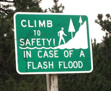
Here is a good photo of the Big Thompson canyon, and you can see why there is so much damage. Upstream from this, there is a large area which will drain into this river. So when it has extremely heaving rains across the area, it will not have anywhere to go except to collect into this narrow canyon. On a good day it is barley wide enough to have the road and the river, but in a flood of this size, there can be a wall of water 30-40 feet going down the bottom of this canyon. There are campgrounds and fishing along this river. In this sort of situation, there is no place to escape to. Climbing the walls of the canyon is the only escape, but in many locations, not realistic for a lot of people.
I’ve only been to Colorado twice in my life, so I may be ignorant on this: but didn’t they build a series of dams and floodgates back in the 1940’s to prevent this sort of thing?
Most of this water is going to Nebraska, not Kansas.
Kansas has been suing Colorado for more than 100 years : often over the Arkansas River.
Much of this flood water will end up in the South Platte River : It flows directly past the communities of Brighton and Fort Lupton, and is joined in succession by Saint Vrain Creek, the Little Thompson River, the Big Thompson River, and the Cache la Poudre River, which it receives just east of Greeley.
East of Greeley it turns eastward, flowing across the Colorado Eastern Plains, past Fort Morgan and Brush, where it turns northeastward. It continues past Sterling, and runs into Nebraska between Julesburg, Colorado and Big Springs, Nebraska. In Nebraska, it passes south of Ogallala and joins the North Platte River near the city of North Platte.
http://www.crh.noaa.gov/mbrfc/
All the dams in this area are full or overflowing.
The land is mixed. In steep mountain canyons, a wall of water can be dozens of feet high. Note the earlier pictures.
In the flat plains, a stream can go from a few feet before the rain to 20 feet high and miles wide now. Many of the older homes/farm buildings from the 1800s are on small hills = dry ( smart old boys then ). Many of the newer trailer parks and such may be under water even though they could not see the river before now.
We’re under a flood warning right now. Not much in my area but this place is soaked to the core now.
Thank you.
Wow. Amazing images. I often ride that road on motorcycles as it is one of the local favorites. It is a total goner.
National Weather Service Enhanced Radar Image Loop.
http://radar.weather.gov/radar.php?product=N0R&rid=ftg&loop=yes
CDOT and the towns will still be cleaning up this mess next year.
We were running a little dry. Nature loves averages, so we had an early and wet monsoon season. Then this big old high pressure system parked itself over Nevada. Colorado is on the upswing side, tons of gulf and Pacific moisture funneling up from the south in a virtual Aerial river.
stay safe. sitting here in littleton watching all this with the CH-47 CHINOOKs out of carson flying over the house. i am at a loss for words, truly a rare occurance.
i read a book on that and on the gelwood springs south mountain fire. to be in anything like that in the daytime has to be scary. i can’t imagine at nigh, hearing flash flood sirens at 0200.
Disclaimer: Opinions posted on Free Republic are those of the individual posters and do not necessarily represent the opinion of Free Republic or its management. All materials posted herein are protected by copyright law and the exemption for fair use of copyrighted works.