Free Republic
Browse · Search
News/Activism
Topics · Post Article

To: Brown Deer
I don't know what to say to you. You claim the map I posted from the state department is wrong, and the boundary described in the treaty is wrong.

As further proof, you post a link to the same text as the treaty, and a map matching what I posted.

What islands do you believe lie east and west of 193 degrees?

193 is not the dividing line, it is a crossing point on that angled line.

The western boundary of the treaty is defined as the midpoint between Krusenstern and Ratmanoff on the 65 degrees, thirty minutes north latitude. From this point is heads straight north.

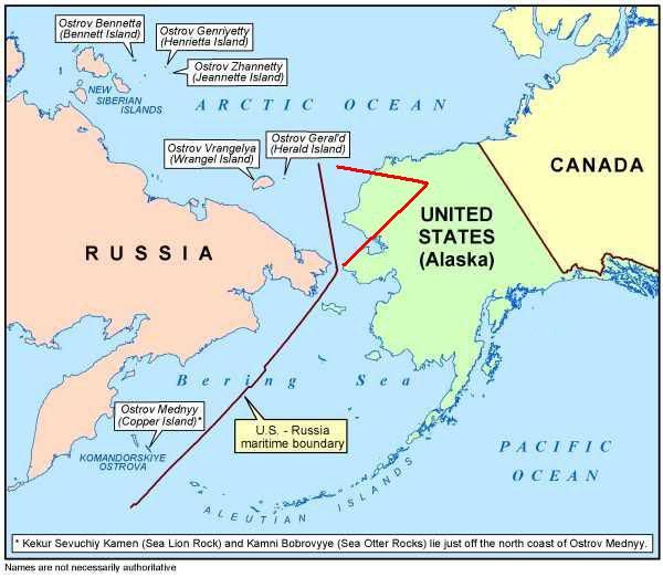
Leaving the claimed islands Bennett, Henrietta, Jeannette, Wrangel and Herald on the Russian side of the border.

Then we go back to the same starting point and head southwest, between St. Lawrence and the southeast point of Cape Choukotski, then continue southwest to pass midway between the island of Attou and Copper island.

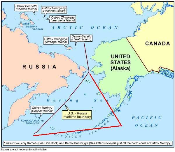
Since the border is east of Copper island, Copper island is in Russia.

None of these island were ever in the US. Can we stop this nonsense now?

68 posted on 03/18/2012 3:28:32 PM PDT by thackney (life is fragile, handle with prayer)
[ Post Reply | Private Reply | To 43 | View Replies ]


To: thackney
You claim the map I posted from the state department is wrong...

Where did I claim that?

As further proof, you post a link to the same text as the treaty, and a map matching what I posted.

Proof of what? You stated that the map I posted was made up! Now you say it's the same as yours?

What islands do you believe lie east and west of 193 degrees?

You still didn't answer the question.
72 posted on 03/18/2012 5:04:43 PM PDT by Brown Deer (Pray for 0bama. Psalm 109:8)
[ Post Reply | Private Reply | To 68 | View Replies ]

Free Republic
Browse · Search
News/Activism
Topics · Post Article


FreeRepublic, LLC, PO BOX 9771, FRESNO, CA 93794
FreeRepublic.com is powered by software copyright 2000-2008 John Robinson