Posted on 04/19/2011 6:01:59 AM PDT by TSgt
SPC AC 190557
DAY 1 CONVECTIVE OUTLOOK NWS STORM PREDICTION CENTER NORMAN OK 1257 AM CDT TUE APR 19 2011
VALID 191200Z - 201200Z
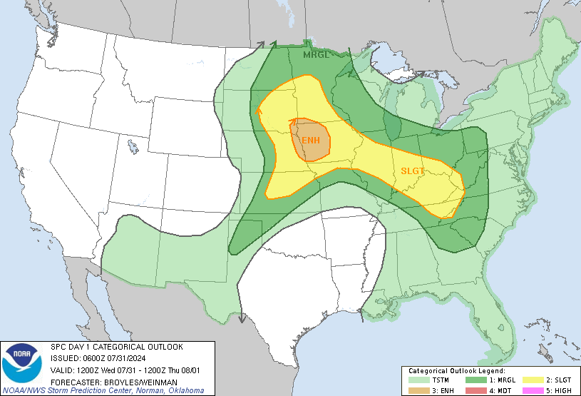
...THERE IS A MDT RISK OF SVR TSTMS ACROSS PARTS OF EASTERN OKLAHOMA...SOUTHERN AND EASTERN MISSOURI...NORTHERN AND WESTERN ARKANSAS...FAR NORTHWEST TENNESSEE...THE SOUTHERN HALF OF ILLINOIS...CENTRAL AND SOUTHERN INDIANA...PARTS OF FAR WESTERN OHIO...AND NORTHERN AND WESTERN MISSOURI...
...THERE IS A SLGT RISK OF SVR TSTMS FROM ERN OK/NERN TX NEWD ACROSS THE MIDWEST INTO THE LOWER GREAT LAKES REGION...
...SYNOPSIS... AN UPPER SHORT-WAVE TROUGH CROSSING THE ROCKIES AT THE START OF THE PERIOD WILL EMERGE INTO...AND THEN QUICKLY CROSS...THE PLAINS STATES THROUGH THE DAY...AS AN ASSOCIATED SURFACE LOW SHIFTS FROM OK NNEWD ACROSS MO THROUGH THE AFTERNOON. THE EWD PROGRESSION OF THE TROUGH WILL CONTINUE OVERNIGHT...REACHING THE MS VALLEY BY THE END OF THE PERIOD. AS THIS OCCURS...THE SURFACE LOW WILL CONTINUE SHIFTING ENEWD ACROSS THE MIDWEST AHEAD OF THE UPPER SYSTEM. THE ASSOCIATED/TRAILING COLD FRONT IS PROGGED TO SHIFT EWD FROM THE CENTRAL PLAINS ACROSS THE MS VALLEY THROUGH THE AFTERNOON...AND THEN ACROSS THE OH/TN VALLEY REGIONS OVERNIGHT...WHILE MOVING MORE SLOWLY SWD ACROSS OK INTO TX THROUGH 20/12Z.
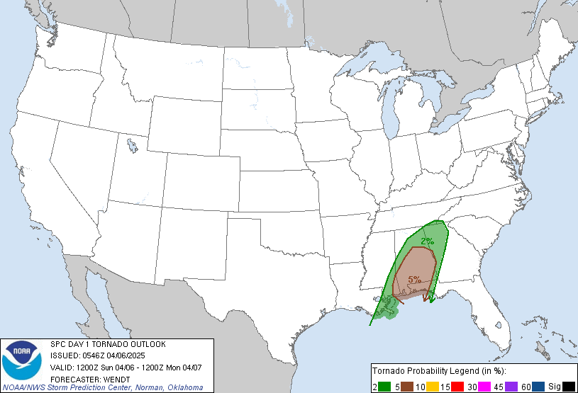
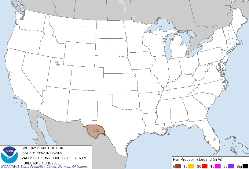
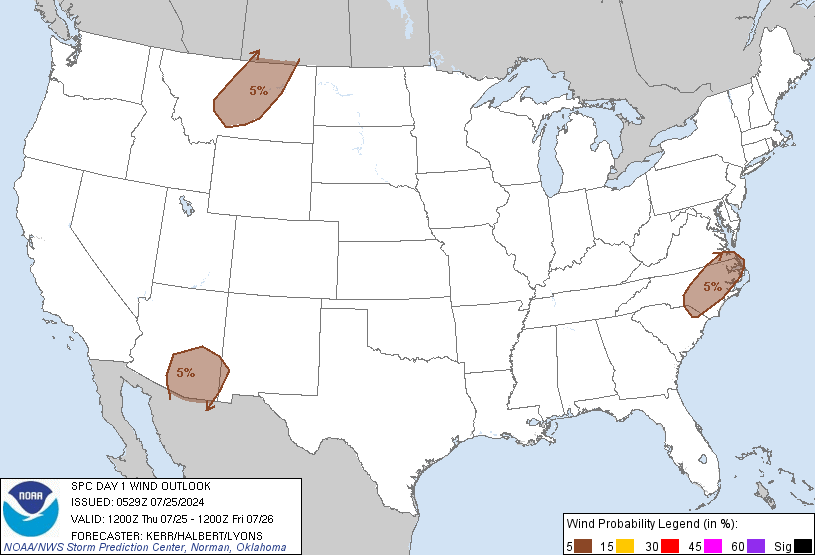
...SERN KS/ERN OK/NERN TX NEWD INTO THE GREAT LAKES... POTENTIALLY SIGNIFICANT SEVERE WEATHER EVENT IS FORECAST TODAY...WITH WIDESPREAD DAMAGING WINDS AND VERY LARGE HAIL EXPECTED...ALONG WITH ISOLATED/POTENTIALLY STRONG TORNADOES.
SHOWERS AND STORMS WILL BE ONGOING AT THE START OF THE PERIOD...PRIMARILY ELEVATED TO THE N OF A SURFACE WARM FRONT EXPECTED TO BE LYING FROM THE OZARKS EWD INVOF THE OH VALLEY. PERSISTENT EWD ADVECTION OF AN EML WILL RESULT IN STEEP LAPSE RATES ALOFT...CONTRIBUTING TO MODERATE INSTABILITY. HOWEVER...THE WARM AIR ALOFT WILL ALSO RESULT IN THE MAINTENANCE OF A CAPPED WARM SECTOR INTO THE AFTERNOON HOURS. WITH TIME...EXPECT ASCENT FOCUSED INVOF THE SURFACE LOW AND TRAILING FRONT COMBINED WITH DAYTIME HEATING/MIXING TO EVENTUALLY WEAKEN THE CAP SUFFICIENTLY TO PERMIT STORM DEVELOPMENT. ATTM...IT APPEARS THAT DEVELOPMENT MAY FIRST OCCUR OVER ERN OK AND VICINITY...WITH INITIAL STORM MODE LIKELY TO BE SUPERCELLULAR GIVEN FAVORABLY STRONG/VEERING FLOW WITH HEIGHT. HOWEVER...UPSCALE GROWTH INTO A MORE LINEAR STORM MODE IS EXPECTED...AS FORCING ALONG THE FRONT FOCUSES DEVELOPMENT AND CAPPING LIKELY LIMITS INITIATION IN THE PRE-FRONTAL WARM SECTOR. STORMS SHOULD DEVELOP NWD ACROSS MO...AND POSSIBLY SWD A BIT INTO NERN TX -- THOUGH DRIER/MORE CAPPED AIRMASS WITH SWD EXTENT SHOULD LIMIT DEGREE OF SWD DEVELOPMENT INTO TX.
WITH THE INITIAL SUPERCELLS...VERY LARGE HAIL AND LOCALLY DAMAGING WINDS CAN BE EXPECTED...ALONG WITH ISOLATED TORNADOES. GREATEST TORNADO POTENTIAL IS FORECAST FROM SERN MO NEWD INTO INDIANA AHEAD OF THE NEWD-MOVING LOW...WHERE MOST FAVORABLE LOW-LEVEL SHEAR IS EXPECTED. WITH TIME HOWEVER...AS STORMS BECOME MORE LINEAR NEAR/AHEAD OF THE COLD FRONT...THREAT FOR DAMAGING WINDS SHOULD INCREASE AND BECOME THE MORE PREVALENT SEVERE WEATHER CONCERN INTO THE EVENING/OVERNIGHT HOURS AS CONVECTION SHIFTS ACROSS THE MID MS/TN/OH VALLEYS. THOUGH SOME EVENTUAL DECREASE IN OVERALL SEVERE THREAT MAY OCCUR LATE IN THE PERIOD...AT LEAST SOME SEVERE WEATHER IS EXPECTED TO PERSIST THROUGH THE END OF THE PERIOD AS STORMS APPROACH THE WRN SLOPES OF THE APPALACHIANS.
..GOSS/COHEN.. 04/19/2011
CLICK TO GET WUUS01 PTSDY1 PRODUCT
NOTE: THE NEXT DAY 1 OUTLOOK IS SCHEDULED BY 1300Z CURRENT UTC TIME: 1249Z (8:49AM), RELOAD THIS PAGE TO UPDATE THE TIME


Anyways, standing by in Little Rock, still recovering from last week's tornados that killed 7. Hopefully this major weather event isn't as bad as that.
Out here.
Based on recent weather events we need to be extra vigilant.
Take care!
TSgt
Here in Florida, we haven’t seen a hurricane in 6 years now....wonder if this is our year .....
Very nice having all the convective outlooks on one screen. Thanks!
Have you noticed
that storm is centered over the New Madrid quake zone almost exactly . . . or maybe even 100% exactly???
Curious . . .
Obviously mere coincidence, of course . . .
one hopes.
It’s already almost 80 and stifingly humid here in Fort Smith with an overcast sky and a bit breezy at times. It figures that my oldest has an academic competition after school today. Just hoping we’re not hearing the sirens go off like we did over and over Thursday night.
Climate change!
Thanks for the ping!
It’s the New Madrid’s fault......get it?
Must be some serious clashing of fronts going on.
Here in Iowa this morning we had thunder in the midst of a heavy snow fall.
(extreme sarcasm)
You're jousting with windmills again, Quix-ote.
I suppose they're laying the groundwork for Planet X/Niburu/Elenin/”some rogue comet to be named at a later date”, which is coming, but being covered up by the government/aliens/UFO’s/Illuminati.
Sorry TSgt, but I think your thread might be overrun by people who believe all this stuff is the actual cause of any quakes/storms/tsunamis/hot, humid days anywhere, any time.
Thanks for the update. BTW did you notice your maps are from the weekend event - 4/15 - 4/16 — not for this event.
Gawd, Quix, is there ANYTHING that you won't mercilessly bang upon to cram it into your nutcase worldview? Tomorrow, the severe weather window will look very different - does that mean that area needs to worry about earthquakes? After all, Charleston, SC had a bad earthquake last century - and Charleston was on the edge of that severe weather outbreak in the Carolinas last weekend. Gotta be a connection there somewhere, using your logic, or lack thereof.
ever heard of tornado alley
Thanks for the ping Quix.
Anyone who has seen the maps of the New Madrid area would think the same thing. It is not unusual to recognize an area like the New Madrid on a map.
I know.
It just struck me and startled me rather forcefully.
Here in NETX, we show as being in the green 2% torn & 15% hail regions on your iso maps.
Thanks for posting!
TXnMA (Skywarn/cartographer)
P.S. We've been able to track the heat plumes from the TX fires on WX RADAR lately..
Thank you for posting. I see we are in the 45% hail target area. I was hoping this would not be like last week. That stormfront hit our area at 1:30am, a very bad time for a dangerous tornadic and straight wind storm to hit since most folks are asleep. When we stepped out on the porch headed for the storm cellar I’ve never seen and heard such a wicked looking and sounding wall cloud in my life (and I’ve seen many a tornadic wall clouds). This one was brightly lit constantly from the unending lightning (it never faded from view in the darkness)and the sound was a constant rumble and roar from both the neverending thunder and from the on-coming straight line winds. It was one of the most apocalyptic-looking storms I’ve ever seen. In the dark it looked like it was consuming everything in its path as it moved. I won’t be taking any chances with this new storm tonight.
Disclaimer: Opinions posted on Free Republic are those of the individual posters and do not necessarily represent the opinion of Free Republic or its management. All materials posted herein are protected by copyright law and the exemption for fair use of copyrighted works.