Posted on 02/17/2010 11:35:37 AM PST by Star Traveler
NewsCore February 17, 2010 12:19PM
- Hiker dead after rescue efforts delayed
- Believed to be alive after initial fall
- Fell 457 metres into volcano's crater

A MAN who fell into the crater of north-west America's Mount St Helens volcano died after rescuers were forced to abandon their bid to save him overnight, it emerged today.
The 53-year-old's body was recovered by a US Navy helicopter after rescue attempts began again this morning.
He was named as Joseph Bohlig, KPTV reported.
He toppled into the crater - falling up to 1500 ft (457m) over rocks and ice then landing on a 70-degree snowy slope near the bottom - after a ledge he stood on near the rim collapsed on Monday.
He was believed to be alive when he landed, although his condition was not known, with rescuers saying they could hear him blowing an emergency whistle.
Attempts to reach him by helicopter on Monday afternoon and evening were called off due to unsafe winds and the approach of darkness, forcing Bohlig to spend the night in the crater.
A medic was airlifted to the crater floor but was unable to climb to Bohlig and had to be flown out again.
Lt. Brooks Crawford of the US Coast Guard - one of two pilots that tried to rescue Bohlig on Monday - told KPTV the victim was buried in snow.
"We were 300 feet (91m) above him," Crawford said. "(The other pilot and the rescue swimmer) saw his head, arms and legs and saw no movement whatsoever. No signaling, nothing to indicate that he was in good shape."
Bohlig had climbed Mount St Helens 68 times, according to the Skamania County sheriff's office. Officials believe he may have been posing for a photo to be taken by his partner when the ledge gave way.
Mount St Helens - famous for a deadly explosion in 1980 which killed 57 people - is an active volcano in the Gifford Pinchot National Forest of Oregon, in the so-called Pacific Ring of Fire geological region.
Thousands of people climb to the crater's rim each year, but permits are required to go above 4800 feet (1463m).
A warning on the US Forest Service Web site said the crater rim is "unstable and can be hazardous at any time".
Part way up the mountain, there was a “turn-around”, a loop, where there was a viewpoint and it was quite a veiwpoint, being high up the mountain-side. And I had been up there several times. It was a beautiful sight.
At that turn-around, it was reported that someone saw a motor home parked there, the evening before the eruption.
Now, this was the “red zone” and no one was allowed in there, but somehow a motor home was up there. Well, it was never seen again after that...

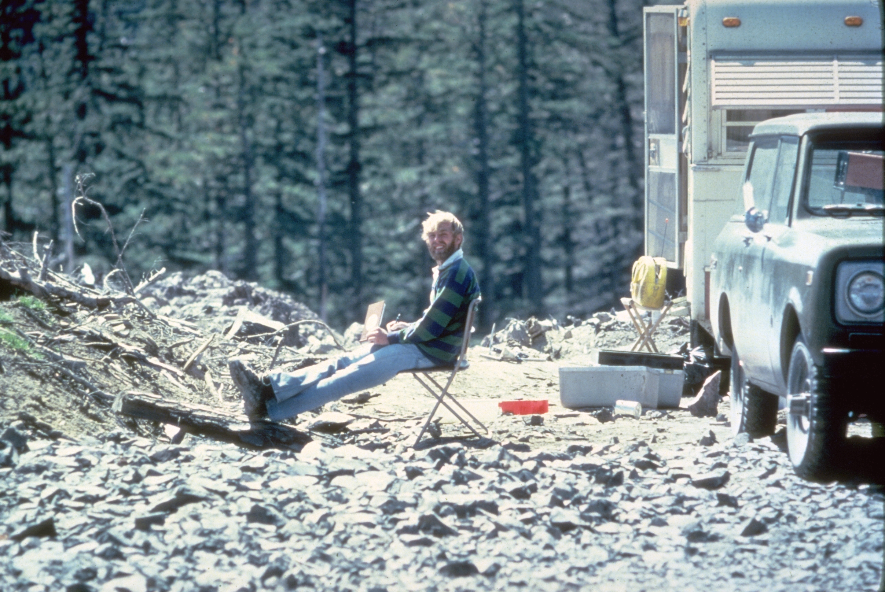
David Alexander Johnston (December 18, 1949 – May 18, 1980) was a volcanologist with the United States Geological Survey (USGS); he was killed by the 1980 eruption of the Mount St. Helens volcano in Washington. He was killed while manning an observation post about 6 miles (10 km) from the volcano on the morning of May 18, 1980. He was the first to report the eruption, transmitting the famous message "Vancouver! Vancouver! This is it!" before being swept away by the lateral blast created by the collapse of the mountain's north flank. Ham radio operator Jerry Martin observed the lateral blast overtaking Johnston's camp. Though Johnston's remains have never been found, remnants of his USGS trailer were found by state highway workers in 1993.
Maybe because it is Abe Vigoda.
Back in the early spring 1990’s I was up about 11,000’ on Sargents Ridge Mt Shasta. I slipped and went down a sheet of ice for about 1200’ before I got into some softer ice and could slow down. I must have been doing at least 65 mph on that ice and those rock out-croppings were coming up fast.
So you’re saying that hikers should *not* avoid falling into volcanoes? : )
LOL... it doesn’t matter where... just avoid falling... :-)
There was a lot of material that got dumped out there. Spirit Lake is two hundred feet higher up than it was before the eruption (meaning there's two hundred feet or slightly more, of dirt and ash underneath it now, raising it that much higher). It sloshed up the other side of the hillside, about 800 feet up, before sloshing back down again. We're talking about the whole lake... :-)
There's stuff buried around there that no one will ever find. And it's not like it's a populated area, either.
It was somewhere around there that the plane hijacker D. B. Cooper was suppposed to have jumped out of the Northwest Orient plane on November 24, 1971. So, it's a pretty isolated area. Things can be lost for a long time, too.
Harry Truman is also buried out there somewhere. He ran the lodge at Spirit Lake. The lodge that was at Spirit Lake has never been found.
There was supposedly a motor home at the turnaround on the road going up Mt. St. Helens, the night before the eruption (it wasn't supposed to be there, as it was in the "red zone"). It's never been found.
The mud flows down the Toutle River covered up a lot of stuff along that way, too... and basically just about stopped all river traffic on the Columbia River. We have ocean-going vessels that come in to Portland from the Pacific, along the Columbia River and that was blocked. The river was still flowing but the ships would ground out.

You can see the height of the mud line on the trunks of the trees in that picture.
Here's a "forest" of trees (and I mean big trees)... all laid down flat in a row, stripped and knocked flat. The picture looks small but this is a forest...

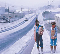
And then the huge ash fall that hit Eastern Washington...

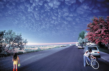
This surreal-looking photo shows an enormous cloud of volcanic ash approaching the small town of Ephrata, Washington, on the morning of May 18, 1980. The ominous cloud was from Mount St. Helens, 145 miles to the west. The volcano had begun to erupt explosively less than 3 hours earlier, catching many communities downwind unprepared for the destructive rain of gritty ash that followed. (Copyrighted photo courtesy of Douglas Miller.)


He’s the only guy to have more ashes than Joe Biden on Ash Wednesday.
Back in the early spring 1990’s I was up about 11,000’ on Sargents Ridge Mt Shasta. I slipped and went down a sheet of ice for about 1200’ before I got into some softer ice and could slow down. I must have been doing at least 65 mph on that ice and those rock out-croppings were coming up fast.
Did you have an ice axe with you? I remember practicing stopping falls with an ice axe, but never had to try it out for real, though... :-)
This guy that fell into the Mt. St. Helens crater, though -- it would have been almost a straight shot down and there would not have been any chance to stop the fall, no matter what he did. That south wall of the crater is pretty steep and you're not going to stop anyone from going down.
That south wall is like a "chimney" for the volcano, as that's where all the stuff blew up and out, so it's scoured almost vertically there...
I did have an ice axe, but the ice was so hard and it was so steep and I picked up speed so fast that the ice axe did not do a whole lot for me except kick up a nice spray of ice behind me. Well I guess it might have scraped off 10 mph or so until I got off that ice field into some softer stuff.
Even in tribal gear, it’s hard not to recognize Abe Vigoda.
I did tile roofing as a teenager. You taught yourself real quick to pull out your framing hammer to keep from sliding off a roof when you stepped on a slick spot.

The diameter of the cloud (from left to right) is about the distance that it is from Portland, Oregon to the beach. And to drive that distance, from Portland to Seaside, takes about 1-1/2 hour. That's how big the eruption cloud is in about 13 minutes.
You’ve made this thread absolutely fascinating with your images and information. Thanks!

But arresting your fall on the sides of the south side of the crater at Mt. St. Helens, would be like arresting your fall with an ice axe (if he had one, but he didn't), on the sides of the TransAmerica Building in San Francisco... LOL...

It wouldn't have helped him... But, in other situations, when someone has fallen on an ice slope, then they have to really dig that ice axe into the ice/snow and put their weight into it. And you won't stop right away... :-)
I like pictures... and they are worth a thousand words... :-)
The Geologist who took that photo, Harry Glicken, was scheduled to be at that spot on the morning of the eruption but had an interview in California. His replacement was killed by the pyroclasitc cloud.
“Spirit Lake in its prettier days...”
Three months after the eruption I came off the interstate and drove to the red zone. There was a road sign for Toutle(I think) and Spirit Lake with the distance to each. Spirit Lake had been painted out in green paint.
Disclaimer: Opinions posted on Free Republic are those of the individual posters and do not necessarily represent the opinion of Free Republic or its management. All materials posted herein are protected by copyright law and the exemption for fair use of copyrighted works.