Air France Flight 447
:
A detailed meteorological analysis
by Tim Vasquez
Great read from an Air Force meteorologist.
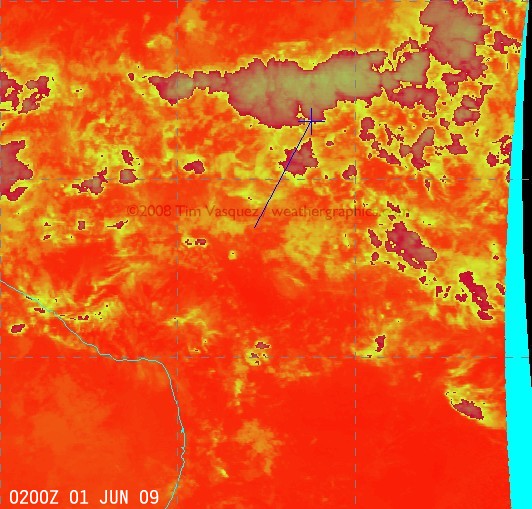 Flight path of AF jet
The radar horizon for an airliner only extends a couple hundred miles, 250 miles at the most. After that you lose sight of the aircraft below the horizon. (There are military “over the horizon” radar, but that technology is not used for civilian ATC.) Radar coverage over the Atlantic in quite sparse.
I haven’t worked in ATC in a while, but we used to sell passive tracking systems to some countries that allowed the aircraft to continuously send its position about once a minute to ATC, sort of a poor man’s radar. A lot of ships use a similar system, they radio their position via satellite once a minute to an international registry in London, which can help resolve insurance claims. I would surprized if the airline industry doesn’t have a similar system, including satellite emergency beacons.
Air France Flight 447
:
A detailed meteorological analysis
by Tim Vasquez
Great read from an Air Force meteorologist.
Flight path of AF jet