To: nuconvert
Found it.
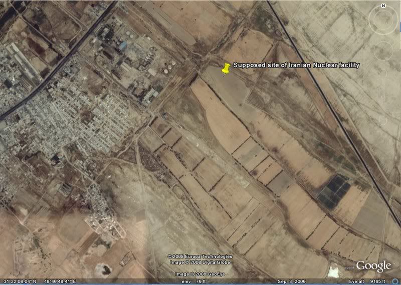
31'21'48.94"N x 48'46'51.17E
Doesnt look like much to me (Based off of sat photo currently on the web).
23 posted on
07/29/2008 9:21:23 PM PDT by
VaBthang4
("He Who Watches Over Israel Will Neither Slumber Nor Sleep")
To: VaBthang4
The Google image says 3rd Sept 2006, before the main thing was built?
41 posted on
07/30/2008 2:31:10 AM PDT by
plenipotentiary
(Free the Oil, Topple the Saudis)
To: VaBthang4
The GPS coordinates aren’t in the story. Where’d you get those?
55 posted on
07/30/2008 7:15:13 AM PDT by
cookcounty
(Obama, the last man to figure out the Surge ---Except for Hopeless Harry Read.)
To: VaBthang4
It’s a secret - go figure.
62 posted on
07/30/2008 10:02:19 AM PDT by
ctdonath2
(The average piece of junk is more meaningful than our criticism designating it so. - Ratatouille)
To: VaBthang4
64 posted on
07/30/2008 10:07:42 AM PDT by
ctdonath2
(The average piece of junk is more meaningful than our criticism designating it so. - Ratatouille)
To: VaBthang4
The date on that image is September 3, 2006.
72 posted on
07/30/2008 1:10:04 PM PDT by
mojito
To: VaBthang4
How about this: 31°22’36.75”N 48°42’20.37”E Industrial Buildings
and
31°22’25.54”N 48°43’36.94”E Round emplacements
Near the river, near the airstrip.
79 posted on
07/31/2008 12:18:27 AM PDT by
plenipotentiary
(Free the Oil, Topple the Saudis)
FreeRepublic.com is powered by software copyright 2000-2008 John Robinson
