The lower drawing shows the extent of the ice. It was not as extensive as you might suspect.
Hope this helps.
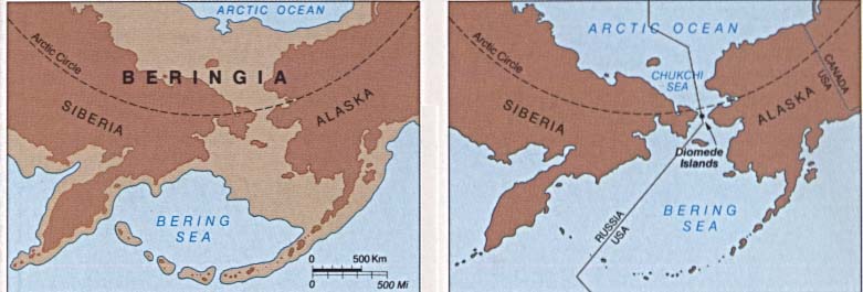
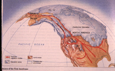
The lower drawing shows the extent of the ice. It was not as extensive as you might suspect.
Hope this helps.
“Hope this helps.”
Probably just my lack of education, but, no. The pics dont help much.
Especially the bottom pic with the ice sheets. That seems to be as purposely constructed to support a theory as what we’re currently dealing with in computer modeling support of climate chaos.
That’s an awful convenient channel through that ice.
I, also, dont understand how the ice cap could extend so far south in NA but remain conveniently retarded enough in the “Beringia” area to permit for the chosen theory to be viable.
Even in this non ice age period, ice in the areas of north eastern depictions on that map is still a problem to navigation and habitation.