Posted on 05/23/2006 8:42:02 AM PDT by Paddlefish
Holy crap - you have, in that shot, mile-wide glaciers emptying into sparse forests.
No way you do a North Side assault, unless you have a suicide pact with "Gaia".
The situation reversed after China took control of Tibet and closed off the country to the West. Nepal then opened up and that is the reason why Hillary's expedition went up from the Kathmandu side.
Politics....LOL!

More, more, more! Looks like suicide on the installment plan.
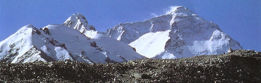
Still, I wonder where Base Camp is on the Chinese side. Probably about from where that shot is taken.
Great thread, BTW.
Yep....somewhere between the Monastery and where the rocky top on the Glacier peters out.
Since the distance is so long, they set up what they call Advance Base Camp near the base of the North Col.
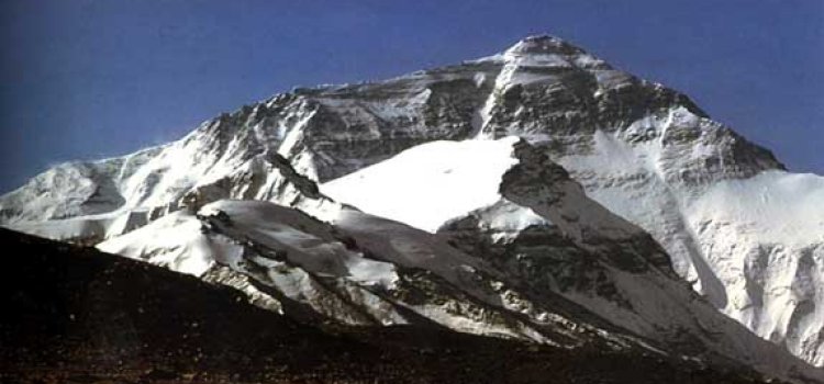
Another camp then on the Col, then one or two more up along the Northeast Ridge....then the dash through the Yellow Band to the First Step/Mushroom Rock/Second Step/Third Step/Snow Pyramid/Summit.
Much of it on edge with a 14,000 foot drop down the Kangshung Face.
Ugh. No thanks. I'd be glad to go up Gibraltar or Emmons, summit Rainier, then get down in time for steak and potatoes.
No one deserves cerebral edema, unless they ask for it. Supplemental oxygen should tell a homo sapiens they have no bidness up there.
Thanks. Yes those pics were taken from around the N. route ABC on the Rongbuk. That directional stamp is one of the things I was looking for.

The pic is a link to an account of some Sherpa's zen.
Not likely, though you do get some freaks who insist on summitting Rainier via the Willis Wall (north face).
At the Paradise Visitor Center, you can catch climbing parties through a touristy telescope. I just wish they had a scale model of Everest somewhere - downloadable would be even better.

Holy Moley - is that you?
Certainly, that party had a more peaceful time than the Paradise/Muir crowd.
This guy is on granite, about that high and on his way up El Capitan at 3300'. He's very good. There's more at rockclimbing.com
Nuts. Save your energy and muletrain yourself to the top, Johnny Walker in tow.
Simply amazing, regardless. 300-feet freehand is quite the "circular fortitude".
You know....from that height I believe you'd be just as dead as if you dropped off the 14,000 ft. Kangshung Face.
But at least you wouldn't be as cold on the way down. :o)
Disclaimer: Opinions posted on Free Republic are those of the individual posters and do not necessarily represent the opinion of Free Republic or its management. All materials posted herein are protected by copyright law and the exemption for fair use of copyrighted works.