
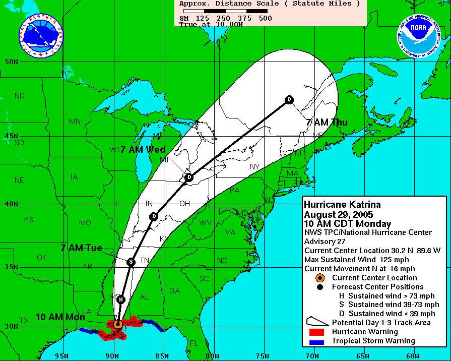
Basically 24 hours in the state. Initially, hurricane force winds extended about 100-120 miles east of the center. The wide swath of wind continued north, but the strongest probably shrank in size to about ~50 miles to the east by the time it exited. There were also similar winds on the west, slightly weaker... and less expansive.
These are the relavent NHC images:
10am Monday
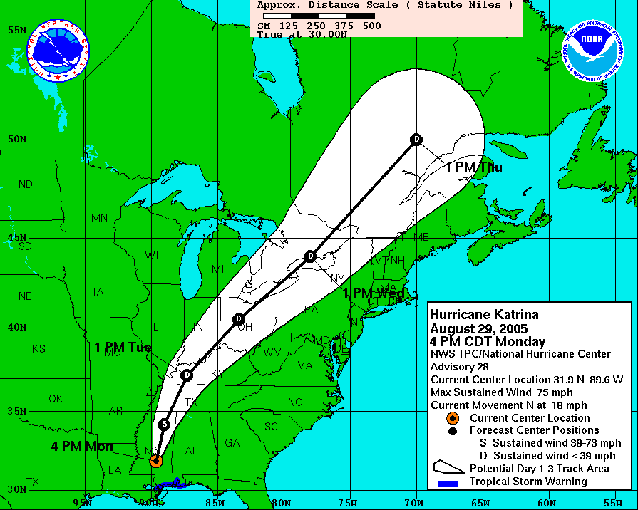
4 pm Monday
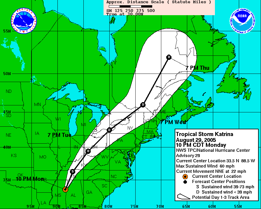
10 pm Monday
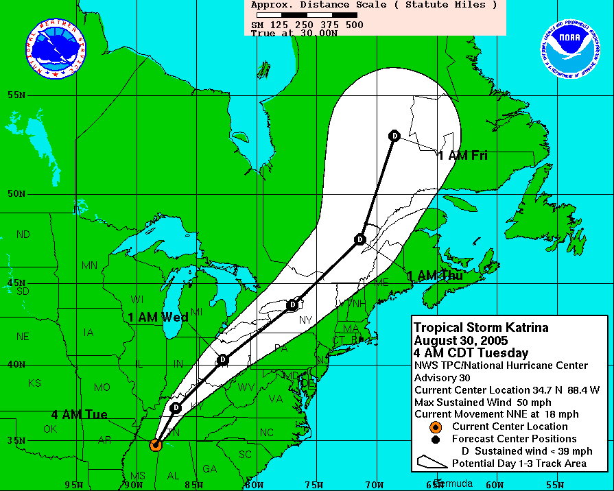
4 am Tuesday
As far as a wind damage map, I don't know if there is one. You can take the numbers above and look at the Beaufort Scale to get an idea of wind damage across the state at that time.