 |
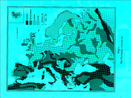
Just 10k years ago the "isles" were a peninsula. At 50k y.a. they may have been a lake.
That's why I doubt they were islands off the coast of Normandy as far back as 400k y.a.
|
Just 10k years ago the "isles" were a peninsula. At 50k y.a. they may have been a lake.
That's why I doubt they were islands off the coast of Normandy as far back as 400k y.a.
LOL. I know about the Ice Age connections. I suppose I should have said 'from a GPS mark 400,000 years ago to a GPS mark today', there is about a 12.5 mile difference.
Click here to see a map of the world with the ocean level reduced by about 300ft...then, imagine it reduced by 500ft as some believe it was during the Ice Age, Glacial Maximum.
The Last Glacial Maximum (LGM) occured about 18,000 years ago.