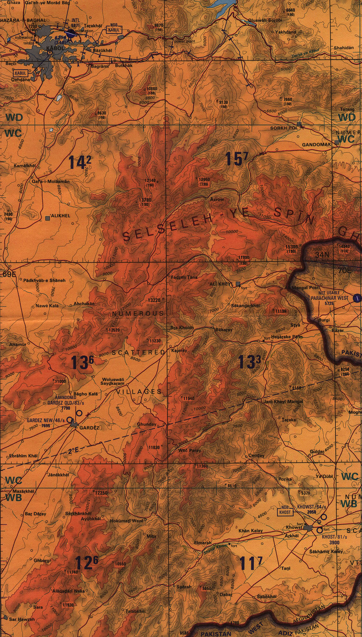
On the map below, scroll to the extreme right and almost to the bottom, there you will find the city of Khowst. It sits at about 4,000 feet, surrounded by mountains with peaks at 12,000 feet. Two miles to the east you will see a circle representing the city's civilian airport, with an 8,100 foot runway. About 3 miles to the northeast of that is a second airport that is almost certainly the "Salerno Base" spoken of in the article. That airport is likely an old military base, but it only has a 6,400 foot runway, which explains the need for the new runway mentioned in the article.
Because of the airport altitude and the very high and nearby mountains, even with an improved runway, this is going to be one hairy-assed place for conventional aircraft to take off from or land. Either you peg the "Pilot Bravery Meter" hard over, or just abort your approach and go home with your tail between your legs. Winter or spring flying will be tough enough, but it will be utter madness during the hot summer months, especially if there is any clouds, wind shear or rollers coming off those mountains. (All things considered, I'd give a months pay to fly in to Salerno!)
Map scale is approximately 3.5 miles to the screen inch, heights are in feet. Note the color coding for altitude: Red is 8,000 and over, orange is 5,000 to 8,000, and yellow is below 5,000. The city of Gardez (elev. 8,000 feet!) is about one screen width to the north west and is the northwest corner of the box where all the operations are being carried out. Khowst is the northeast corner of that box.
ENJOY!
(And I apologize for putting such a large graphic on this thread.)
--Boot Hill