Thanks TXnMA.
I recently discovered a LiDAR database that covers almost all of my (Northeastern Texas) area of responsibility and interest.
The dataset's point spacing is marginal, (only 2.2 points/meter) which is useless for viewing small, discrete objects, but is sufficient -- with appropriate spatial (matrix convolution) filtering -- to distinguish and map linear features like trails, roads and abandoned railbeds.
We have just added LiDAR to our toolkit for our multi-year, multi-county project of mapping the early immigration route called, "Trammel's Trace".
In 1813, Nicholas Trammell began on the west bank of the Red River at its "Great Bend", (where I-30 now crosses it) and, effectively, extended the "Great Southwest Immigration Trail" -- that crossed Arkansas diagonally -- into Texas.
In Western Cass County, Texas -- at what we call the "Y" -- he joined his new Trace with the pre-existing N-S "Spanish Trace", and then improved that route southward to its intersection with the old Spanish "El Camino Real" to San Antonio -- just west of Nacogdoches, Texas.
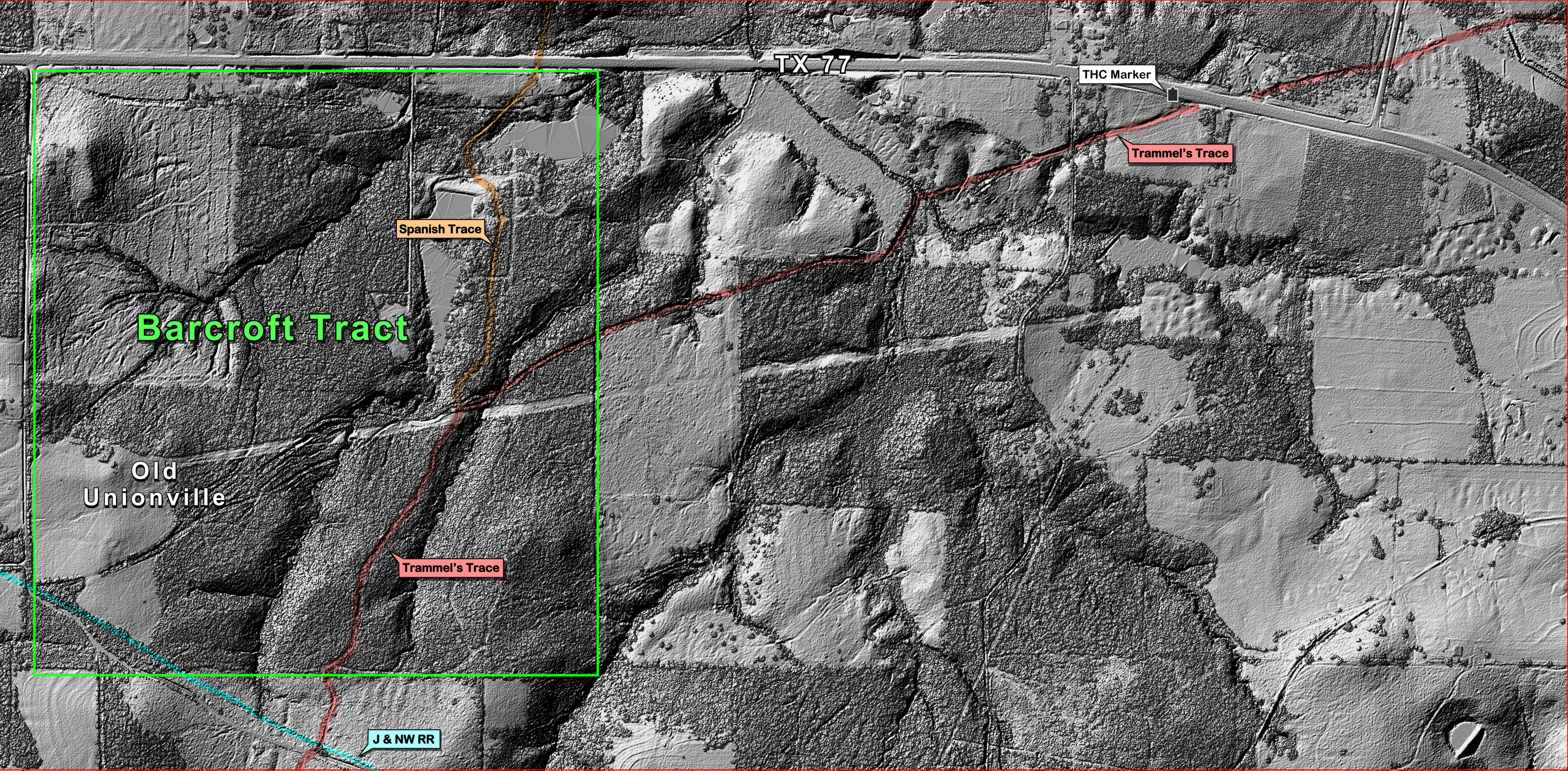
I selected the Cass County area including the "Y" where Trammell joined his Trace with the Spanish Trace as the test site" for evauating the LiDAR dataset:
The post-processed "Bare Ground" LiDAR image revealed a plethora of trails, ruts, etc.
This "annotated" version of the Bare Ground" image clearly shows both Traces -- and the "Y" where they join:
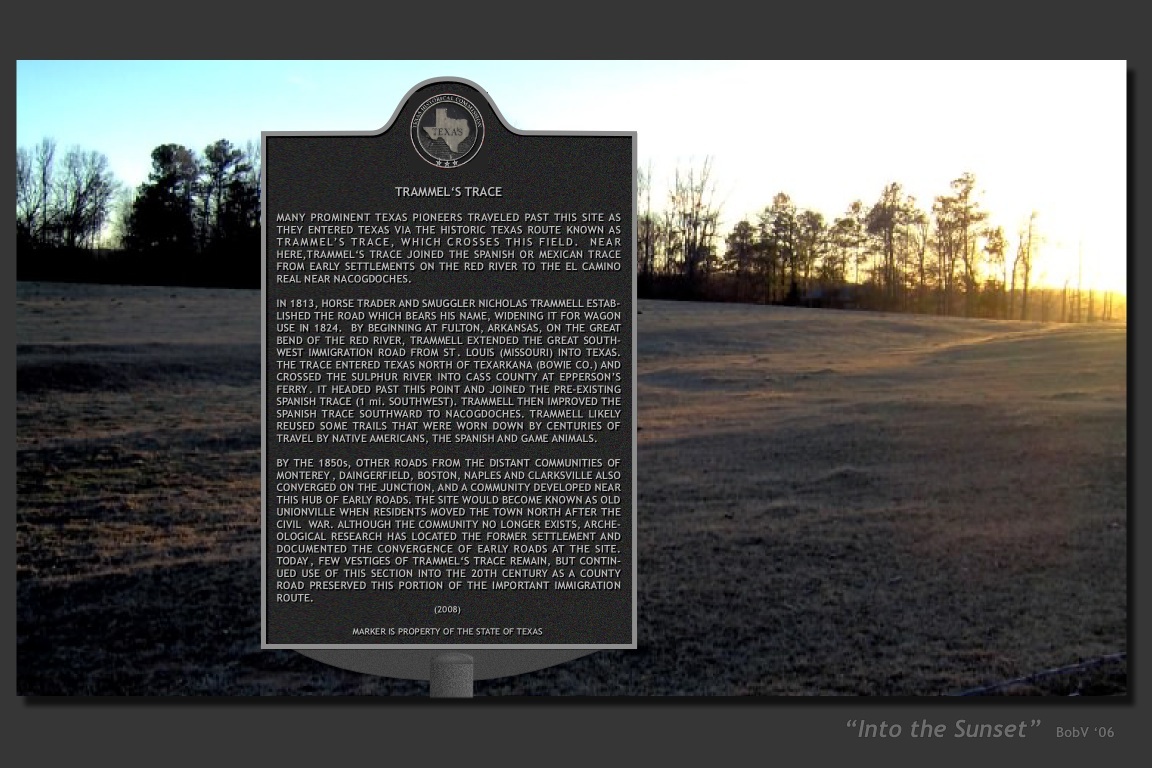
And -- it also shows the site of this historical marker -- at the only known site where Trammel's Trace is still visible from a State highway:
And, finally -- with the foliage cover not subtracted -- it is evident that foliage is no impediment to detecting and mapping the Trace with LiDAR.
In fact, the area surrounded the "Y" intersection is totally overgrown in dense sweetgum brush -- so dense that you can't even walk through it, much less see or follow old, faint ruts.
As expected, travelers on the Traces spread out to the west of the "Y" to form a campground that eventually became the townsite of "Old Unionville". Yet -- with LiDAR -- that (predicted) fanout of ruts westward from the "Y" is still clearly visible.
~~~~~~~~~
Yep, LiDAR data is extremely effective for mapping historic routes -- but, it also is extremely expen$ive!
.-) Anyone got a $$$pare hundred grand lying around -- so we can obtain the data to finish mapping those important (but, rapidly-vanishing) historic immigration routes? '-)
Thanks TXnMA.
