Posted on 12/05/2009 7:32:20 PM PST by lainie
LA CANADA FLINTRIDGE — Two storms appeared to be on course Friday to hit Southern California next week with potentially heavy rainfall that could unleash floods of mud and debris-laden water from wildfire burn areas into adjacent communities.
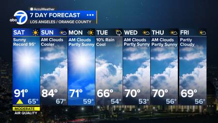
The National Weather Service said the exact tracks of the storms and rainfall amounts were still uncertain, but it was likely that rain would fall over the region on Monday and possibly through the week until Friday. There was a possibility showers could arrive as early as Sunday night, the NWS said.
A major area of concern is the string of Los Angeles suburbs below the south face of the steep San Gabriel Mountains, where the Station Fire burned away 250 square miles of forest vegetation during the summer and destroyed 89 of some 7,000 homes it threatened.
The U.S. Geological Survey has warned that storms could unleash huge flows of water laden with mud, rocks and other debris deep into the communities.
Authorities have installed concrete barriers and sandbags to protect homes, and cleared accumulated debris from flood-control catch basins. The defenses were given a small test last month when a brief, unexpected downpour sent mud coursing down slopes in La Canada Flintridge.
La Canada Flintridge posted the daily chances of rain through the next week on a "Potential Mudslide Events" section of the city's Web site, and neighboring Glendale announced the city is ready for potential flooding.
City spokesman Ritch Wells said in a statement that preparations that began after the fire were continuing and included installation of cameras so officials can monitor any debris flows.
The first precipitation is expected from a cold storm that originated over Canada and may also bring heavy snow to the mountains, forecasters said.
The second storm may arrive Wednesday and last through Friday as the jet stream tracks across Southern California, bringing moisture from the tropical west Pacific, the NWS said.
"This second storm could bring widespread heavy rainfall," the NWS said.
The private forecasting company AccuWeather.com said the first storm is likely to deliver a half-inch to 1 inch of rain in Southern California, while the second storm could drop amounts ranging from 1 inches to 4 inches. But AccuWeather warned that up to four times that much precipitation could fall on some west- and south-facing slopes of the mountains from the central coast down to Southern California.
"If these model projections are even close to being right, we are staring straight in the face of widespread flooding problems," AccuWeather said in a release.
Wildfires this year have also burned many other areas of Southern California, including Santa Barbara and Ventura counties to the northwest of Los Angeles, and in the inland region to the east. Many areas are also still denuded from fires in previous years.
As a result...there is a very real concern for flooding near the
station and Morris burn areas...and a Flash Flood Watch may be
needed. Will hold off issuing this until either tonight or tomorrows shift...
but all signs currently point to yes for this need.
Southwest California area forecast discussion...update 340 PM PST Sat Dec 5 2009
Here we go.
Yup. looks like El Nino is about ready to pop this week .. or is getting ready to soon. Here’s hoping it is slow and not gullywashers when it gets here.
They are talking snow showers and ?? in the vineyards and possibly here in Sillycon Valley as well possibly..
that’s pretty sweet!
Yeah that fire was caused by an arsonist, heck most of the fires here in LA were caused by some idiot arsonist. It has been really cold here lately(Damn global warming LOL) I am looking forward to the rain, we do need it, but the burn areas dont
I just saw frost & hard freeze warnings for Sacramento and San Joaquin valleys. brrr!
One kid started the Azusa fire, and some immigrant started another...but the BIG STATION FIRE hasnt been solved. The USFS stated it was “human caused” but retracted that statement later.
For the rest of southern Nevada...northwest Arizona...and southeast
California...gusty south winds will develop Sunday afternoon and
continue through Monday night across much of the area. Skies will
continue to clear across the south with few-scattered clouds around 8k-12k
feet developing across the north over the next few hours. A winter
storm system will bring impacts to the area Monday and Monday night.
In addition to the strong gusty winds mentioned above...ceilings
could fall below 3k feet and visibility below 4sm at times in
moderate rain and snow.
&&
They’re giving us a 70 percent chance of spritz here in the Coachella Valley desert for Monday. We’re ready - nothing since a 10 minute shower back in August.
Thanks,...gonna get cold too.
NATIONAL WEATHER SERVICE SAN DIEGO CA
459 AM PST SUN DEC 6 2009
A STRONG COLD FRONT WILL MOVE ACROSS SOUTHERN CALIFORNIA MONDAY INTO
TUESDAY...BRINGING...
* RAIN...HEAVY AT TIMES...WITH LOCAL URBAN AND SMALL STREAM
FLOODING POSSIBLE WEST OF THE MOUNTAINS...
* A LOT OF MOUNTAIN SNOW ABOVE 4000 FEET...WITH A WINTER STORM WATCH
IN EFFECT FOR THE SAN BERNARDINO AND RIVERSIDE COUNTY MOUNTAINS
FROM MONDAY MORNING THROUGH LATE MONDAY NIGHT...
* STRONG SOUTH TO WEST WINDS...PARTICULARLY IN THE MOUNTAINS AND
DESERTS WHERE 60 MPH GUSTS ARE POSSIBLE...
* SMALL CRAFT ADVISORY CONDITIONS FOR WINDS AND STEEP SEAS IN THE
INNER AND OUTER WATERS FROM MID MORNING MONDAY THROUGH MID
MORNING TUESDAY...
* ABOVE NORMAL SURF AT THE BEACHES LATE MONDAY THROUGH TUESDAY
WITH SOME SETS WELL OVER 6 FEET.
A WARMER...WEAKER STORM WILL BRING LIGHTER AMOUNTS OF RAIN ON
THURSDAY. MOSTLY CLOUDY NEXT WEEKEND WITH CHANCES OF PRECIPITATION
AS A SYSTEM MOVES BY MOSTLY TO THE NORTH OF THE AREA.
AccuWeather is predicting 3 to 4 inches of rain, but it’s likely that number will increase in the mountain areas, which could lead to mudslides and flooding in foothill communities near the burn areas from the Station fire.
Scientists with the U.S. Geological Survey identified Pacoima Canyon, Big Tujunga Canyon, the Arroyo Seco, the West Fork of the San Gabriel River and Devils Canyon as being most at risk of mudslides.
Under certain conditions, mud flows could occur as far south as Foothill Boulevard in La Cañada Flintridge and La Crescenta, federal scientists said in a report.
3 to 4 inches?
Ern, you don't sound very confident in the forecast ;)
Looks pretty grey and gloomy out there today..Pasadena looked dark about a hour ago!
Monday night into Tuesday will also be full of interest. In addition to
the strong northerly winds...moisture will bank up on the northern
mountains and foothills. With snow levels plummeting to fairly rare
levels of 2000 feet and below...even the Antelope...slow and Cuyama
valleys could wake up to a white Tuesday. Snow advisories may be
needed for those areas.
wh wh whut?
PC will kill us all.
Disclaimer: Opinions posted on Free Republic are those of the individual posters and do not necessarily represent the opinion of Free Republic or its management. All materials posted herein are protected by copyright law and the exemption for fair use of copyrighted works.