
Posted on 01/22/2017 9:41:14 PM PST by Ernest_at_the_Beach
New analysis and graphing tools for sea-level data at SeaLevel.info
Guest essay by David Burton
http://www.SeaLevel.info now has interactive regression analysis (line/curve fitting) and visualization (graphing) tools available for mean sea level (MSL) measurements from over 1200 tide gauges, plus spreadsheets which combine various subsets of that data. This article is intended as a primer, for how to use these new tools.
But first, a few notes:
Note #1: This is a work in progress. I already have a large “to-do list,” but suggestions & corrections are nevertheless very welcome.
Note #2: These tools are my free contribution to the community. There’s no charge to use them.
Note #3: These tools are ideologically neutral.
One of the inspirations for this site was Paul Clark’s famous WoodForTrees, which provides some similar tools for temperature data. Paul is a lifelong “Green” activist, but to his credit, the usefulness of his site is independent of his ideology.
The data shows what the data shows, regardless of my opinions, Paul’s, or anyone else’s. I hope these tools are useful to everyone doing sea-level work, regardless of their views on climate issues.
Nevertheless, in the interest of full disclosure, I consider myself a “lukewarmer.” I am a signer of the Global Warming Petition. In my opinion, the weight of the evidence indicates that anthropogenic global warming is real, modest and benign, and anthropogenic CO2 emissions are beneficial to both human agriculture and natural ecosystems.
Site overview
When you visit SeaLevel.info, you’re greeted with a picture of Maui kitesurfers, and a menu on the left.
1. On the “Home” page you can scroll down to see the latest announcements, mostly about the site. There are also links to the usual “About” and “Contact” pages (which might get combined, when I get a round tuit).
2. The “Resources” page is a large compilation of climate-related resources, with an emphasis on sea-level. It includes search tools, glossaries, a climate conversion factor cheat sheet, and links to other tools (like WoodForTrees). It has a lot of information about sea-level (of course), but also about sea ice, floods, climate reports, climate cycles, temperatures, greenhouse gases, energy, the great North Carolina 2010-2012 legislative sea-level kerfuffle, and more.
3. The “Blogs etc.” page is a list of top climate blogs, plus some other useful climate sites, and a little bit of doggerel. I’ve listed blogs from both sides of the climate debate, though I’ve excluded a few prominent ones which are so heavily censored to prevent dissent that I judge them to be useless (or worse).
4. The “Papers” page has a list of about 120 papers and articles in four categories: Sea-level rise acceleration, How long a sea level record should be for long-term trend analysis, “Science [is a mess],” and “Other.”
5. The “Feedbacks” page has information about feedback systems in general, and climate feedbacks in particular. It is intended to contain a complete list of all significant known or hypothesized climate-related feedback mechanisms. I have a degree in Systems Science, from long ago, which is the discipline that studies such things, and I still remember a little of it.
6. The “Data” page is the topic of the rest of this article.
The Data Page
Sealevel.info has coastal Mean Sea Level (MSL) measurement data from more than 1200 tide gauges. (Currently, all of the data is from PSMSL and NOAA.) On the Data page you can:
1. Search for a tide gauge
2. View or download Excel-compatible spreadsheets.
3. View thumbnail pages corresponding to the spreadsheets.
It begins with a few links:

1. Search. You can search for a tide gauge location by PSMSL station number, NOAA station number, or full or partial station location (e.g., “Honolulu”). Currently it just finds one gauge; I plan to add the ability to find a list of stations (e.g., search for “NC, USA” and find all the North Carolina tide gauges).

2(a). Spreadsheets. If you click on “Spreadsheets & thumbnails” (or just scroll down a bit), you’ll see the section where you can select a Microsoft Excel-compatible spreadsheet with sea-level measurement data from various sets of tide gauges, or a “thumbnail” page with little versions of the MSL graphs for the corresponding tide gauges:

Although the spreadsheets are regular web pages, they have additional information embedded, in Excel-compatible HTML-export format, including formulae for calculating averages, medians, etc., and full-precision (unrounded) numbers. The spreadsheets are compatible with Excel 2003 and later.
The easiest way to download a spreadsheet and view it in Excel, all in one step, is to run Excel, and then in the “Open” dialog paste the spreadsheet’s URL in place of the file name. (Alternately, you can right-click the spreadsheet web page and “save as” a file on your computer, and then open the saved file in Excel.)
Here’s a screenshot from one of the spreadsheets, as viewed in the Internet (not in Excel). These spreadsheets are quite large, so this screenshot is severely truncated, in both length and width:

This excerpt shows the first 11 spreadsheet columns for 13 northern European tide gauges (out of 375 gauges in that spreadsheet).
Scroll to the bottom of each spreadsheet to see summary info (averages & medians).
If you click a column header, it will sort the spreadsheet by that column, but for any manipulation more involved than that you’ll need to download the spreadsheet and manipulate it in Excel. (If you need to do that but you don’t own a copy of Microsoft Excel, then email me and I’ll convert the spreadsheets that you need into a different format for you, for use in a different spreadsheet program.)
If you click a link in the “Location” column (“column D”) of the spreadsheet, it will take you to the sealevel.info analysis page for that tide gauge. If you click a link in the “NOAA stn” column (“B”) it will take you to NOAA’s page for that gauge. If you click a link in the “PSMSL stn” column (“C”) it will take you to PSMSL’s page for that gauge.
In the “Trend” and “±95% CI (trend)” columns you can see the result of linear regression (i.e., fitting a line to the data) for these 13 stations. At four of the stations sea-level is falling, at seven it is rising, and at the other two there’s no statistically significant trend (i.e., the 95% confidence interval is larger than the linear trend).
In the “Accel” and “±95% CI (accel)” columns you can see the result of quadratic regression (which detects acceleration or deceleration). At two of these 11 locations sea-level rise has been accelerating slightly. At one location sea-level rise has been decelerating slightly. At the other ten locations there has been no statistically significant acceleration or deceleration.
At the bottom of the spreadsheet you can see the calculated averages and medians (for the whole spreadsheet).
If you download the spreadsheet and load it into Excel, you can do interesting tests. You could, for example, delete gauges which have less than fifty years of data (since the literature indicates that at least 50-60 years of data is needed to determine a robust sea-level trend from a single tide gauge). The Average and Median cells are determined by Excel formulae, so they will update automatically in Excel, when you make such changes.
2(b). Thumbnails. Corresponding to the spreadsheets we also have “thumbnail” pages, which contain tiny versions of the graphs for all the tide gauges listed in the corresponding spreadsheets. Here’s an example:

In this screenshot you can see that the mouse cursor is hovering over the first thumbnail, which causes it to pop-up a “tool-tip” showing the station number and location name. If you click on a thumbnail it will take you to the analysis page for that tide gauge.
The Individual Tide Gauge Analysis Pages
For any tide gauge which you select by any of the above means (by searching, or by clicking on a thumbnail, or by clicking on the “Location” in one of the spreadsheets), you’ll be taken to the analysis page for that tide gauge. Here’s an example (Honolulu), graphed with the default options:

There are many options available. You may:
a. View a graph of sea-level measurements from that location (of course). That’s the blue graph trace.
b. Follow links to the NOAA and PSMSL pages for that tide gauge.
c. Follow links to view the “next” or “previous” tide gauge.
d. Calculate linear and quadratic regressions (line/curve fitting).
e. View graphical representations of the linear and/or quadratic regressions.
f. View confidence intervals and/or prediction intervals for the regressions.
g. View or suppress a juxtaposed graph of CO2 measurements, to see what effect CO2 has had on sea-level rise or fall at that location.
h. Apply boxcar or triangle smoothing to the sea-level graph.
i. Adjust the appearance of the graphs (color scheme, line thickness, etc.)
j. Adjust the date ranges used in the regression calculations and/or displayed on the graph.
k. Select the data source (PSMSL and/or NOAA).
l. Save or bookmark your customized graph.
Note the regression results (d). Here’s a close-up:

As you can see, the slope and acceleration calculated are:
slope = 1.434 ±0.211 mm/yr
acceleration = -0.01004 ±0.01454 mm/yr²
From the slope we can see that over the 110 year history of that tide gauge, sea-level has risen at an average rate of 1.434 ±0.211 mm per year, i.e., 4.8 to 6.5 inches per century. (That’s very typical, by the way.)
The negative sign on the “acceleration” indicates that the rate of sea-level rise at Honolulu has decelerated, but 0.01 mm/yr² is a very small number (which, if it persisted for a century, would cause the rate of sea-level rise to change by only 1 mm/yr), and the confidence interval is broader than the rate of deceleration, so it should properly be reported as “no statistically significant acceleration or deceleration” (which is also typical).
The various options that you select all become part of the URL for the web page. For instance, if you check the “thick” line weight option, then “&thick” gets added to the URL. So this is the link to the same graph, but with thicker traces:
http://www.sealevel.info/MSL_graph.php?id=1612340&thick
Here it is without the green CO2 graph juxtaposed (the “&co2=0” at the end suppresses it):
http://www.sealevel.info/MSL_graph.php?id=1612340&thick&co2=0
Here it is in black & white, with thick traces. (Several other color schemes are also available.):
http://www.sealevel.info/MSL_graph.php?id=1612340&thick&colors=2
Black & white is useful for preparing graphs for printed material that won’t be printed in color. Here’s how it looks:

Here’s almost the same thing, but with 3-month boxcar smoothing. The smoothing doesn’t affect the regression analyses (except for prediction intervals), but it makes the graph prettier:
http://www.sealevel.info/MSL_graph.php?id=Honolulu&colors=2&thick&boxcar=1&boxwidth=3
Note that in that URL we used the station name (“id=Honolulu”) instead of the station number (“id=1612340”). You may also use the PSMSL station number (“id=155”), or the old-style coast-station code (“id=760-031”). They all produce the same graph:

Here it is with quadratic regression graphed instead of linear, plus I’ve restricted it to using data from 1930 on, and I’ve graphed it with the regression curves extended to 2100, using thick traces, an alternate color scheme, and minimal smoothing:
http://www.sealevel.info/MSL_graph.php?id=Honolulu&quadratic=1&thick&co2=0&linear=0&lin_ci=0&quad_pi=0&quad_ci=1&colors=3&g_date=1900/1:2099/12&c_date=1930/1:2019/12&boxcar=1&boxwidth=2
It looks like this:

Note that in that screenshot I’ve hovered the mouse cursor over a point on the graph to view the exact value (in this case, the high-end of the 95% confidence interval for 2100).
Also note that linear trend is slightly different (because we’ve excluded data before 1930). The data which was excluded from the calculations is graphed with a lighter shade of blue, and a red double-dagger footnote is added to the page:
‡Light blue data is excluded from regression calculations
This version is almost the same, but the green CO2 graph is included, and the confidence intervals have been replaced with prediction intervals (dotted orange):
http://www.sealevel.info/MSL_graph.php?id=Honolulu&quadratic=1&thick&linear=0&lin_ci=0&g_date=1900/1:2099/12&c_date=1930/1:2019/12&boxcar=1&boxwidth=2&quad_pi=1&quad_ci=0&colors=3
Note: There’s a link on the right side of the page, to a short video by Dr. Gerard Verschuuren, which explains the difference between “confidence intervals” and “prediction intervals.”

Cautions
These tools can produce regressions and graphs for more than 1200 tide gauges, but for many of them I’ve never even looked at the graphs. Doing regression calculations and generating graphs without manual “sanity checks” has pitfalls.
For instance, some of the MSL data at some locations has been identified by PSMSL and/or NOAA as being of questionable accuracy, and these tools do not currently take that into account. (It’s on the to-do list.)
Also earthquakes can cause sometimes-extreme distortions in the trend. Consider the case of Seward, AK:

March 27, 1964 was the date of the Great Alaska Earthquake (magnitude 9.2!). Seward got a full meter of sea-level rise, all at once. So if you’re going to calculate the MSL trend for Seward, you should start with the data after that date, like this:
http://www.sealevel.info/MSL_graph.php?id=9455090&c_date=1964/5:2019/12&co2=0&thick:

Note that NOAA did that on their web page for Seward:

So, when using these tools to analyze sea-level data, I recommend that you also click on the NOAA and PSMSL links, to view their pages about the tide gauges of interest, and I recommend that you look in particular for warnings about questionable data, apparent datum shifts, and earthquakes.
Future
There are still many rough edges to these tools. I have an ever-growing to-do list, and I look forward to WUWT readers growing the list even more.
“Facts are stubborn things; and whatever may be our wishes, our inclinations, or the dictates of our passions, they cannot alter the state of facts and evidence.”
– John Adams
“Fallacies do not cease to be fallacies because they become fashions.”
– G. K. Chesterton
“Save me, O LORD, from lying lips and from deceitful tongues.”
– Psalm 120:2
Warmest regards,
L8r
I went to the “data” section and went through graphs for about 50 or 60 data collection points.
What is clear is atmospheric “warming” models cannot accurately explain “sea level” at all, because the ACTUAL change, from one place to another not only varies widely but is lower at many places, not just uniformly higher.
Other factors obviously related to changes with the land itself are at work when it comes to the sea level relative to any particular location.
Also of note is that on one coast, the sea level shows a RISE, while on another coast, the sea level shows a LOWERING.
IF the sea were actually rising or falling, it would do the same on BOTH COASTS.
Yeah, there is still rising coastlines in some areas caused by spring back from the weight removed by the melting of glaciers from the last ice age.
No, they are not. For the overall sea level to 'rise' would require VAST amounts of water. Where would that water be coming from ? The amount of water on the planet Earth has not changed significantly for millions of years, if not billions of years.
HOWEVER, the GROUND moves up and down CONSTANTLY.
Weather Prediction is based on Probabilities.
That is why Weather Forecasters give us PERCENTAGE for the possibility of RAIN or SNOW.
An 80% chance of rain means that 80% of the time the conditions were EXACTLY THE SAME it rained, 20% of the time it DIDN’T, and no one knows WHY.
No, it has been generally rising since the end of the last ice age 21,000 years ago. Several hundred feet due to ice melt primarily, and some thermal expansion. It has been rising very slowly for the last 8,000 years. The ground moves up and down, but has a relatively small impact in comparison.
Claim That Sea Level Is Rising Is a Total Fraud

Sea levels began to rise 18k years ago at the end of the last glacial period. They have risen about 135 meters since then which is an average of 7.5 millimeters per year. That is an average of 750 mm per century (29.5 inches) which is far more than the average over the last century.
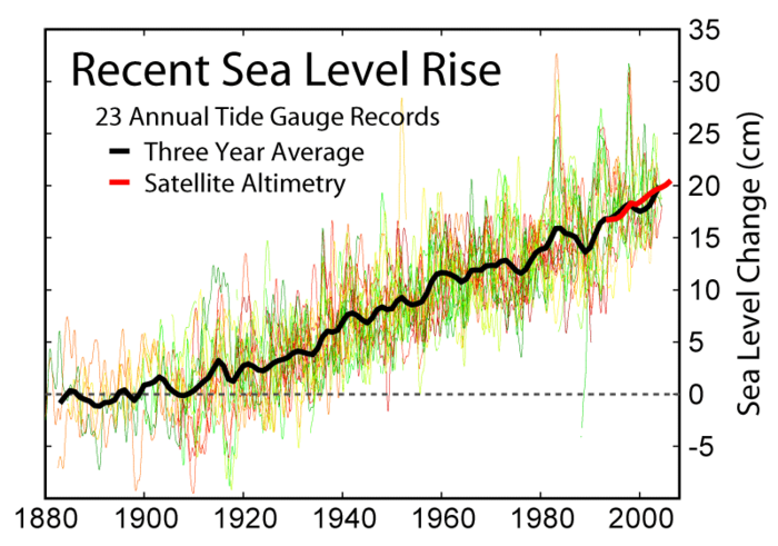
From 1880 to 2000 sea level rose about 20 cm or just under 8 inches. Far less than the nearly 30 inches per century average over the last 18,000 years.
Disclaimer: Opinions posted on Free Republic are those of the individual posters and do not necessarily represent the opinion of Free Republic or its management. All materials posted herein are protected by copyright law and the exemption for fair use of copyrighted works.