http://www.freerepublic.com/focus/f-news/1173403/posts
Posted on 08/09/2004 4:21:54 PM PDT by BurbankKarl
Incident: 2788 Type: Structure or Grass Fire Location: BOUQUET CANYON RD AT ELIZABETH LAKE RD Zoom Map: 4194 6B Info as of: 8/11/2004 7:56:06 PM
ADDITIONAL DETAILS
7:34PM - BRUSH IS ON FIRE --
RESPONDING OFFICERS STATUS
7:54PM - CHP Unit On Scene
again?
Weird. I don't hear that on local scan at all.
How much brush does that particular intersection have left to burn, anyway?
Butte County..that's what I saw on TV. Looks bad. I don't know what Redding got to, but their forecast for today was 108F (tomorrow's 105F).
Thank you very much.
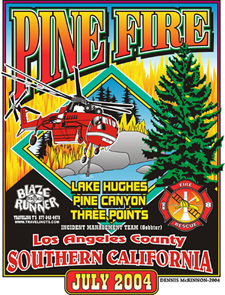
Could someone post the Forest Service link we had during the Acton/Lake Hughes/Crown fires? I forgot to bookmark it and can't find it, thanks.we I had good summaries of each fire, size, etc.
lots of new lightning starts in the S.B. mtns today
Cargo Fire -- Irwin Lake area, near Big Bear H.S.
new start near Onyx area
many others.. they're very busy
34.13.30; 116.45.91
another on Sugarloaf, 1/4 mi. above Hwy 138
they had a minnelusa fire this morning...been listening in on shasta this morning...
(did you hear about that accident on the 210 this morning, boy ejected from car landed on the Gold Line Trolley tracks and was run over...lost a leg...in critical condition)
USAF over LA, Bush arriving shortly.
No, I didn't hear. I got up before dawn to watch meteors and ignored the news altogether. That's terrible.
The air reconnaissance guys are reporting all the new lightning starts, at the same time they're trying to determine which ones will be taken care of by all the rain. Heavy downpours in parts up there.
http://www.freerepublic.com/focus/f-news/1173403/posts
Oh, and I was happy to see the photo you posted of what looks like Harrison Scott or one of his cohorts driving the old Ridge Route, one of my favorite places.
New Fires
Talking about a couple new fires in the ANF area, one near the shooting range off the 210 in Tujunga Cyn...looks like that is suppressed...and then out in the SAGE fire area....also a tornado near Victorville!
TORNADO WARNING
BULLETIN - EAS ACTIVATION REQUESTED
TORNADO WARNING
NATIONAL WEATHER SERVICE SAN DIEGO CA
1242 PM PDT SAT AUG 14 2004
THE NATIONAL WEATHER SERVICE IN SAN DIEGO HAS ISSUED A
* TORNADO WARNING FOR...
WEST CENTRAL SAN BERNARDINO COUNTY IN SOUTHEAST CALIFORNIA
* UNTIL 115 PM PDT
* AT 1232 PM PDT...LOCAL LAW ENFORCEMENT REPORTED A TORNADO NEAR
PHELAN...OR ABOUT 14 MILES SOUTHWEST OF VICTORVILLE. THIS TORNADO
WAS NEARLY STATIONARY.
* THE TORNADO IS EXPECTED TO BE NEAR...
RURAL WESTERN SAN BERNARDINO COUNTY AT 100 PM PDT
AT 1240 PM...LAW ENFORCEMENT REPORTED A TORNADO ON THE GROUND NEAR
PHELAN. THE TORNADO WAS REPORTED AS 1/2 MILE WIDE.
THE SAFEST PLACE TO BE DURING A TORNADO IS IN A BASEMENT. GET UNDER A
WORKBENCH OR OTHER PIECE OF STURDY FURNITURE. IF NO BASEMENT IS
AVAILABLE...SEEK SHELTER ON THE LOWEST FLOOR OF THE BUILDING IN AN
INTERIOR HALLWAY OR ROOM SUCH AS A CLOSET. USE BLANKETS OR PILLOWS TO
COVER YOUR BODY AND ALWAYS STAY AWAY FROM WINDOWS.
IF IN MOBILE HOMES OR VEHICLES...EVACUATE THEM AND GET INSIDE A
SUBSTANTIAL SHELTER. IF NO SHELTER IS AVAILABLE...LIE FLAT IN THE
NEAREST DITCH OR OTHER LOW SPOT AND COVER YOUR HEAD WITH YOUR HANDS.
dang!
I drove home around 4 p.m. and noticed it looked black as night to the east over the Mohave. Guess it was a tornado. The report says nothing about damage.. hopefully it just took out some lonely scrub and tumbleweeds in the middle of nowhere.
Disclaimer: Opinions posted on Free Republic are those of the individual posters and do not necessarily represent the opinion of Free Republic or its management. All materials posted herein are protected by copyright law and the exemption for fair use of copyrighted works.