Posted on 09/12/2018 1:53:29 PM PDT by NautiNurse
The National Hurricane Center has been issuing advisories for Hurricane Florence since August 30. The five day "Cone of Uncertainty" archive progression since Aug. 30 may be found here. As the super-size storm named Florence approached the U.S. Atlantic Coast, stories abound of people who are refusing to evacuate barrier islands.
The 82nd Airborne has relocated all of its assets, while FEMA is using Fort Bragg as a major staging area for post-storm supplies, including meals, water and cots. Fort Jackson (Columbia SC) has cancelled events including basic training graduation to prepare for military and civilian evacuees from coastal locations.
While hurricane preparations are rushed to completion, some stores are closing for lack of hurricane supplies inventory. Smart phone app Gas Buddy provides updates for gasoline availability along evacuation routes.
Wave heights to 83 ft. were recorded while Hurricane Florence churned 435 miles from Wilmington, NC. Storm surge is predicted to reach 6-13 ft along the coastline to the N of landfall. Steering currents are forecast to collapse at or near landfall, resulting in Florence meandering for days. This is expected to result in up to 40 inches of rainfall in isolated areas in the Carolinas, and up to a foot of rain in the Appalachian Mountains.
Tropical Storm Isaac: The government of France has issued Tropical Storm Warnings and Watches for the Lesser Antilles.
Invest 95L: The National Hurricane Center predicts 70% chance of development in the Gulf of Mexico. Limited forecast models, satellite graphics and GOM buoy info are available for Invest 95L below.
Mash the graphics below to enlarge. All links and images are self-updating.
Local Weather: |
Unlike the Gulf or Caribbean, I don’t think the Atlantic waters are warm enough to hold the 4 status.
Agree. I think some tend to let their guard down with the down grading on the SS scale. But, Sandy is a good example of a lower level storm that can create terrible damage.
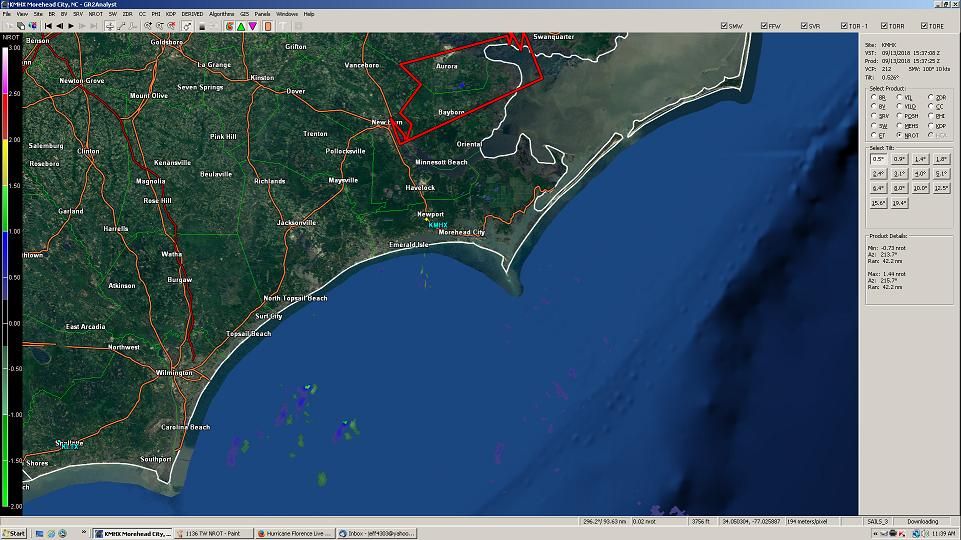
1131 AM EDT THU SEP 13 2018
...A TORNADO WARNING REMAINS IN EFFECT UNTIL 1145 AM EDT FOR
SOUTHEASTERN BEAUFORT AND CENTRAL PAMLICO COUNTIES...
At 1131 AM EDT, a severe thunderstorm capable of producing a tornado
was located near Lowland, or 25 miles southeast of River Road, moving
southwest at 40 mph.
HAZARD...Tornado.
SOURCE...Radar indicated rotation.
IMPACT...Flying debris will be dangerous to those caught without
shelter. Mobile homes will be damaged or destroyed. Damage
to roofs, windows, and vehicles will occur. Tree damage is likely.
This dangerous storm will be near...
Royal and Maribel around 1140 AM EDT.
Grantsboro around 1145 AM EDT.
Other locations impacted by this tornadic thunderstorm include
Aurora, Stonewall, Mesic, Alliance, Bayboro, Vandemere and Bridgeton.
The ocean temps off South Carolina and North Carolina up past Cape Hatteras are just as warm as the Gulf of Mexico or the Caribbean. 84 degrees.
https://www.windy.com/-Show-add-more-layers/overlays?sst,36.505,-79.739,5
Me.
Oh my!! Please keep us updated when it’s safe to do so. I really hope you’ll be ok.
Ps your name is so appropo right now.


Amazing info you have there!
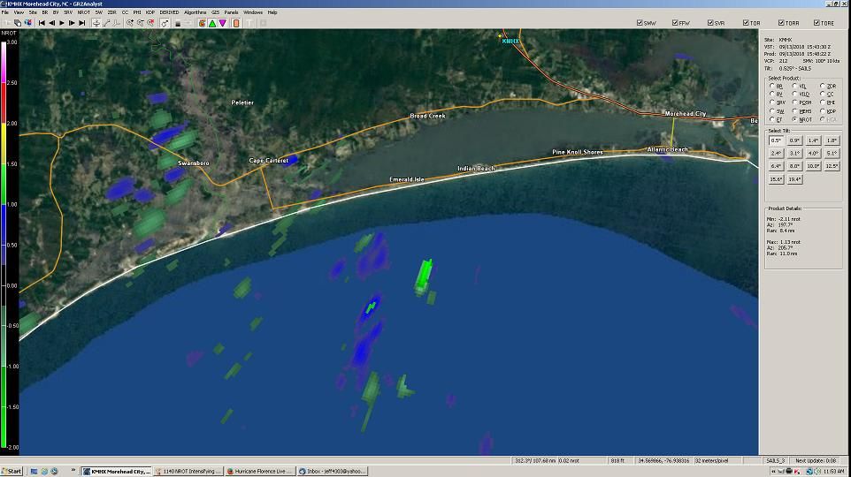
I have work to do here. Cats are massing for attack if I don’t feed them. I’ll go out on a limb and say tornadic potential highest threat until surge at landfall. NWS and NHC better at reading WSR-88D data than I am, especially with hurricanes. ANY decent radar site will keep you informed, but watch the timestamp on the datasets. At some point we are liable to lose KMHX radar at Morehead City, and while your feed may stop, short lived tornadoes will not.
You guys crack me up:)
Per cellphone, this feed runs 0.5 to 1.5 minutes out of realtime. Variance depending on site traffic. Even so, I have to screen-cap, paste to image software, tweak, upload to Photobucket, and post here, so 5 to 7 minutes if fingers not fat.
Just got back to this while eating brunch. (Busy day.)
Anyway, thanks!
Will hold your spot until your return. Thanks for your valuable input.
WoW take a look at this!....webcam 32 miles off the coast!
Frying Pan tower has a ‘live webcam ‘ and it is still up....chilling wind sounds and view of rising ocean
Turn Volume DOWN...
https://www.youtube.com/watch?v=deG4NxkouGM&feature=youtu.be
Here’s the Bogue Inlet Pier Cam, on Emerald Isle. Some pretty heavy wave action, the wooden pier is shaking. Protective beach dune line looks fine however, no erosion, sea oats in place so no issue there with overwash at this point.
http://www.ebmcdn.net/webcast/flash/bogue-inlet/live-iframe.html
Good observations, including Bastardi’s comparison of a smaller storm with higher winds or weaker winds in a massive, slow-moving storm.
Just incredible stuff there, jeffers!
Checking in on lunch break...back to work now
If we lose KMHX, alternate radar sites will provide less useful data, due to increased distance from storm features, greater pixel size and therefore decreased data granularity, (very important in measuring adjacent parcel shear) and radar beam heigth due to tilt angle. Tornadic significance maxes out at ground level, so not only will your ability to predict decrease, but so will NWS’.
KLTX (Wilmington-ish) and KRAX (Raleigh) are your best bets. Of the two, LLTX probably better, given spaghetti projections, but we could just as easily lose that site as well, since it’s near the coast.
Disclaimer: Opinions posted on Free Republic are those of the individual posters and do not necessarily represent the opinion of Free Republic or its management. All materials posted herein are protected by copyright law and the exemption for fair use of copyrighted works.