
Posted on 10/07/2018 10:07:16 AM PDT by NautiNurse
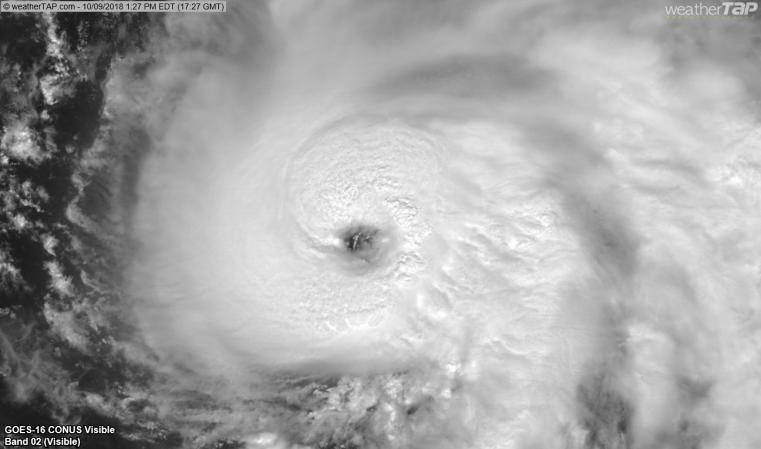
Tropical Storm Mitchell: The NHC has issued a Public Advisory Update indicating Tropical Storm Mitchell has formed about 90 miles South of Cozumel, Mexico. Current forecast predicts Mitchell will reach hurricane strength in the Gulf of Mexico before making landfall in the Northern GOM. Landfall is estimated by 96 hours.

Gulf of Mexico Satellite Channels

Public Advisories
NHC Discussions
NHC Local Weather Statements/Radar Key West FL
NHC Local Weather Statements/Radar New Orleans, LA
NHC Local Weather Statements/Radar Mobile AL/Pensacola FL
NHC Local Weather Statements/Radar Panama City, FL
NHC Local Weather Statements/Radar Tallahassee, FL
NHC Local Weather Statements/Radar Tampa Bay, FL
Should they have rounded up to 111?
Michael will fill Tampa bay tomorrow because it will pass to the west.
NHC designates wind speeds in multiples of 5 mph. Hurricane Michael is anticipated to reach major Category 3 (111-129 mph) status today. At that point, NHC will report sustained winds of at least 115 mph.
We still have a ESE wind here at the beach but it’s going to progress to SW throughout the day it seems.
Ugh. Did not want to see him strengthening this quickly.
Prior to passing Tampa Bay, the storm will lower sea level in the bay. Once the storm is north of Tampa Bay and TB is on the “dirty side,” the winds will pile up water into the bay.
To All:
One of the many models showing path.
Click the play arrow at the top after the frames load.
This is not official — just one of many possibles — rely on local authorities for life safety information.
Looks like it’s going to dump a lot of water into the Apalachicola River then travel up the Flint dumping more water upstream. Looks like lots of flooding on the lower Flint and Apalachicola that’s going to last a while. Looks like Lake Seminole is about a foot down from full pool. (The dam there is primarily used to maintain a navigational depth for barges going up the rivers, not for flood control).

Models are clearly converging tightly on the area between Panama City and Mexico Beach... looks like the hurricane-force windfield is running about 50 miles wide right now, so the entire area will be impacted.
At least this one isn't going to linger: should be out into the Atlantic in about 66 more hours.
“...it is headed directly for my home on Cape San Blas...”
-
Hope you are somewhere else when it gets there, friend.
(former resident of Mexico Beach and worked in St. Joe)
I’ve heard that Mexico Beach is a hidden gem for shelling and beach walking. Is that an over statement?
The hidden hideaway. No one knows how awesome the beaches are there, and I’ll bet that’s how y’all like it.
The tracks do seem to be shifting slightly west.
I saw a forecast of 56 degrees for Mobile this week. Whew!
You Alabama residents, check this.
(Ahem, as important as hurricanes)
Yep..not good news
worst case is landfall just west of Panama City Area..Bay county has 185,000 people....the two counties east less then 15,000 each
Can’t tell you (it’s a secret).
Disclaimer: Opinions posted on Free Republic are those of the individual posters and do not necessarily represent the opinion of Free Republic or its management. All materials posted herein are protected by copyright law and the exemption for fair use of copyrighted works.