
Posted on 11/17/2013 9:14:54 AM PST by dirtboy
That is nasty.
Looks like we’re clear NW side of Indy, still sweating my kids on NE side.
I think they’ve restarted the game.

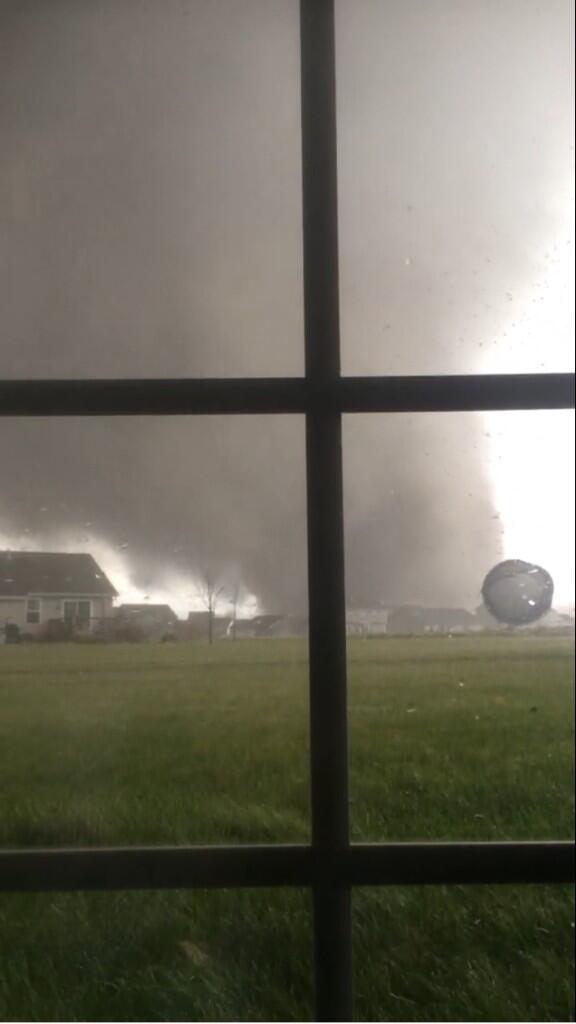
Yes these photos were earlier to give an idea what they were facing....hard to get them as they happen as most folks are taking cover.
Try this one:
http://www.wunderground.com/radar/radblast.asp?ID=GRR&MR=1
Everything just turned a tad darker here in Chelsea. Looks like a small cell moving in from Grass Lake.
3:35pm EST:
Confirmed “large and extremely dangerous #tornado” 9 mi NW of Shoals, IN (closer to Loogootee) moving NE at 70mph.
I posted this on another thread, but it belongs here. As the pictures in the thread show...
There’s a series of tornado warnings along the front line, up and down the length of Indiana and into the western tip of Kentucky right now (3:45 PM EST). The front line is moving east, rather quickly, so this should be across Indiana and into Ohio before sundown.

Latest watch is until 10:00 along those states you’ve mentioned.
7 tornados hit in and around Peroria..via fox news live.
I am in Northwestern Pa.
.... it’s been dark here and raining most of the day....the warning here is winds to pick up about 1:00 am til 6:00 in the morning.....possible trees down and power outages expected.

Thanks for the thread
Have B-I-L, etc in Washington ILL, have heard they are OK but it was a near run thing!
Regards
alfa6 ;>}


Stay safe.....May God protect you all...PLEASE report in when you can

Disclaimer: Opinions posted on Free Republic are those of the individual posters and do not necessarily represent the opinion of Free Republic or its management. All materials posted herein are protected by copyright law and the exemption for fair use of copyrighted works.