
Posted on 04/14/2008 11:08:44 AM PDT by blam
Was he there for the TT?
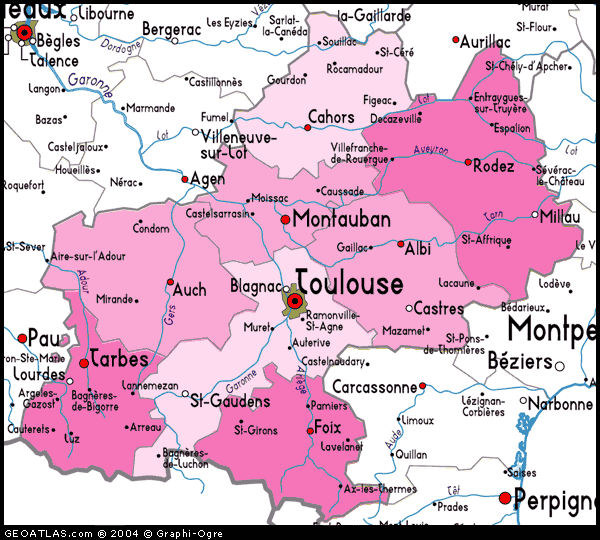
Whats’ with the dotted lines across Spain? There was no water route across spain in 325BC, was there?
The Midi canal wasn’t completed until the 17th century, IIRC.
Or do the dotted lines indicated Pytheas just crossed land the usual way?
Looking at it I don’t understand why he would unnecessarily cross the Pyranees? Couldn’t he just have gone across Southern France to the Garonne river and then take a boat to Brittany, then to Britain, Isle of Man and elsewhere?
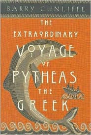
“The explorer Pytheas”
He invented the Pyth helmet.
While crossing Spain he stopped to take a Pyth, hence the Iberian river system. (unsubstantiated)
He then coined the phrase: “By Athena’s beard, `tis better to be pythed off than pythed on.”
Just checking his route it doesn't look like he actually went around Scota, just between Scota and Alba ~ again, the same interests that made Galicia so dangerous to Eastern invaders also made Scota dangerous.
Recall what I said about the Gaelic speaker in Galicia (NW Spain) and Scota (Ireland) using Greek as their written language ~ they were in the habit of getting a new Greek to do that writing whenever the old one wore out! (Bwahahahahahahahaha!)
Even bigger news: God himself visited Israel in the flesh in the year zero BC. (give or take a year or so)
Really? Since when did the solstice lasted several weeks or months.
Guessing that the Carthaginians were blocking the Straits of Gibraltar? Perhaps the overland leg was a way to avoid a sort of naval blockade or pirates?
Yup. They were guarding their source of tin in the British Isles.
|
|
|||
Gods |
Thanks Blam. |
||
|
· Mirabilis · Texas AM Anthropology News · Yahoo Anthro & Archaeo · · History or Science & Nature Podcasts · Excerpt, or Link only? · cgk's list of ping lists · |
|||
The soltice (from the Latin for “sun standing still”, in its endless north-south oscillation) is but an instant. In fact, near the solstice, the motion of the sun is slow enough that its motion in a day is probably much less than the resolution of the instruments available.
Presumably the Greeks knew the dates of the soltices well enough, but you would also have to know the direction south (the direction of the meridan) and have a way of measuring the sun’s altitude.
But anyone who knew enough positional astronomy to know the date of the solstices and had sufficient instrumentation to measure the sun’s altitude when it crossed the meridan, could have determined altitude from a few key stars much more easily. (Polaris was not the Pole Star in those days, nor was there a good alternative.)
The sun is possibly the worst choice of a reference for latitude. It must have occured to people who navigated on open waters that the stars provide a good reference frame.
“During his voyage, Pytheas – who coined the name ‘British Isles’ as a geographical description of Britain and Ireland “
Though they don’t tell us about the Pritani tribe and thus the origin of the name?
Lots of half-infos here, I wonder if the writer decided it was to much info for his space limit or he didn’t know himself.
Disclaimer: Opinions posted on Free Republic are those of the individual posters and do not necessarily represent the opinion of Free Republic or its management. All materials posted herein are protected by copyright law and the exemption for fair use of copyrighted works.