Posted on 03/01/2015 9:19:11 AM PST by Scooter100
Silly me. I thought the Google street-view mapping chaps used bullet-proof vans. Maybe I'm thinking of Texas. No second-guessing the Brits, of course.
If he's only at Stonehenge, no need to rush that Faraday cage project just yet. BTW, with the right tracking gear and attachments, you could make this guy's life pretty miserable with a few drones and some water balloons.
Nice pants.
I was just trying to find the apartment building in Santa Monica where I lived as a child. It’s on Barrington Avenue, within walking distance of the Mar Vista Elementary School.
I found it on the aerial view, but when I tried to look at it from street view I couldn’t. It looks like the Googlemobile didn’t want to go down Barrington between the Whole Foods (which, of course, wasn’t there in 1960) and the school.
I wonder why? It looks like it’s still a good neighborhood.
This was summer, bermuda shorts and all. But the balloons could be filled with, uh, biological items— algal filled water or neutral gelatin (creating movie... gooo or gaack).
LOL.
Great post. Humor. Drones at my bud’s place get shot down— with glee.
I had my place blurred out on street view. The Google camera’s are very good. In my front window you could see my youngest son walking in the living room.
They’re cool about it; just submit a request and your property is blocked/blurred usually within 24 hours.
If it looks anything like a private lane, I don’t think they want to risk the legal hassles. A few of my friends’ homes are missing too, thankfully.
Great movie bit, I think. Nasty little computer geeks pestering the next door neighbor with drone attacks. I’m sure we’ll see it soon.
Ran across a broken down mapping vehicle in the outback a few weeks ago. Guy wouldn’t say if it was google or not. It was an exterra and crammed to the walls with computers and video gear. Offered him assistance but he said the “support” vehicle was on the way.
I don't see how anyone could mistake it for a private lane.
And what's even odder is that when you try to navigate down that stretch of Barrington, it shunts you off into the alley behind the apartments, which I recognized, because I spent more time playing and exploring there, around the garages and gas meters, than I did on the street side of the row of apartment buildings.
It all looked brand-new back then, and probably was. If you went into the alley, hung a left and walked to where it came to a street, there was a Baskin-Robbins right there.
My parents let me explore all that when I was six years old.
To their “quelle horreur” a PETA type anti hunting group already has a “movie” on youtube made by them of “doze nasty psycho hunters”.... who shot their video drone out of the sky in SC and, with the help of SC sheriffs (who hunt) RAN them off.
Real 501(c)3 pains in the a@@ types with drones. LOL. And the film from the drone shows it getting hit. May still be on U tub.
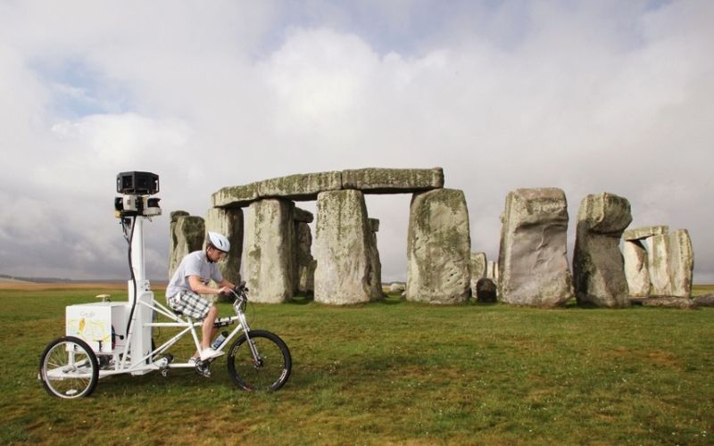
Are folks even allowed to get that close to Stonehenge now? I thought it was fenced off.
One hell of a rifle shot.
Someone with pull may live on that street, or maybe threats or payoffs kept it secure.
Possible.
It's not for safety, it's for aerodynamics so he can get around faster!
Bird shot, when they swooped in for closeups of the hunt. Multiple shots— more pellets on target. A beautiful thing. Like flak on a V-1 or V-2.
Google is doing trail mapping now, with people wearing, I guess, cameras something like that in the photo, walking down trails in National Parks.
Kinda cool, actually. I looked up an old stomping ground in Arches NP.
Mapping is still in it's infancy and we have not seen anything yet. Mapping technology is rapidly accelerating and soon we will be able to access incredible detail about the world around us in real time. Imagine traveling to a restaurant and being guided into an open parking space.
Or imagine this, a diner leaving the restaurant will be able to make his space available for a fee. Approaching diners will bid up the price and as the parking space is exchanged, the negotiated fee will automatically transact electronically between buyer and seller. We might only be talking a dollar or two but who would pay a couple dollars to get a prime parking space on a busy Friday or Saturday night?
Or let's say you work in the city and take a city bus to the train station. Future apps will be able to tell you exactly where the bus is so that you can leave your office when the bus is just a few blocks away. No more waiting out in the rain or cold waiting for a bus to show up.
Potential is almost limitless with mapping.
And yes, for better or worse, privacy is pretty much a thing of the past. You step out into a public street and you are going to be on camera in one form or another.
Disclaimer: Opinions posted on Free Republic are those of the individual posters and do not necessarily represent the opinion of Free Republic or its management. All materials posted herein are protected by copyright law and the exemption for fair use of copyrighted works.