Yellowstone Park is simply the current location of the deep-seated, basically stationary, "hot spot". As the North American continent, via continental drift/plate tectonics, drifts over the spot a trail of volcanic calderas is left behind. You can easily spot the trail on a topographic map of the area, where it forms a diagonal path across the state of Idaho. It actually blew apart and annihilated the mountains that were there.
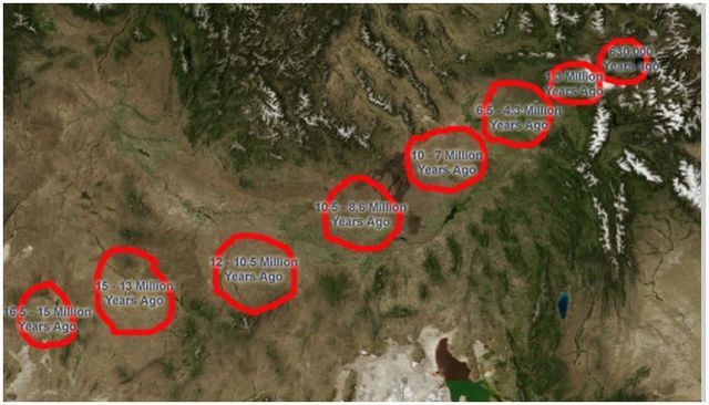
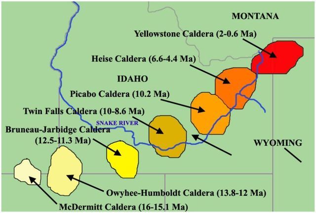
Below is a topographic map of Idaho showing the hot spot path, aka Snake River plain.

29 posted on
06/29/2017 10:24:06 AM PDT by
ETL
(Obama-Hillary, the REAL Russia-US scandal (UraniumOne Deal, Missile Defense, Nukes) See my home page)
That's an encouraging map. Only a couple more million years and it becomes Wyoming's problem.
Well, I feel better about it, anyway.


