NauticalChartsOnline.com is down right now [20240408-135750 EDT Monday], so nautical charts 14883 and 14882 cannot be viewed online, there.
First Local News outlet "focusing on local news from Sault Ste. Marie Ontario and Michigan as well as district news in Algoma and the Upper Peninsula" . . . produced the following image:
- - -
For a closeup look, go to:
Office of Coast Survey - NOAA ENC Viewer
https://nauticalcharts.noaa.gov/enconline/enconline.html
Upper left area of the NOAA ENC Viewer, there is a data entry box. Enter: "Munuscong Lake"
Select: "Munuscong Lake, ON, CAN"
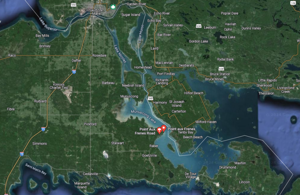
Munuscong Lake is the northern lake, and Mud Lake is the southern lake. They join at a relative "narrows" - that includes a navigable channel with a variety of navigation aids.
At the relative "narrows," to the west, is "Point aux Frenes," and to the east, "Hay Point" with a pair of "Hay Point Range" lights.
For a southbound freighter, the ship would approach the junction (the relative "narrows") by keeping itself aligned with the "Hay Point Range" front and rear lights/markers (large reflective panels).
On the ship's starboard bow, you find buoys 21 followed by 19 to the south-southeast from buoy 21.
On the ship's port bow, you find buoys 22 followed by 20 to the south-southeast from buoy 22, and then buoy 18 follows after 20.
Again (heading south), 21 then 19 on the starboard side, and 22, then 20, then 18 on the port side.
MV American Mariner lost control in the turn, while heading southbound and ran over, then stopped above, buoy 19 ("the light tower"):
12960 LIGHT 19
46-07-48.513N
084-01-00.655W
Fl G 2.5s [Flashing GREEN evey 2.5 seconds]
White cylindrical tower (33 ft) with GREEN band
- - -