To: BenLurkin
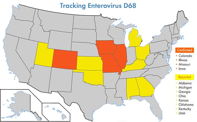
Are the disease rates commensurate w/the map?
14 posted on
10/12/2014 12:47:45 PM PDT by
hulagirl
(Mother Theresa was right)
To: hulagirl
16 posted on
10/12/2014 12:48:48 PM PDT by
BenLurkin
(This is not a statement of fact. It is either opinion or satire; or both.)
To: hulagirl; BenLurkin
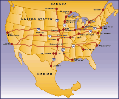
Actually the spread of the disease is mapped by looking at the transportation routes.
20 posted on
10/12/2014 1:02:07 PM PDT by
UCANSEE2
(Lost my tagline on Flight MH370. Sorry for the inconvenience.)
To: hulagirl; BenLurkin
Are the disease rates commensurate w/the map?NO.
Since the first cases seemed to start in Kansas City, I think this particular virus is being spread via the NAFTA SUPERHIGHWAY (I-70 + I-35) the same way that many viruses end up coming to us. Illegal immigrant traffic.
The recent influx of large numbers of 'unaccompanied minors' from Central America may not be the source of the virus.
29 posted on
10/12/2014 1:12:57 PM PDT by
UCANSEE2
(Lost my tagline on Flight MH370. Sorry for the inconvenience.)
FreeRepublic.com is powered by software copyright 2000-2008 John Robinson