Free Republic
Browse · Search
News/Activism
Topics · Post Article

To: henkster
German map for the Vosges:

10 Oct 44 Vosges photo 10OCT44Vosges_zps8624990e.jpg

15 posted on 10/10/2014 6:15:38 AM PDT by henkster (Do I really need a sarcasm tag?)
[ Post Reply | Private Reply | To 14 | View Replies ]


To: henkster
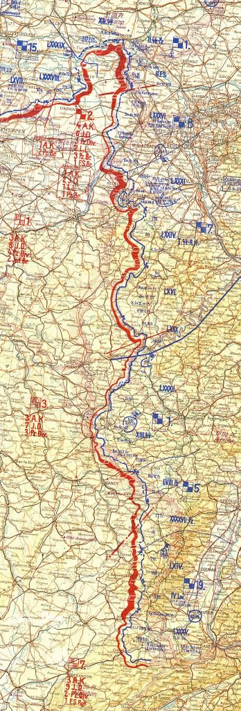
Just for grins and giggles, here is the entire active sector of this map showing the western front. It gives a sense of perspective just how big these maps were. And this is just a narrow strip along the western border of the Reich. The preceding posts cropped sections from this section, which was itself cropped from a much larger map. Despite the scale, there is still a lot of detail.

10 Oct 44 West Front photo 10OCT44Westfront_zps13519545.jpg

16 posted on 10/10/2014 6:19:23 AM PDT by henkster (Do I really need a sarcasm tag?)
[ Post Reply | Private Reply | To 15 | View Replies ]

Free Republic
Browse · Search
News/Activism
Topics · Post Article


FreeRepublic, LLC, PO BOX 9771, FRESNO, CA 93794
FreeRepublic.com is powered by software copyright 2000-2008 John Robinson