Video at site.
Posted on 02/13/2017 10:36:27 PM PST by nickcarraway
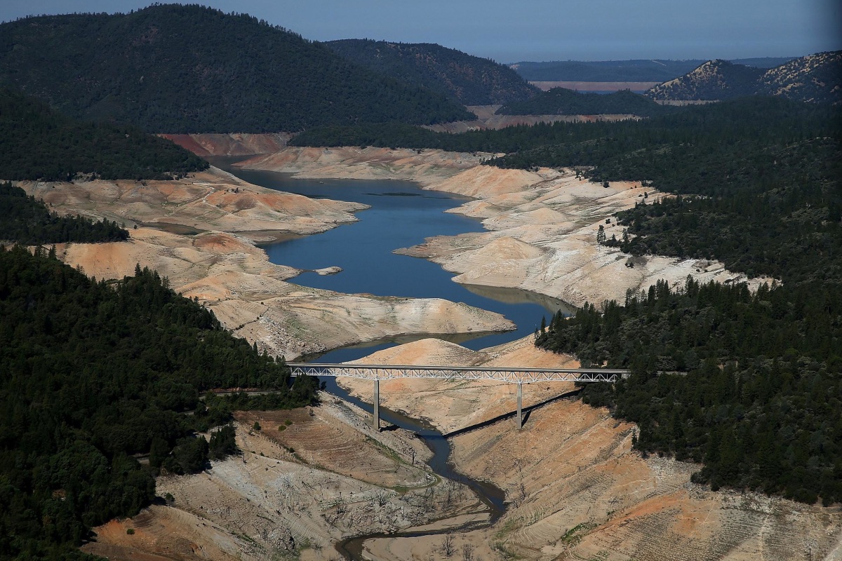
LiveCopter 3 shows extremely low water levels in 2008
Before Lake Oroville became so full that it overflowed the emergency spillway, the lake was a barren body of water that suffered heavily during the drought. This video was taken by LiveCopter 3 in 2008 when water levels were extremely low.
Video at site.
Thanks for sharing that, now an abundance of water to prove the climate doomsayers wrong. I love it.
Oh boy.
fyi
Ain’t Mother Nature great, should have prepared for that proverbial rainy day!
It looks pretty tame to me...what’s the problem? It’s never gonna rain in California again! /s
We can blame it on Al Gore that they didn’t prepare.
The dems did nothing to maintain the dam and its spillway.
They did however take on the educational expenses of illegals.
I hope Trump tells Moonbeam to fix it himself unless he deports all the illegals from California.
And it’s exactly where it needs to be right now to allow time to rebuild the main spillway, improve the emergency spillway, repair the powerhouse and lines.
They should look at an alternate means to lower dam level even if it requires blasting elsewhere or a drainage tunnel.
Yeah, I’ve been seeing these kind of photos, but only just recently ... meaning that I never knew anything about Lake Oroville until the events of the last few days.
But I have to say, it seems like the California DWR hasn’t been doing any better. It’s really a scandal, isn’t it? Especially with the record of those hearings 12 years ago.
The town of Alma is completely submerged .
You can’t see the rooftop of any buildings...
An interesting suggestion. In fact, it looks like there is an "out" near the town of Oroville East, where a pair of dams prevents flow into Miners Ranch Resevoir. Something that, if I were Overlord of the Situation, I think I would have to look at.
BTW, this from Google Earth, which gives elevation, but is nevertheless being deprecated in favor of Google Maps, which does not, unless someone wants to tell me otherwise.
Cute.
LOL
very few people know that joke...
An outlet here would bleed down into the same flood plain that a “dam break” would flood, but the flow would be restricted by a narrow arm of the reservoir, or lake, in contradistinction to the broad lowland in front of the dam and the spillways. So I think this suggests possibilities, in the abstract, at least.
There are no secrets anymore ;-)
Well, they would have been fine if global warming had not caused an abrupt end to the global warming induced drought
Blame the US Supreme Court. Plyler v. Doe, 1982.
Disclaimer: Opinions posted on Free Republic are those of the individual posters and do not necessarily represent the opinion of Free Republic or its management. All materials posted herein are protected by copyright law and the exemption for fair use of copyrighted works.