Skip to comments.
Hurricane Sandy (LIVE THREAD)
NOAA/NHC & Various ^
| 10/25/2012
| NOAA/NHC & Various
Posted on 10/25/2012 8:53:50 AM PDT by NautiNurse
Late season Hurricane Sandy churning poleward off the Eastern U.S. coast.


Sea Surface Temps
Public Advisories
NHC Tropical Discussions
Satellite Images
Buoy Data: Current Observations
TOPICS: Breaking News; Extended News; News/Current Events; US: Connecticut; US: Delaware; US: Florida; US: New Jersey; US: New York; US: Pennsylvania
KEYWORDS: frankenstorm; hurricane; hurricanesandy; nautinurse; sandy; tropical
Navigation: use the links below to view more comments.
first previous 1-20 ... 321-340, 341-360, 361-380 ... 441-455 next last
To: carriage_hill
341
posted on
10/29/2012 6:53:03 AM PDT
by
lonestar
(It takes a village of idiots to elect a village idiot.)
To: metmom
I worked 9wks on cleaning/reorganizing it all, both sides; it was a "horror show" for 17yrs before that.

342
posted on
10/29/2012 6:54:35 AM PDT
by
Carriage Hill
("0bummer's a towering figure" - even a Garden Gnome casts a long shadow at sunset.)
To: tomkat
I’m 20 miles inland from Atlantic City,NJ The path seems to turn a little west of my town, Hammonton, NJ. I’ll be a little east of the eye if it follow the track I saw last.
343
posted on
10/29/2012 6:54:55 AM PDT
by
mware
(By all that you hold dear on this good earth, I bid you stand, Men of the West)
To: metmom
I am in Minnesota, so not much help to you. But the sky was very red in the east at sunrise and an eerie purplish gray in the west. Which is odd because the only rain I see is way to the east of us.
344
posted on
10/29/2012 6:55:32 AM PDT
by
defconw
(It's not about a video Dummycrats!)
To: mware
Sad to say, that’s the worst side of the storm to be on, the right hand side of the direction it’s traveling. in.
345
posted on
10/29/2012 6:56:44 AM PDT
by
metmom
(For freedom Christ has set us free; stand firm therefore & do not submit again to a yoke of slavery)
To: lonestar
Got a 15cuft freezer full of ice & cold-paks, in garage. Plus lots of Allen Bros styrofoam shipping boxes, Coleman cold chests etc. 2 freezers are now ¼-full of cold-paks in case electric goes south.
346
posted on
10/29/2012 6:57:24 AM PDT
by
Carriage Hill
("0bummer's a towering figure" - even a Garden Gnome casts a long shadow at sunset.)
To: metmom
Can any FReepers out there report on what the winds are doing in their area? I’m in central PA, near York. We had a pretty good squall move through early this morning but now a steady rain. If definitely got chillier and the wind is picking up. We are not supposed to get the worst of it until later this afternoon through tonight – heavy rain, sustained 30-40 mph winds with gusts 60+ mph, perhaps even up to 75.
Like you we have had days of overcast and morning fog with drizzle and one morning the fog was as bad as I’ve seen it around here.
To: tomkat
I have a tree twice the size of my house in my front yard.
It's a maple, so if it goes I'm have enought cords of wood to last three years.
Of couse if it goes in the wrong direction, I won't have a house to burn the wood in.
348
posted on
10/29/2012 6:58:46 AM PDT
by
mware
(By all that you hold dear on this good earth, I bid you stand, Men of the West)
To: gleeaikin
>Whatever happened to rinsing and filling milk bottles and soda bottles with tap water. I have six gallons all full and stashed away. Cost almost nothing.<
I’ll do you one better. We’ve got a bunch of gallon jugs with drinking water, plus a 32 gallon trash can filled with water for the animals and for flushing (since we’re on a well - no power, no H2O).
349
posted on
10/29/2012 6:58:55 AM PDT
by
Darnright
("I don't trust liberals, I trust conservatives." - Lucius Annaeus Seneca)
To: defconw
Thanks! This waiting for the storm is maddening.
350
posted on
10/29/2012 7:00:27 AM PDT
by
Miss Didi
("After all...tomorrow is another day." Scarlett O'Hara, Gone with the Wind)
To: defconw
They’re on my revised “to get” list, along with another 500-600 items; I love Cheese Puffs! I’m gonna need more than the 20 shelves I’ve got!
351
posted on
10/29/2012 7:00:43 AM PDT
by
Carriage Hill
("0bummer's a towering figure" - even a Garden Gnome casts a long shadow at sunset.)
To: carriage_hill
Very nice... Color me jealous! ;)
To: carriage_hill
LOL, If you have to sit out a storm, cheese puffs are a must.
353
posted on
10/29/2012 7:03:22 AM PDT
by
defconw
(It's not about a video Dummycrats!)
To: TornadoAlley3
This live stream just a picture of a street with water though the narration is interesting. Any links to live beach cams?
354
posted on
10/29/2012 7:04:09 AM PDT
by
CedarDave
(Presstitutes: Journalists who refuse to ask hard questions and who report by omission or distortion)
To: carriage_hill
That’s great...you have to realize your store room is the size of most NYC apts—LOL!
355
posted on
10/29/2012 7:05:08 AM PDT
by
Miss Didi
("After all...tomorrow is another day." Scarlett O'Hara, Gone with the Wind)
To: Miss Didi
I bet! 20 years ago I lived in Maryland/DC area. So I have a clue. I love Ocean City, Maryland. I can’t believe that water is up on the boardwalk. WOW!
356
posted on
10/29/2012 7:05:35 AM PDT
by
defconw
(It's not about a video Dummycrats!)
To: All
These impacts have been put together by Weather Underground meteorologists.
Maine
• Storm tide and surge: 1 to 2 feet of storm surge on top of tides.
• Wind: 30 to 40 mph with gusts up to 60 mph. The strongest winds will occur Monday afternoon and evening.
• Rain: Widespread totals from 1 to 3 inches, with isolated amounts up to 5 inches
• Inland Flooding: Significant urban and small stream flooding is possible, which could linger into Tuesday.
• Power outages: Spotty power outages are possible as wind takes down branches and trees.
Massachusetts
• Storm tide and surge: Up to 4 feet of storm surge on top of tides, with a 10-20% chance of surge exceeding 5 feet.
Storm tide forecast for Buzzards Bay, MA is 7-8 feet.
Storm tide forecast for Woods Hole, MA is 6-7 feet.
Storm tide forecast for Nantucket, MA is 6-7 feet.
• Wind: 25 to 35 mph with gusts up to 60 mph. The strongest winds will occur Monday afternoon and evening
• Rain: Widespread totals from 1.5 to 3 inches, with isolated amounts up to 5 inches
• Inland Flooding: Significant urban and small stream flooding is possible, which could linger into Tuesday.
• Power outages: Spotty power outages are possible as wind takes down branches and trees
Rhode Island
• Storm tide and surge: 4 to 5 feet of surge is possible on top of tides, with a 10-20% chance of surge exceeding 5 feet.
Storm tide forecast for Newport, RI is 8-9 feet.
Storm tide forecast for Providence, RI is 10-11 feet.
Storm tide forecast for Block Island, RI is 7-8 feet.
• Wind: 25 to 35 mph with gusts up to 60 mph. The strongest winds will occur Monday afternoon and evening
• Rain: Widespread totals from 1.5 to 3 inches, with isolated amounts up to 5 inches
• Inland Flooding: Significant urban and small stream flooding is possible, which could linger into Tuesday.
• Power outages: Spotty power outages are possible as wind takes down branches and trees
Connecticut
• Storm tide and surge: 6 to 9 feet of surge is possible on top of tides, with a 60% chance of surge exceeding 5 feet west of Bridgeport. Surge will be worse as you move west along the Connecticut coastline.
Storm tide forecast for New London, CT is 8-9 feet.
Storm tide forecast for Bridgeport, CT is 14-15 feet.
• Wind: 25 to 35 mph with gusts up to 60 mph. The strongest winds will occur Monday afternoon and evening
• Rain: Widespread totals from 1.5 to 3 inches, with isolated amounts up to 5 inches
• Inland Flooding: Significant urban and small stream flooding is possible, which could linger into Tuesday.
• Power outages: Power outages are possible as wind takes down branches and trees
New York
• Storm tide and surge:
Long Island Sound -- 6-7 feet on top of tide with a 50% chance of exceeding 7 feet. Storm tide forecast for Port Jefferson is 13-14 feet.
Manhattan -- 4-5 feet on top of tide with a 40% chance of exceeding 7 feet.
Staten Island -- 4-5 feet on top of tide with a 60% chance of exceeding 7 feet.
Storm tide forecast for Montauk, NY is 7-8 feet.
Storm tide forecast for Port Jefferson, NY is 13-14 feet.
Storm tide forecast for Kings Point, NY is 12-13 feet.
Storm tide forecast for The Battery, NY is 9-10 feet.
Storm tide forecast for Bergen Pt, NY is 10-11 feet.
• Wind: Long duration, damaging winds expected. 35 to 45 mph with gusts up to 80 mph. The strongest winds will occur Monday afternoon and night.
• Rain: Widespread totals from 2 to 4 inches, with isolated amounts up to 6 inches, especially in the higher elevations. 1 to 2 inches PER HOUR are expected where the heaviest rain bands set up.
• Inland Flooding: Widespread urban flooding is expected Monday and into Tuesday. Fast-responding streams are expected to flood, as well. The flooding will be exacerbated by blockages in storm drains as well as rising storm tide.
• Power outages: Power outages are possible, even likely, as wind takes down branches and trees.
Pennsylvania
• Storm tide and surge: 1 to 2 feet of surge is possible on top of tides, with a 30-40% chance of surge exceeding 3 feet.
Storm tide forecast for Philadelphia, PA is 8-9 feet.
• Wind: 35 to 45 mph with gusts up to 70 mph. The strongest winds will occur Monday afternoon and evening and into Tuesday. Wind speeds will increase closer to the coast.
• Rain: Widespread totals from 4 to 10 inches, with the highest amounts mainly from Philadelphia metro southward. Heavy rain is expected to begin Sunday night, with the heaviest occurring Monday night into Tuesday.
• Inland Flooding: Significant urban and small stream flooding is possible, which could linger into Tuesday. RIver flooding is possible.
• Power outages: Power outages are likely as wind takes down branches and trees.
New Jersey
• Storm tide and surge: 4 to 5 feet of surge is possible on top of tides, with a 30-50% chance of surge exceeding 7 feet. Surge will be worse as you move north along the New Jersey coastline.
Storm tide forecast for Sandy Hook, NJ is 10-11 feet.
Storm tide forecast for Atlantic City, NJ is 9-10 feet.
Storm tide forecast for Cape May, NJ is 9-10 feet.
• Wind: 35 to 45 mph with gusts up to 70 mph. The strongest winds will occur Monday afternoon and evening and into Tuesday. Wind speeds will increase closer to the coast.
• Rain: Widespread totals from 4 to 10 inches. Heavy rain is expected to begin Sunday night, with the heaviest occurring Monday night into Tuesday.
• Inland Flooding: Significant urban and small stream flooding is possible, which could linger into Tuesday. RIver flooding is possible.
• Power outages: Power outages are likely as wind takes down branches and trees.
Delaware
• Storm tide and surge: 4 to 5 feet of surge is possible on top of tides, with a 20% chance of surge exceeding 6 feet.
Storm tide forecast for Reedy Point, DE is 8-9 feet.
Storm tide forecast for Lewes, DE is 9-10 feet.
• Wind: 35 to 45 mph with gusts up to 70 mph. The strongest winds will occur Monday afternoon and evening and into Tuesday. Wind speeds will increase closer to the coast.
• Rain: Widespread totals from 4 to 10 inches. Heavy rain is expected to begin Sunday night, with the heaviest occurring Monday night into Tuesday.
• Inland Flooding: Significant urban and small stream flooding is possible, which could linger into Tuesday. RIver flooding is possible.
• Power outages: Power outages are likely as wind takes down branches and trees.
Maryland and Washington D.C.
• Storm tide and surge: 4 to 5 feet of surge is possible on top of tides on the ocean coast, with a 10-20% chance of surge exceeding 6 feet.
• Wind: 35 to 45 mph with gusts up to 60 mph. The strongest winds will occur Monday afternoon and evening and into Tuesday. Wind speeds will increase closer to the coast, and will also be stronger along the ridges.
• Rain: Widespread totals from 3 to 6 inches, with locally higher amounts, especially in the D.C. metro. Heavy rain is expected to begin Sunday night, with the heaviest occurring Monday night into Tuesday.
• Inland Flooding: Moderate to major flooding is possible on the smaller creeks and streams. Flooding is also possible on the larger mainstream rivers beyond Tuesday.
• Power outages: Power outages are likely as wind takes down branches and trees.
Virginia
• Storm tide and surge: 2 to 4 feet of surge is possible on top of tides on the ocean coast.
Storm tide forecast for Chesapeake Bay Bridge Tunnel, VA is 6-7 feet.
Storm tide forecast for Wachapreague, VA is 7-8 feet.
Storm tide forecast for Kiptopeke Beach, VA is 6-7 feet.
• Wind: 35 to 45 mph with gusts up to 60 mph. The strongest winds will occur Monday afternoon and evening and into Tuesday. Wind speeds will increase closer to the coast, and will also be stronger along the ridges.
• Rain: Widespread totals from 3 to 6 inches, with locally higher amounts, especially in the D.C. metro. Heavy rain is expected to begin Sunday night, with the heaviest occurring Monday night into Tuesday.
• Inland Flooding: Moderate to major flooding is possible on the smaller creeks and streams. Flooding is also possible on the larger mainstream rivers beyond Tuesday.
• Power outages: Power outages are likely as wind takes down branches and trees.
North Carolina
• Storm tide and surge: 2 to 4 feet of surge is possible on top of tides.
Storm tide forecast for Duck Pier, NC is 7-8 feet.
• Wind: 35 to 45 mph with gusts up to 60 mph. The strongest winds will occur Monday afternoon and evening and into Tuesday. Wind speeds will increase closer to the coast, and will also be stronger along the ridges.
• Rain: An additional 1 to 3 inches possible overnight Sunday.
• Inland Flooding: Flood threat is tapering off as Sandy moves north.
• Power outages: Sporadic power outages are possible as wind breaks branches off trees.
357
posted on
10/29/2012 7:06:02 AM PDT
by
NautiNurse
(Barack Obama--you are the weakest link. Goodbye!)
To: carriage_hill
WOW now that is one impressive “ pantry”!!!
358
posted on
10/29/2012 7:08:06 AM PDT
by
pollywog
("O Thou who changest not, abide with me.".......)
To: DollyCali
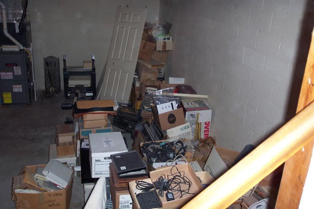
Thank you, DC. Glad to share.
Here's the mess I started with, just on one side:
359
posted on
10/29/2012 7:08:59 AM PDT
by
Carriage Hill
("0bummer's a towering figure" - even a Garden Gnome casts a long shadow at sunset.)
To: defconw
I saw that on Fox this morning. Pretty boring here...a little wind, leaves on the sidewalk and grey skies. Not that I’m complaining. :)
360
posted on
10/29/2012 7:10:14 AM PDT
by
Miss Didi
("After all...tomorrow is another day." Scarlett O'Hara, Gone with the Wind)
Navigation: use the links below to view more comments.
first previous 1-20 ... 321-340, 341-360, 361-380 ... 441-455 next last
Disclaimer:
Opinions posted on Free Republic are those of the individual
posters and do not necessarily represent the opinion of Free Republic or its
management. All materials posted herein are protected by copyright law and the
exemption for fair use of copyrighted works.
FreeRepublic.com is powered by software copyright 2000-2008 John Robinson
