In spite of its very large ragged eye...Wilma has continued to
intensify and based on Doppler and aircraft data...it is now a
high-end Cat. 3...110-kt...hurricane.  Aircraft flight level winds
were as high as 135 kt earlier but Doppler radar observations
indicate that these winds were likely associated with transient
mesoscale features.  No significant changes in intensity are likely
prior to landfall.  After crossing Florida...Wilma should
transition into a powerful extratropical storm within a couple of
days as it interacts with an intense baroclinic trough over the
eastern United States.
Recon and radar fixes indicate that the motion is about 050/17.
Acceleration is forecast as Wilma is becoming caught in the
southwesterly flow associated with the abovementioned trough.
Track guidance models are in excellent agreement for the next 24
hours or so of the forecast and diverge thereafter as the models
disagree on how Wilma will interact with the higher latitude flow.
No significant changes in the NHC forecast track have been made
over the first 24 hours or so.  The latter part of the official
forecast is a little east of the previous track... over the North
Atlantic.
The forecast track takes Wilma inland in a few hours.  People in
southern Florida should be mindful that destructive winds and large
storm surges are occurring well away from the center...particularly
over the southern semicircle of the hurricane.
Forecaster Pasch
forecast positions and Max winds
initial      24/0900z 25.5n  82.4w   110 kt
 12hr VT     24/1800z 27.9n  79.0w    85 kt
 24hr VT     25/0600z 32.9n  73.1w    75 kt
 36hr VT     25/1800z 39.0n  66.5w    60 kt...extratropical
 48hr VT     26/0600z 44.0n  60.0w    60 kt...extratropical
 72hr VT     27/0600z 47.5n  51.0w    55 kt...extratropical
 96hr VT     28/0600z 48.0n  40.0w    55 kt...extratropical
120hr VT     29/0600z 48.0n  29.0w    50 kt...extratropical
Lost power for five minutes here. Am surprised it came back.
Thanks for the new thread and all your hard work!
Here we go.
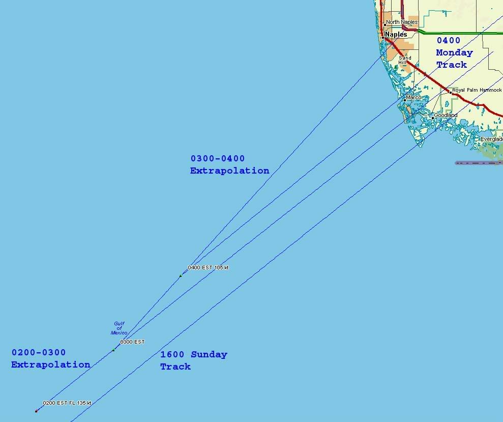
Marco is probably gone. A big part of Naples' future depends on which one of these four lines approximates reality the closest:
http://i4.photobucket.com/albums/y138/jeffers_mz/Wilma/02landfall.jpg
Any post-Charlie bliss for Ft. Myers and Sanibel is about to suffer a hit.
FWIW, the 1600 Sunday track exits Florida at essentially the same place as the 0400 Monday track, halfway between Hobe Sound and Port Salerno, no real changes in course.